Meirionnydd is a coastal and mountainous region of Wales. It has been a kingdom, a cantref, a district and, as Merionethshire, a county.

The Kingdom of Gwynedd was a Roman Empire successor state that emerged in sub-Roman Britain in the 5th century during the Anglo-Saxon settlement of Britain.

The Kingdom of Powys was a Welsh successor state, petty kingdom and principality that emerged during the Middle Ages following the end of Roman rule in Britain. It very roughly covered the northern two-thirds of the modern county of Powys and part of today's English West Midlands. More precisely, and based on the Romano-British tribal lands of the Ordovices in the west and the Cornovii in the east, its boundaries originally extended from the Cambrian Mountains in the west to include the modern West Midlands region of England in the east. The fertile river valleys of the Severn and Tern are found here, and this region is referred to in later Welsh literature as "the Paradise of Powys".

Caernarfon Bay is an inlet of the Irish Sea defined by the Llŷn peninsula and Anglesey.

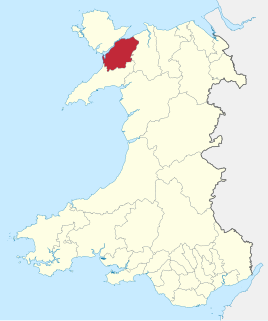
Arfon was one of five districts of Gwynedd, Wales, from 1974 to 1996.

Aberffraw is a small village and community on the south west coast of the Isle of Anglesey, in Wales, by the west bank of the Afon Ffraw. Access by road is by way of the A4080 and the nearest rail station is Bodorgan. The community includes Soar and Dothan.

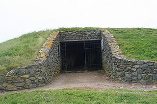
Barclodiad y Gawres is a Neolithic burial chamber between Rhosneigr and Aberffraw on the south-western coast of the island of Anglesey in North Wales. It is an example of a cruciform passage grave, a notable feature being its decorated stones. Similar graves and marks exist across the Irish Sea in the Boyne Valley.

The Anglesey Coastal Path is a 200-kilometre (124 mi) long-distance footpath around the island of Anglesey in North Wales. The route is part of the Wales Coast Path.

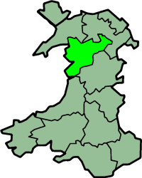
The mediaeval Welsh cantref of Arfon in north-west Wales was the core of the Kingdom of Gwynedd. Later it was included in the new county of Caernarfonshire, together with Llŷn and Arllechwedd under the terms of the Statute of Rhuddlan in 1284. The island of Anglesey faced it across the Menai Strait; to the east was the cantref of Arllechwedd, to the south the cantref of Eifionydd, and to the west was the cantref of Llŷn.

Rhosyr is a community in the far southern corner of Anglesey, Wales. It includes the villages of Dwyran and Newborough, Llangeinwen and Llangaffo.

The A4080 is a British A road which is located on the Island of Anglesey, Wales. It follows a very roundabout route from the A5 road at Llanfairpwllgwyngyll via Newborough and Rhosneigr back to the A55 and the A5 about 9 miles south of Holyhead. In all the road is about 17 miles long.

Llanfaes is a small village on the island of Anglesey, Wales, located on the shore of the eastern entrance to the Menai Strait, the tidal waterway separating Anglesey from the north Wales coast. Its natural harbour made it an important medieval port and it was briefly the capital of the kingdom of Gwynedd. Following Prince Madoc's Rebellion, Edward I removed the Welsh population from the town and rebuilt the port a mile to the south at Beaumaris. It is in the community of Beaumaris.

Cemais was one of the three medieval cantrefs on the island of Anglesey, north Wales, in the Kingdom of Gwynedd. It lay on the northern side of the island on the Irish Sea.
The House of Aberffraw was a cadet branch of the Kingdom of Gwynedd originating from the sons of Rhodri the Great in the 9th century. Establishing the Royal court of the Aberffraw Commote would begin a new location from which to rule Wales. The cadet branch achieved the recognised title of Prince of Wales, and were sometimes named King of Aberffraw.
Dindaethwy was in medieval times one of two commotes of the cantref of Rhosyr, in the south-east of the Isle of Anglesey. It was between the Menai Strait and Conwy Bay, and the Irish Sea and Red Wharf Bay.

Llangadwaladr is a small village in south-west Anglesey, Wales, located around 2 miles east of Aberffraw and 3 miles south of Gwalchmai. It is part of the community of Bodorgan.

St Beuno's Church, Aberffraw is a 12th-century parish church in Anglesey, north Wales. A church was established in Aberffraw in the 7th century by St Beuno, who became the abbot of Clynnog Fawr, Gwynedd. St Beuno's may have been used as a royal chapel during the early Middle Ages, as the princes of Gwynedd had a court in Aberffraw. The oldest parts of the church date from the 12th century, although it was considerably enlarged in the 16th century when a second nave was built alongside the existing structure, with the wall in between replaced by an arcade of four arches. Restoration work in 1840 uncovered a 12th-century arch in the west wall, which may have been the original chancel arch or a doorway to a western tower that has been lost. The church also has a 13th-century font, some memorials from the 18th century, and two 18th-century copper collecting shovels.

Rhosyr was the name of one of the three medieval cantrefs on the island of Anglesey, north Wales, in the Kingdom of Gwynedd. It lay on the southern side of the island facing the Menai Strait which separates Anglesey from the mainland.
Aberffraw is village and community in Anglesey, Wales.
The Afon Ffraw is a short river on the Isle of Anglesey, Wales. It arises at Llyn Coron and flows southwest for two miles along the northwestern margin of Twyn Aberffraw via the village of Aberffraw to Aberffraw Bay on the island's west coast. The river is tidal to a point just northeast of Aberffraw and is accompanied by the Wales Coast Path and Isle of Anglesey Coastal Path. Llyn Coron is fed by the Afon Gwna which rises near to Llangefni in the centre of Anglesey. The flow of the Ffraw is bolstered by the left-bank tributary, the Afon Frechwen and a larger, though unnamed right-bank tributary which rises near Gwalchmai. Pont Aberffraw is a bridge spanning the river constructed as a single stone arch in 1731. When the A4080 main coastal road was diverted onto a new line, the old bridge closed to traffic.


