Shaykh Issa is a town in northern Aleppo Governorate, northwestern Syria. Located north of Aleppo, it is administratively part of Nahiya Tell Rifaat in A'zaz District. Nearby localities include Tell Rifaat to the west, Kaljibrin to the north and Mare' to the east. In the 2004 census, Shaykh Issa had a population of 4,296. The town is at 36.47926 ° N 37.14506 ° E

Akhtarin is a town in northern Aleppo Governorate, northwestern Syria. The largest town and administrative centre of Nahiya Akhtarin of the A'zaz District has a population of 5,305 in the 2004 census. Located 38 km (24 mi) northeast of the city of Aleppo, nearby localities include Mare' to the southwest, Dabiq to the northwest, and Ziadiyah to the northeast.
Kafr Naya is a town in northern Aleppo Governorate, northwestern Syria. Located north of Aleppo, the town is administratively part of Nahiya Tell Rifaat in A'zaz District. Nearby localities include Mayer to the southwest. In the 2004 census, Kafr Naya had a population of 5,647. The village is inhabited by Turkmen.
Tell Jabin is a town in northern Syria, administratively part of the A'zaz District of Aleppo Governorate, located north of Aleppo. Nearby localities include Tell Rifaat and Kafr Naya to the north, Mare' to the northeast, Bayanoun, Mayer and al-Zahraa to the west. According to the Syria Central Bureau of Statistics, Tell Jabin had a population of 2,579 in the 2004 census.
Herbel is a village in northern Aleppo Governorate, northwestern Syria. With a population of 3,403 as per the 2004 census. Administratively, it is part of the Nahiya Mare' in A'zaz District. Nearby localities include Tell Rifaat to the northwest, Mare' to the northeast, Maarat Umm Hawsh to the southeast and Ihras to the southwest.
Menagh is a town near Azaz 16 km North of Aleppo in northwestern Aleppo Governorate of northern Syria.
Maryamin is a village in northwestern Aleppo Governorate northwestern Syria. Administratively, the village belongs to Nahiya Afrin in Afrin District. Nearby localities include Jalbul to the south, Afrin to the west, Qatma to the north and A'zaz to the east. In the 2004 census, Maryamin had a population of 810. The village is inhabited by Turkmen.
Kafr Halab or Kafr Aleppo is a town in northern Syria, administratively part of the Atarib District of the Aleppo Governorate, located southwest of Aleppo. Nearby localities include Zardana to the west, Kafr Nuran, al-Jinah and Ibbin Samaan to the northwest, Urum al-Sughra to the north, al-Bawabiya to the south and Maarrat al-Ikhwan and Taftanaz to the southwest. According to the Syria Central Bureau of Statistics (CBS), Kafr Halab had a population of 4,136 in the 2004 census.
Urum al-Kubrah is a town in western Aleppo Governorate, northwestern Syria. With a population of 5,391 as per the 2004 census, it is the administrative center of Nahiya Urum al-Kubrah in Atarib District. Located southwest of Aleppo, nearby localities include Atarib to the west, Awayjil to the north, Kafr Naha to the east, al-Radwan to the south and Urum al-Sughra to the southwest.
Urum al-Sughra is a village in western Aleppo Governorate, northwestern Syria. With a population of 637 as per the 2004 census, the village administratively belongs to Nahiya Urum al-Kubrah in Atarib District.

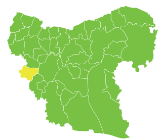
Tell Rifaat Subdistrict is a subdistrict of Azaz District in northwestern Aleppo Governorate of northern Syria. Administrative centre is the town of Tell Rifaat.
Mreimin is a village in Idlib Governorate, Syria. Administratively, the village belongs to Nahiya Darkush in Jisr al-Shughur District. In the 2004 census, Mreimin had a population of 1923.
Zunqul, also spelled Zūnqal, Zounqul or Zornaqal, is a village located 14 kilometers (8.7 mi) northwest of Manbij in northern Syria. In the 2004 census, it had a population of 1,966.

Al-Khafsah, also spelled Khafsa, is a village located 77 kilometers (48 mi) east of Aleppo in northern Syria. In the 2004 census, it had a population of 5,393.
Ibbin Samaan is a small town in western Aleppo Governorate, northwestern Syria. With a population of 6,220 as per the 2004 census, the town is the administrative center of Nahiya Ibbin Samaan.
Tell Rahal is a village located 25 km (16 mi) northeast of the city of Aleppo in northern-central Aleppo Governorate, northwestern Syria. It is administratively part of Nahiya al-Bab in al-Bab District. The village had a population of 2,866 as per the 2004 census.
Arab Azzah is a village in northern Aleppo Governorate, northwestern Syria. It is located midway between al-Rai and Jarabulus, at the eastern banks of Sajur River, just north of Sajur Lake and close to the Syria–Turkey border. Administratively belonging to Nahiya Ghandoura in Jarabulus District, the village has a population of 417 as per the 2004 census. The village is inhabited by Turkmen of the Elbegli tribe.
Tat Hims, alternatively spelled Tathumus, is a village in northern Aleppo Governorate, northwestern Syria. About 45 kilometres (28 mi) northeast of the city of Aleppo and just about 4 km (2.5 mi) south of Syria's border with Turkey, it is administratively part of Nahiya Akhtarin of Azaz District. Nearby localities include Qantarah 1 km (0.62 mi) to the south and al-Rai 6 km (3.7 mi) to the east. In the 2004 census, Tat Hims had a population of 1,722.
Ghaytun is a village in northern Aleppo Governorate, northwestern Syria. About 30 kilometres (19 mi) north of the city of Aleppo and some 20 km (12 mi) south of Syria's border with Turkey, it is administratively part of Nahiya Akhtarin of Azaz District. Nearby localities include Akhtarin 4 km (2.5 mi) to the northeast, Ghuz 2 km (1.2 mi) to the south, and Mare' 9 km (5.6 mi) to the west. In the 2004 census, Ghaytun had a population of 1,080.
Oweishiyeh or Uwaishiyah is a village in al-Bab District in northern Aleppo Governorate, northwestern Syria.
