Abuko

Last updated
Abuko
1014050-Market in Abuko-The Gambia.jpg
Livestock market in Abuko
Gambia rel location map.svg
Red pog.svg
Abuko
Location in the Gambia
Coordinates: 13°24′15″N16°39′21″W / 13.40417°N 16.65583°W / 13.40417; -16.65583
Country The Gambia
Division Western Division
District Kombo North/Saint Mary
Elevation
49 ft (15 m)
Population
 (2012)
  Total6,572
  [1]
Time zone UTC+0 (UTC)

Abuko is a town in the West Coast Division of the Gambia, five miles southwest of the capital Banjul. It is located in the district of Kombo North/Saint Mary to the north of Banjul International Airport and Abuko Nature Reserve.

Contents

Location

Abuko is in the West Coast Division, in the western part of the country, 10 kilometres (6.2 mi) south-west of the capital city Banjul. It had 6,572 inhabitants as of 2012. [1] The area around Abuko is well-populated, with 1,056 people per square kilometer. [2] The nearest larger city is Serekunda, 4.5 kilometres (2.8 mi) north-west of Abuko. [3] The town is home to the Abuko United FC. [4]

The 259 acres (105 ha) Abuko Nature Reserve, created in 1968, lies to the south of the town. It is the most visited tourist attraction in Gambia, with over 30,000 visitors annually. It contains tropical canopy forest near the Lamin Stream, giving way to Guinean savanna further from the water. The reserve is home to many species of bird, four primates and a variety of reptiles. [5]

Terrain

Abuko is 15 metres (49 ft) above sea level. [lower-alpha 1] The surrounding land is mainly flat. [lower-alpha 2] The highest point nearby has an elevation of 26 metres (85 ft), 1 kilometre (0.62 mi) south of Abuko. [lower-alpha 3] The vegetation around Abuko is almost all fields. [3] Peninsulas and islands are common in the region. [lower-alpha 4]

Climate

Abuko has a savanna climate. The average temperature is 24 °C (75 °F). The hottest month is April, with 27 °C (81 °F) and the coldest month is July, with 22 °C (72 °F). [7] Average annual rainfall is 1,148 millimetres (45.2 in). The wettest month is August, with 449 millimetres (17.7 in) of rain, and the driest month is February, with 1 millimetre (0.039 in) of rain. [8]

Abuko
Climate chart (explanation)
J
F
M
A
M
J
J
A
S
O
N
D
 
 
2
 
 
32
15
 
 
1
 
 
33
17
 
 
1
 
 
36
17
 
 
1
 
 
36
18
 
 
18
 
 
36
18
 
 
63
 
 
27
19
 
 
269
 
 
25
19
 
 
449
 
 
22
22
 
 
254
 
 
24
21
 
 
86
 
 
27
22
 
 
3
 
 
29
20
 
 
1
 
 
31
17
Average max. and min. temperatures in °C
Precipitation totals in mm
Source: [7]
Imperial conversion
JFMAMJJASOND
 
 
0.1
 
 
90
59
 
 
0
 
 
91
63
 
 
0
 
 
97
63
 
 
0
 
 
97
64
 
 
0.7
 
 
97
64
 
 
2.5
 
 
81
66
 
 
11
 
 
77
66
 
 
18
 
 
72
72
 
 
10
 
 
75
70
 
 
3.4
 
 
81
72
 
 
0.1
 
 
84
68
 
 
0
 
 
88
63
Average max. and min. temperatures in °F
Precipitation totals in inches


Notes

  1. Elevation is calculated from elevation data from the Viewfinder Panoramas. [1] [6]
  2. Terrain characteristics are calculated from the variance of all elevation data from the Viewfinder Panoramas within a 10 kilometres (6.2 mi) radius. [6]
  3. Calculated from elevation data from the Viewfinder Panoramas. [6]
  4. Peninsulas, and islands are more common in a 10 kilometres (6.2 mi) radius than for the average point on the earth, according to the GeoNames. [1]

Related Research Articles

The Kadassa River is a river of Sumba, East Nusa Tenggara, Indonesia.

The Kadumbul River is a river of Sumba, East Nusa Tenggara, Indonesia.

The Melolo River is a river of Sumba, Indonesia.

<span class="mw-page-title-main">Mount Zwegabin</span> Mountain in Karen State, Myanmar

Mount Zwegabin (Kwekabaw) (Phlone: ခွဲါက္ၜင်; Burmese: ဇွဲကပင်တောင်; S'gaw Karen: ကွဲၢ်ကဘီကစၢၢ်) is a mountain in Myanmar. It is located in Kayin State, in the southern part of the country, around 450 km south of the capital Naypyidaw. The top of Zwegabin is 722 metres (2,369 ft) above sea level.

Coyoles Central is a village in the municipality of Olanchito in Honduras. It is located in the department of Yoro, in the central part of Honduras, 160 km north of the capital Tegucigalpa. Coyoles Central initially served as a company town for workers of Standard Fruit Company, and was one of the principle settings in the book Prisión Verde, by Ramón Amaya Amador.

Jorkins Point is a cape in Canada. It is located on Swindle Island in the Regional District of Kitimat-Stikine in the province of British Columbia in the southwestern part of Canada, 3,800 km west of Canada's capital, Ottawa.

Brahman is a cattle station supplied with an airport near the eastern highlands of Madang Province, Papua New Guinea. It is located 500 km north of Port Moresby and is 128 meters above sea level.

Mount Richardson is in northern Fiordland, in the Southland District of New Zealand, in the southwestern part of the country. The summit is 485 metres (1,591 ft) above sea level. The terrain around Mount Richardson is hilly to the northwest, and mountainous to the southeast.

<span class="mw-page-title-main">Plagia, Kilkis</span> Place in Greece

Plagia is a village in the Kilkis region of Greece. It is situated in the municipal unit of Cherso, in the Kilkis municipality, within the Kilkis region of Central Macedonia.

<span class="mw-page-title-main">Kalindria</span> Place in Greece

Kalindria is a village in the Kilkis region of Greece. It is situated in the municipal unit of Cherso, in the Kilkis municipality, within the Kilkis region of Central Macedonia.
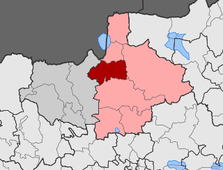
<span class="mw-page-title-main">Koromilia, Kilkis</span> Place in Greece

Koromilia is a village in the Kilkis region of Greece. It is situated in the municipal unit of Cherso, in the Kilkis municipality, within the Kilkis region of Central Macedonia.

<span class="mw-page-title-main">Megali Sterna</span> Place in Greece

Megali Sterna is a village in the Kilkis region of Greece. It is situated in the municipal unit of Cherso, in the Kilkis municipality, within the Kilkis region of Central Macedonia.

<span class="mw-page-title-main">Akritas, Kilkis</span> Place in Macedonia, Greece

Akritas is a village situated in the municipal unit of Doirani of the municipality of Kilkis, in the Kilkis regional unit of Central Macedonia, Greece.

<span class="mw-page-title-main">Plagia, Paionia</span> Place in Greece

Plagia is a village in the Kilkis regional unit of Greece. It is situated in the municipal unit of Axioupoli, in the Paionia municipality, within the Kilkis region of Central Macedonia.

<span class="mw-page-title-main">Megali Vrysi, Kilkis</span> Place in Greece

Megali Vrysi or Megali Vrisi is a village in the Kilkis region of Greece. It is situated in the municipal unit of Kilkis, in the Kilkis municipality, within the Kilkis region of Central Macedonia.

<span class="mw-page-title-main">Neo Gynaikokastro</span> Place in Greece

Neo Gynaikokastro is a village in the Kilkis region of Greece. It is situated in the municipal unit of Pikrolimni, in the Kilkis municipality, within the Kilkis region of Central Macedonia.

Sansha Town (三沙镇) is a town under the jurisdiction of Ningde City, Xiapu County in Fujian Province, China.

Changchun (长春镇) is a town in Xiapu County, Fujian.

Shuimen She Ethnic Township (水门畲族乡) is a township in Xiapu County.

Chongru She Ethnic Township (崇儒畲族乡) is an ethnic township in Xiapu County.

References

  1. 1 2 3 4 "abuko". Geographic Names Information System . United States Geological Survey, United States Department of the Interior. 2012-01-18. Retrieved 2015-05-23.
  2. "NASA Earth Observations: Population Density". NASA/SEDAC. Archived from the original on 9 February 2016. Retrieved 30 January 2016.
  3. 1 2 "NASA Earth Observations: Land Cover Classification". NASA/MODIS. Archived from the original on 28 February 2016. Retrieved 30 January 2016.
  4. "Abuko United completes East quarter-finals line-up", The Point, 30 October 2014, retrieved 2016-09-24
  5. Abuko Nature Reserve, Access Gambia, retrieved 2016-09-24
  6. 1 2 3 "Viewfinder Panoramas Digital elevation Model". 2015-06-21.
  7. 1 2 "NASA Earth Observations Data Set Index". NASA. Archived from the original on 3 February 2016. Retrieved 30 January 2016.
  8. "NASA Earth Observations: Rainfall (1 month - TRMM)". NASA/Tropical Rainfall Monitoring Mission. Archived from the original on 19 April 2019. Retrieved 30 January 2016.