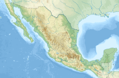
Durango, officially the Free and Sovereign State of Durango, is one of the 31 states which make up the 32 Federal Entities of Mexico, situated in the northwest portion of the country. With a population of 1,832,650, the 8th lowest of Mexico's states, Durango has Mexico's second-lowest population density, after Baja California Sur. The capital city, Victoria de Durango, is named after the first President of Mexico, Guadalupe Victoria.
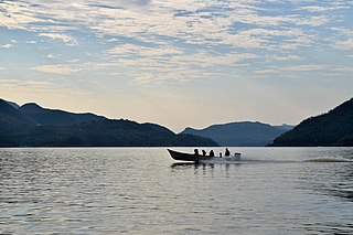
Nayarit, officially the Free and Sovereign State of Nayarit, is one of the 31 states that, along with Mexico City, comprise the Federal Entities of Mexico. It is divided in 20 municipalities and its capital city is Tepic.

Tepic is the capital and largest city of the western Mexican state of Nayarit, as well as the seat of the Tepic Municipality.
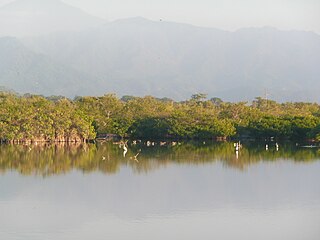
Marismas Nacionales–San Blas mangroves is a mangrove ecoregion of the Pacific coast of Mexico. The marismas nacionales stretches from Mazatlán, Sinaloa southwards to San Blas, Nayarit.

The Río Grande de Santiago, or Santiago River, is a river in western Mexico. It flows westwards from Lake Chapala via Ocotlán through the states of Jalisco and Nayarit to empty into the Pacific Ocean. It is one of the longest rivers in Mexico, measuring up 433 km (269 mi) long.
El Nayar is a municipality in the Mexican state of Nayarit. The population was 30,551 in 2005 in a total area of 5,100 km². The municipal seat of Jesús María had a population of 1,520 in 2005. El Nayar is the home of the Huichol, Cora, and the Tepehuán Indians.

Acaponeta is both a municipality and a town in the northern part of the Mexican state of Nayarit. The town is located at the geographical coordinates of 22°29′47″N105°21′34″W. The population of the municipality was 34,665 in the 2005 census, living in a total area of 1,667.7 km2. The population of the municipal seat was 18,066, the fifth-largest community in the state. The Acaponeta River flows through the town.
Tecuala is both a municipality and a town in the Mexican state of Nayarit, on the Pacific coast. The population of the municipality was 42,237 in a total area of 1,137 km² (2000) while the population of the town and municipal seat was 14,584 (2000). One of the longest beaches in the world, Playa Novillero, is located here.
Huajicori is both a municipality and the municipal seat of the same in the Mexican state of Nayarit. The population of the municipality was 10,294 in 2000 in a total area of 2,603.5 km2. Its area makes up almost 10% of the state. The population of the town was 2,201 (2005).
Mexicanero is the Nahuan language spoken by the Mexicanero people of southern Durango and northern Nayarit. It has around 1000 speakers in the remote towns of San Pedro Jícora and San Juan Buenaventura in the Mezquital municipality, Durango, where they coexist with speakers of Low Southern Tepehuán, and some 300 speakers in the Acaponeta municipality of Nayarit. There are significant differences between the varieties of San Pedro Jícora on the one hand and San Agustín Buenaventura and Nayarit on the other. The language is vibrant and spoken by adults and children.
Mexico's Natural resources protection areas are nine federally-recognized protected areas in Mexico that are administrated by the federal National Commission of Protected Natural Areas.

Santiago de Ixcuintla is a municipality and a municipal seat in the western Mexican state of Nayarit. The municipal population was 84,314 inhabitants with the municipal seat having 18,269. The area of the municipality was 1,831.92 square kilometers. It is located at 21º48'40" N and 105º12'23" W.
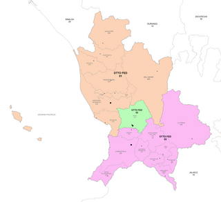
The 1st federal electoral district of Nayarit is one of the 300 electoral districts into which Mexico is divided for elections to the federal Chamber of Deputies and one of three such districts in the state of Nayarit.
The San Pedro Mezquital River is a river of Nayarit, Mexico.
The following television stations broadcast on digital or analog channel 32 in Mexico:
The following television stations broadcast on digital channel 27 in Mexico:
The Mexicaneros are an indigenous people of Durango and Nayarit, Mexico. They are one of the 62 original cultures of Mexico. They speak the Mexicanero language, a variety of the Nahuatl family. Some 1,300 individuals spoke the Mexicanero language as of 2011. They live in Mezquital Municipality, Durango and Acaponeta and El Nayar municipalities in Nayarit.
Federal Highway 15D is the name for toll highways paralleling Federal Highway 15. The toll segments of Highway 15D include some of the most significant highways in the country along the Nogales-Mexico City corridor. The highway is the southern terminus of the CANAMEX Corridor, a trade corridor that stretches from Mexico north across the United States to the Canadian province of Alberta.
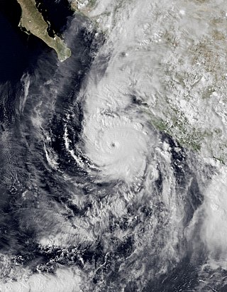
Hurricane Willa was a powerful tropical cyclone that brought torrential rains and destructive winds to southwestern Mexico, particularly the states of Sinaloa and Nayarit, during late October 2018. It was the twenty-fifth tropical cyclone, twenty-second named storm, thirteenth hurricane, tenth major hurricane, and record-tying third Category 5 hurricane of the 2018 Pacific hurricane season. Willa was the first major hurricane to make landfall in the Mexican state of Sinaloa since Lane in 2006.

Hurricane Pamela was a Category 1 Pacific hurricane that caused significant damage across several northwestern and western states of Mexico in October 2021. The sixteenth named storm and seventh hurricane of the 2021 Pacific hurricane season, the storm originated from a tropical wave over the Atlantic basin, over the Caribbean Sea. It then quickly crossed into the Pacific Ocean, where it slowly consolidated, with a low-pressure area forming from the wave on October 9. Environmental conditions in the area were proved favorable for tropical cyclogenesis and developed into Tropical Depression Sixteen-E on the next day. It then organized further into Tropical Storm Pamela on that night. Despite wind shear and dry air affecting the cyclone, Pamela continued to strengthen and became a hurricane on October 12 before weakening back to a tropical storm as it continued to succumb onto these factors. However, as the system turned towards the coast of Mexico, Pamela restrengthened to a low-end hurricane before making landfall over Estacion Dimas, Sinaloa on 15:00 UTC on October 13 before rapidly weakening inland. It then dissipated over Coahuila on the early hours on the next day.

