List of rivers of the Americas by coastline

Last updated
Map all coordinates using: OpenStreetMap
Americas N&SAmerica-pol.jpg
Americas
Capes in the Americas Capes in the Americas.png
Capes in the Americas

This list of rivers of the Americas by coastline includes the major coastal rivers of the Americas arranged by country. A link to a map of rivers with known coordinates is listed at right. The ocean coasts are demarcated as follows:

Contents

This is a counterpart to the primarily alphabetical List of rivers of the Americas and other lists of rivers of countries, although only rivers which reach the ocean are included here, not tributaries.

Arctic Ocean coast

Arctic Ocean Arctic.svg
Arctic Ocean

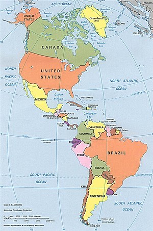
In the Americas, only the United States, Canada, and Greenland have rivers on the Arctic Ocean coast. Greenland is surrounded by the Barents Sea (part of the Arctic Ocean), the Greenland Sea (often described as part of the Arctic Ocean), Baffin Bay to the west (marginal sea of the Arctic Ocean), the Labrador Sea to the south (part of the Arctic Ocean), and directly to the Arctic Ocean to the north. The following is a list of rivers flowing into the Arctic Ocean. The province and country where the mouth is located are included. [1]

List of rivers flowing into the Arctic Ocean
NameState or Province (mouth)Country (mouth)Route to Arctic Oceancoordinate (mouth)
Mackenzie Northwest Territories Canada Beaufort Sea [1] 68°56′23″N136°10′22″W / 68.93972°N 136.17278°W / 68.93972; -136.17278 (Mackenzie River, A1)
Chesterfield Inlet Nunavut CanadaHudson Bay [2] 63°32′24″N091°04′48″W / 63.54000°N 91.08000°W / 63.54000; -91.08000 (Chesterfield Inlet, A2)
Dawson Inlet NunavutCanadaHudson Bay [3] 61°50′00″N93°25′00″W / 61.833333°N 93.416667°W / 61.833333; -93.416667 (Dawson Inlet, A3)
Maguse River NunavutCanadaHudson Bay [4] 61°17′N094°05′W / 61.283°N 94.083°W / 61.283; -94.083 (Maguse River, A4)
Tha-anne River NunavutCanadaHudson Bay [5] 60°31′00″N94°38′00″W / 60.516667°N 94.633333°W / 60.516667; -94.633333 (Tha-anne River, A5)
Thlewiaza River NunavutCanadaHudson Bay [6] 60°28′59″N94°40′0″W / 60.48306°N 94.66667°W / 60.48306; -94.66667 (Thlewiaza River, A6)
Nanook River NunavutCanada Hadley Bay,
Viscount Melville Sound [7]
71°36′00″N107°46′59″W / 71.600°N 107.783°W / 71.600; -107.783 (Nanook River, A7)
Caribou River ManitobaCanadaHudson Bay [8] 59°19′30″N94°44′07″W / 59.325°N 94.735278°W / 59.325; -94.735278 (Caribou River, A8)
Seal River Manitoba CanadaHudson Bay [9] 59°4′19″N94°47′56″W / 59.07194°N 94.79889°W / 59.07194; -94.79889 (Seal River, A9)
North Knife River ManitobaCanadaHudson Bay [10] 58°57′01″N94°36′47″W / 58.950278°N 94.613056°W / 58.950278; -94.613056 (North Knife River, A10)
South Knife River ManitobaCanadaHudson Bay [11] 58°53′55″N94°35′56″W / 58.898611°N 94.598889°W / 58.898611; -94.598889 (South Knife River, A11)
Churchill River ManitobaCanadaHudson Bay [12] 58°47′45″N94°12′15″W / 58.79583°N 94.20417°W / 58.79583; -94.20417 (Churchill River, A12)
Nelson River ManitobaCanadaHudson Bay [1] 57°5′5″N92°30′8″W / 57.08472°N 92.50222°W / 57.08472; -92.50222 (Nelson River, A13)
Firth River Alaska US Beaufort Sea 69°33′00″N139°30′00″W / 69.5500000°N 139.5000000°W / 69.5500000; -139.5000000 (Firth River, A14)
Kongakut River AlaskaUSBeaufort Sea 69°46′35″N141°42′16″W / 69.77639°N 141.70444°W / 69.77639; -141.70444 (Kongakut River, A15)
Aichilik River AlaskaUSBeaufort Sea 69°50′24″N141°07′34″W / 69.84000°N 141.12611°W / 69.84000; -141.12611 (Aichilik River, A16)
Jago River AlaskaUSdirect 70°06′34″N143°18′23″W / 70.1094°N 143.3064°W / 70.1094; -143.3064 (Jago River, A17)
Okpilak River AlaskaUSdirect 70°04′40″N144°03′09″W / 70.0778°N 144.0525°W / 70.0778; -144.0525 (Okpilak River, A18)
Hulahula RiverAlaskaUSdirect [13] 70°03′54″N144°04′57″W / 70.0650000°N 144.0825000°W / 70.0650000; -144.0825000 (Hulahula River, A19)
Sadlerochit RiverAlaskaUSCamden Bay, Beaufort Sea [14] 70°01′22″N144°26′08″W / 70.0227778°N 144.4355556°W / 70.0227778; -144.4355556 (Sadlerochit River, A20)
Canning River AlaskaUSCamden Bay, Beaufort Sea 70°04′42″N145°33′56″W / 70.07833°N 145.56556°W / 70.07833; -145.56556 (Canning River, A21)
Shaviovik RiverAlaskaUSdirect [15] 70°12′16″N147°16′50″W / 70.2044444°N 147.2805556°W / 70.2044444; -147.2805556 (Shaviovik River, A22)
Kadleroshilik River AlaskaUSFoggy Island Bay,
Beaufort Sea
70°12′26″N147°36′27″W / 70.2073°N 147.6076°W / 70.2073; -147.6076 (Kadleroshilik River, A23)
Kuparuk River AlaskaUSBeaufort Sea 70°25′28″N148°52′15″W / 70.42444°N 148.87083°W / 70.42444; -148.87083 (Kuparuk River, A24)
Colville River AlaskaUSdirect 70°26′46″N150°21′28″W / 70.44611°N 150.35778°W / 70.44611; -150.35778 (Colville River, A25)
Fish CreekAlaskaUS
Ikpikpuk RiverAlaskaUS Smith Bay, Beaufort Sea [16] 70°49′25″N154°18′09″W / 70.8236111°N 154.3025000°W / 70.8236111; -154.3025000 (Ikpikpuk River, A27)
Topagoruk RiverAlaskaUS Admiralty Bay [17] 70°45′24″N155°55′35″W / 70.7566667°N 155.9263889°W / 70.7566667; -155.9263889 (Topagoruk River, A28)
Meade River AlaskaUSBeaufort Sea 70°54′12″N155°57′27″W / 70.90333°N 155.95750°W / 70.90333; -155.95750 (Meade River, A29)
Kuk River AlaskaUS Chukchi Sea 70°36′29″N160°06′40″W / 70.60806°N 160.11111°W / 70.60806; -160.11111 (Kuk River, A30)
Utukok River AlaskaUSChukchi Sea 70°02′49″N162°27′26″W / 70.04694°N 162.45722°W / 70.04694; -162.45722 (Utukok River, A31)
Kokolik River AlaskaUSChukchi Sea 69°46′15″N162°59′48″W / 69.77083°N 162.99667°W / 69.77083; -162.99667 (Kokolik River, A32)
Kukpowruk River AlaskaUSChukchi Sea 69°36′57″N163°01′06″W / 69.61583°N 163.01833°W / 69.61583; -163.01833 (Kukpowruk River, A33)
Pitmegea River AlaskaUSChukchi Sea 68°54′53″N164°37′32″W / 68.91472°N 164.62556°W / 68.91472; -164.62556 (Pitmegea River, A34)
Kukpuk River AlaskaUSChukchi Sea 68°24′57″N166°22′37″W / 68.41583°N 166.37694°W / 68.41583; -166.37694 (Kukpuk River, A35)
Kivalina River AlaskaUS Kivalina Lagoon 67°49′03″N164°40′46″W / 67.81750°N 164.67944°W / 67.81750; -164.67944 (Kivalina River)
Albany River Ontario Canada James Bay 52°17′00″N81°30′59″W / 52.28333°N 81.51639°W / 52.28333; -81.51639 (Albany River)
Severn River OntarioCanadaHudson Bay 55°59′N87°38′W / 55.983°N 87.633°W / 55.983; -87.633 (Severn River)
Horton River Northwest TerritoriesCanada 69°56′01″N126°48′10″W / 69.93361°N 126.80278°W / 69.93361; -126.80278 (Horton River)
Back River Northwest TerritoriesCanada 67°16′00″N95°15′00″W / 67.26667°N 95.25000°W / 67.26667; -95.25000 (Back River)
Thomsen River Northwest TerritoriesCanada Castel Bay, Viscount Melville Sound 73°59′41″N119°43′27″W / 73.99481°N 119.7242°W / 73.99481; -119.7242 (Thomsen River)
Wolf River NunavutCanadaExpedition Fjord, Strand Bay, Sverdrup Channel 79°23′00″N91°07′00″W / 79.38333°N 91.11667°W / 79.38333; -91.11667 (Wolf River)
Børglum Elv Greenland 82°11′00″N30°20′00″W / 82.183333°N 30.333333°W / 82.183333; -30.333333 (Borglum Elv)
Minturn ElvGreenland Baffin Bay 78°48′07″N69°17′47″W / 78.801944°N 69.296389°W / 78.801944; -69.296389 (Minturn Elv)

Atlantic Ocean coast

Area of the Atlantic Ocean Atlantic Ocean - en.png
Area of the Atlantic Ocean

The Atlantic Ocean has irregular coasts indented by numerous bays, gulfs and seas. These include the Baltic Sea, Black Sea, Caribbean Sea, Davis Strait, Denmark Strait, part of the Drake Passage, Gulf of Mexico, Labrador Sea, Mediterranean Sea, North Sea, Norwegian Sea, almost all of the Scotia Sea, and other tributary water bodies. [18] Including these marginal seas the coast line of the Atlantic measures 111,866 km (69,510 mi) compared to 135,663 km (84,297 mi) for the Pacific. [18] [19]

The rivers in the following sections flow into the Atlantic Ocean, unless indicated otherwise. The rivers of Cuba and several other countries flow into the Caribbean Sea which connects to the Atlantic Ocean. Some rivers also flow into the Gulf of Mexico before the water reaches the main Atlantic Ocean. A few of the major, notable rivers flowing into the Caribbean and Gulf of Mexico are included below. These lists contain rivers with Wikipedia articles and a few other well-documented rivers.

Argentina, Atlantic Ocean coast

Coastal rivers of Argentina with mouth on the Atlantic Ocean coast
NameCountry (mouth)Coordinate (mouth)
Río de la Plata Argentina 35°40′S55°47′W / 35.667°S 55.783°W / -35.667; -55.783 (Río de la Plata)
Paraná Argentina, Uruguay 34°0′5″S58°23′37″W / 34.00139°S 58.39361°W / -34.00139; -58.39361 (Paraná River)
Quequén Grande River Argentina 38°30′33″S58°44′03″W / 38.50917°S 58.73417°W / -38.50917; -58.73417 (Quequén Grande River)
Sauce Grande River Argentina 38°59′34″S61°05′47″W / 38.992782°S 61.096432°W / -38.992782; -61.096432 (Sauce Grande River)
Arroyo Napostá Argentina 38°47′31″S62°14′18″W / 38.79183563201333°S 62.238242343742755°W / -38.79183563201333; -62.238242343742755 (Arroyo Napostá)
Rio Sauce Chico Argentina 38°47′00″S62°18′00″W / 38.783333°S 62.3°W / -38.783333; -62.3 (Rio Cauce Chico)
Colorado River Argentina 39°42′54.39″S62°7′52.43″W / 39.7151083°S 62.1312306°W / -39.7151083; -62.1312306 (Colorado River)
Río Negro Argentina 41°01′50″S62°47′23″W / 41.03056°S 62.78972°W / -41.03056; -62.78972 (Rio Negro)
Chubut River Argentina 43°20′32″S65°03′18″W / 43.34233217025459°S 65.05502613544668°W / -43.34233217025459; -65.05502613544668 (Chubut Rivere)
Deseado River Argentina 47°45′39″S65°53′56″W / 47.7608°S 65.8989°W / -47.7608; -65.8989 (Deseado River)
Santa Cruz River Argentina 50°08′S68°21′W / 50.133°S 68.350°W / -50.133; -68.350 (Santa Cruz River)
Coig River Argentina 50°57′00″S69°10′00″W / 50.9500°S 69.1667°W / -50.9500; -69.1667 (Coig River)
Gallegos River Argentina 51°35′40″S68°58′30″W / 51.59444°S 68.97500°W / -51.59444; -68.97500 (Gallegos River)
Rio Grande Argentina 53°48′00″S67°41′00″W / 53.800000°S 67.683333°W / -53.800000; -67.683333 (Rio Grande)
Fuego River Argentina 54°00′17.9″S67°37′12.8″W / 54.004972°S 67.620222°W / -54.004972; -67.620222 (Fuego River)
Rio Grande Argentina 53°47′21″S67°40′56″W / 53.78917°S 67.68222°W / -53.78917; -67.68222 (Rio Grande)

Bahamas, Caribbean Sea, Atlantic Ocean coast

While there are many tidal creeks in The Bahamas, the Goose River is the only river ( 24°21′N78°06′W / 24.350°N 78.100°W / 24.350; -78.100 (Goose River) ). Its mouth is on the Caribbean Sea.

Barbados, Caribbean Sea, Atlantic Ocean coast

The following rivers in Barbados flow to the Atlantic Ocean. [20]

The following rivers in Barbados flow to the Caribbean Sea. [20]

Belize, Caribbean Sea, Atlantic Ocean coast

All coastal rivers in Belize drain to the Caribbean Sea before going into the Atlantic Ocean.

Brazil, Atlantic Ocean coast

Rivers of Brazil where the mouth is on the Atlantic Coast
NameState (mouth)Coordinates
Amazon River Amapá 0°42′28″N50°5′22″W / 0.70778°N 50.08944°W / 0.70778; -50.08944 (Amazon River)
Araguari River Amapá 1°15′00″N49°55′00″W / 1.25°N 49.916667°W / 1.25; -49.916667 (Araguari River)
Macari River Amapá 1°52′N50°31′W / 1.867°N 50.517°W / 1.867; -50.517 (Macari River)
Flechal River Amapá 2°8′N50°42′W / 2.133°N 50.700°W / 2.133; -50.700 (Flechal River)
Calçoene River Amapá 2°30′25″N50°49′15″W / 2.50694°N 50.82083°W / 2.50694; -50.82083 (Calçoene River)
São Francisco River Bahia 10°29′59″S36°23′44″W / 10.49960341381051°S 36.39546430246904°W / -10.49960341381051; -36.39546430246904 (São Francisco River)
Mucuri River Bahia 18°05′37″S39°32′49″W / 18.09361°S 39.54694°W / -18.09361; -39.54694 (Mucuri)
Peruípe River Bahia 17°54′S39°21′W / 17.900°S 39.350°W / -17.900; -39.350 (Peruípe River)
Caravelas River Bahia 17°44′38″S39°11′12″W / 17.743979°S 39.186784°W / -17.743979; -39.186784 (Caravelas River)
Itanhaém River Bahia 17°32′S39°12′W / 17.533°S 39.200°W / -17.533; -39.200 (Itanhaém River)
Jucurucu River Bahia 17°23′S39°12′W / 17.383°S 39.200°W / -17.383; -39.200 (Jucurucu River)
Caraíva River Bahia 16°47′59″S39°08′39″W / 16.799722°S 39.144167°W / -16.799722; -39.144167 (Caraíva River)
Frades River Bahia 16°41′22″S39°06′17″W / 16.689403°S 39.104817°W / -16.689403; -39.104817 (Frades River)
Buranhém River Bahia 16°27′24″S39°03′54″W / 16.45667°S 39.06500°W / -16.45667; -39.06500 (Buranhém River)
João de Tiba River Bahia 16°15′04″S39°00′39″W / 16.25111°S 39.01083°W / -16.25111; -39.01083 (João de Tiba River)
Jequitinhonha River Bahia 15°51′00″S38°51′27″W / 15.85000°S 38.85750°W / -15.85000; -38.85750 (Jequitinhonha River)
Pardo River Bahia 15°39′S38°57′W / 15.650°S 38.950°W / -15.650; -38.950 (Pardo River)
Una River Bahia 15°13′47″S39°00′00″W / 15.229637°S 38.999881°W / -15.229637; -38.999881 (Una River)
Almada River Bahia 14°46′31″S39°03′06″W / 14.775278°S 39.051753°W / -14.775278; -39.051753 (Almada River)
Tijuípe River Bahia 14°25′S39°1′W / 14.417°S 39.017°W / -14.417; -39.017 (Tijuípe River)
Jequiriçá River Bahia 13°13′S38°56′W / 13.217°S 38.933°W / -13.217; -38.933 (Jequiriçá River)
Pojuca River Bahia 12°35′50″S38°01′49″W / 12.59722°S 38.03028°W / -12.59722; -38.03028 (Pojuca River)
Itapicuru River Bahia 11°47′S37°32′W / 11.783°S 37.533°W / -11.783; -37.533 (Itapicuru River)
Real River Bahia 11°27′S37°21′W / 11.450°S 37.350°W / -11.450; -37.350 (Real River)
Vaza-Barris River Bahia 11°10′17″S37°09′49″W / 11.171380°S 37.163546°W / -11.171380; -37.163546 (Vaza-Barris River)
Sergipe River Sergipe 10°57′40″S37°02′0″W / 10.96111°S 37.03333°W / -10.96111; -37.03333 (Sergipe River)
Japaratuba River Sergipe 10°44′30″S36°51′02″W / 10.74167°S 36.85056°W / -10.74167; -36.85056 (Japaratuba River)
São Francisco River Sergipe 10°29′59″S36°23′44″W / 10.49960341381051°S 36.39546430246904°W / -10.49960341381051; -36.39546430246904 (São Francisco River)
Coruripe River Alagoas 10°09′30″S36°09′03″W / 10.15833°S 36.15083°W / -10.15833; -36.15083 (Coruripe River)
Jequiá River (Alagoas) Alagoas 10°02′57″S36°01′51″W / 10.049147°S 36.030748°W / -10.049147; -36.030748 (Jequiá River (Alagoas))
São Miguel River Alagoas 9°51′S35°54′W / 9.850°S 35.900°W / -9.850; -35.900 (São Miguel River)
Prataji River Alagoas 9°34′S35°39′W / 9.567°S 35.650°W / -9.567; -35.650 (Prataji River)
Meirim River Alagoas 9°32′51″S35°37′07″W / 9.54750°S 35.61861°W / -9.54750; -35.61861 (Meirim River)
Tatuamunha River Alagoas 9°14′S35°21′W / 9.233°S 35.350°W / -9.233; -35.350 (Tatuamunha River)
Manguaba River Alagoas 9°9′S35°18′W / 9.150°S 35.300°W / -9.150; -35.300 (Manguaba River)
Salgado River Alagoas 9°4′S35°14′W / 9.067°S 35.233°W / -9.067; -35.233 (Salgado River)
Mundaú River Pernambuco 8°54′S35°9′W / 8.900°S 35.150°W / -8.900; -35.150 (Mundaú River)
Una River Pernambuco 8°51′40″S35°07′48″W / 8.861°S 35.13°W / -8.861; -35.13 (Una River)
Sirinhaém River Pernambuco 8°36′40″S35°02′45″W / 8.61111°S 35.04583°W / -8.61111; -35.04583 (Sirinhaém River)
Ipojuca River Pernambuco 8°24′39″S34°58′04″W / 8.41083°S 34.96778°W / -8.41083; -34.96778 (Ipojuca River)
Jaboatão River Pernambuco 8°13′31″S34°55′35″W / 8.22528°S 34.92639°W / -8.22528; -34.92639 (Jaboatão River)
Goiana River Pernambuco 7°33′11″S34°49′58″W / 7.55306°S 34.83278°W / -7.55306; -34.83278 (Goiana River)
Guaju River Pernambuco 6°29′16″S34°58′06″W / 6.48778°S 34.96833°W / -6.48778; -34.96833 (Guaju River)
Gurupí River Pará 1°07′01″S46°03′18″W / 1.116806°S 46.055048°W / -1.116806; -46.055048 (Gurupí River)
Parnaíba River Piauí 2°45′01″S41°49′15″W / 2.75033°S 41.8208°W / -2.75033; -41.8208 (Parnaíba River)

Canada, Atlantic Ocean coast

Canadian coastal river basins flow towards either the Arctic Ocean, Atlantic Ocean, or Pacific Ocean. The major Canadian rivers with their mouth on the Atlantic Ocean coast are included in the list below. The Province where the mouth is located is also given. [21]

Colombia, Caribbean Sea, Atlantic Ocean coast

Colombian rivers with their mouth on the Caribbean Sea, Atlantic Ocean coast include:

Costa Rica, Atlantic Ocean coast

All Costa Rican drainage basins flow to either the Caribbean Sea or the Pacific Ocean.

Cuba, Caribbean Sea, Atlantic Ocean coast

All Cuban coastal rivers have their mouth on the Caribbean Sea, including the following major river:

Dominican Republic, Caribbean Sea, Atlantic Ocean coast

The following rivers of the Dominican Republic have their mouth on the Atlantic Ocean:

French Guiana, Atlantic Ocean coast

Rivers of French Guiana where the mouth is on the Atlantic Ocean coast include the following: [22]

Guyana, Atlantic Ocean coast

Rivers of Guyana where the mouth is on the Atlantic Ocean coast include the following:

Haiti, Caribbean Sea, Atlantic Ocean coast

Coastal rivers of Haiti have their mouths on the Caribbean Sea, including:

Honduras, Caribbean Sea, Atlantic Ocean coast

Coastal rivers of Honduras flow into either the Caribbean Sea or Pacific Ocean.

Mexico, Atlantic Ocean coast

Coastal rivers of Mexico include Pacific Ocean coastal rivers and the following river with its mouth on the Gulf of Mexico.

Nicaragua, Caribbean Sea, Atlantic Ocean coast

Coastal rivers of Nicaragua with their mouth on the Caribbean Sea, Atlantic Ocean include:

Panama, Caribbean Sea, Atlantic Ocean coast

Coastal rivers in Panama have their mouth on either the Caribbean Sea in the Atlantic or the Pacific Ocean. Some of the rivers with their mouth on the Caribbean Sea include:

Suriname, Atlantic Ocean coast

Coastal rivers of Suriname where the mouth is on the Atlantic Ocean coast include: [24]

United States, Atlantic Ocean coast

The U.S. coastal rivers where the mouth is on the Atlantic Ocean coast include: [25]

U.S. Atlantic Ocean coastal rivers
NameState (mouth)route to AtlanticCoordinates (mouth)
Connecticut River Connecticut Long Island Sound 41°16′20″N72°20′03″W / 41.27222°N 72.33417°W / 41.27222; -72.33417 (Connecticut River)
Delaware River Delaware Delaware Bay 39°25′13″N75°31′11″W / 39.42028°N 75.51972°W / 39.42028; -75.51972 (Delaware River)
St. Marys River Florida 30°43′23″N81°29′41″W / 30.72306°N 81.49472°W / 30.72306; -81.49472 (St. Marys River)
Nassau River Florida 30°30′48″N81°26′20″W / 30.5132944°N 81.4389777°W / 30.5132944; -81.4389777 (Nassau River)
Fort George River Florida 30°26′22″N81°25′27″W / 30.4394064°N 81.4242539°W / 30.4394064; -81.4242539 (Fort George River) [26]
St. Johns River Florida 30°24′05″N81°24′3″W / 30.40139°N 81.40083°W / 30.40139; -81.40083 (St. Johns River)
Matanzas River Florida 29°54′50″N81°17′01″W / 29.9138577°N 81.2836827°W / 29.9138577; -81.2836827 (Matanzas River)
Halifax River Florida 29°04′25″N80°55′22″W / 29.07361°N 80.92278°W / 29.07361; -80.92278 (Halifax River)
Indian River North Florida 27°50′N80°27′W / 27.83°N 80.45°W / 27.83; -80.45 (Indian River)
Indian River Florida 27°50′N80°27′W / 27.83°N 80.45°W / 27.83; -80.45 (Indian River)
St. Lucie River Florida 27°10′10″N80°11′09″W / 27.1694938°N 80.1858788°W / 27.1694938; -80.1858788 (St. Lucie River)
Loxahatchee River Florida 26°56′57.9″N80°6′25.8″W / 26.949417°N 80.107167°W / 26.949417; -80.107167 (Loxahatchee River)
Hillsboro River Florida 27°56′31″N82°27′29″W / 27.9419663°N 82.4581501°W / 27.9419663; -82.4581501 (Hillsboro River)
Stranahan River Florida 26°06′07″N80°07′09″W / 26.1020314°N 80.1192112°W / 26.1020314; -80.1192112 (Stranahan River) [27]
Oleta River Florida 25°56′N80°08′W / 25.93°N 80.13°W / 25.93; -80.13 (Oleta River)
Little River Florida Biscayne Bay 25°51′03″N80°11′27″W / 25.85096°N 80.19071°W / 25.85096; -80.19071 (Little River)
Miami River Florida 25°46′14″N80°11′06″W / 25.7705°N 80.1851°W / 25.7705; -80.1851 (Miami River)
Savannah River Georgia, South Carolina 32°02′16″N80°51′00″W / 32.0377132°N 80.8501103°W / 32.0377132; -80.8501103 (Savanna River)
Bull River Georgia 31°58′48″N80°55′41″W / 31.980°N 80.928°W / 31.980; -80.928 (Bull River)
Halfmoon River Georgia 31°57′35″N80°56′31″W / 31.95966°N 80.94205°W / 31.95966; -80.94205 (Halfmoon River)
Wilmington River Georgia 31°55′16″N80°56′15″W / 31.92105°N 80.93761°W / 31.92105; -80.93761 (Wilmington River)
Odingsell River Georgia 31°51′34″N81°00′24″W / 31.85939°N 81.00677°W / 31.85939; -81.00677 (Odingsell River)
Ogeechee Georgia 31°50′1″N81°1′39″W / 31.83361°N 81.02750°W / 31.83361; -81.02750 (Ogeechee River)
Bear River Georgia 31°43′35″N81°09′08″W / 31.72633°N 81.15232°W / 31.72633; -81.15232 (Bear River)
Medway River GeorgiaSt. Catherines Sound 31°43′00″N81°10′38″W / 31.71661°N 81.17732°W / 31.71661; -81.17732 (Medway River)
North Newport River Georgia 31°41′50″N81°10′57″W / 31.697208°N 81.182442°W / 31.697208; -81.182442 (North Newport River)
South Newport River Georgia 31°33′17″N81°11′40″W / 31.55467°N 81.19454°W / 31.55467; -81.19454 (South Newport River)
Sapelo River Georgia 31°32′11″N81°16′37″W / 31.53633°N 81.27704°W / 31.53633; -81.27704 (Sapelo River)
Mud River Georgia 31°32′07″N81°14′31″W / 31.53522°N 81.24204°W / 31.53522; -81.24204 (Mud River)
Duplin River Georgia 31°24′52″N81°18′00″W / 31.41439°N 81.30010°W / 31.41439; -81.30010 (Duplin River)
North River Georgia 31°24′05″N81°20′45″W / 31.40139°N 81.34583°W / 31.40139; -81.34583 (North River)
South River Georgia 31°22′02″N81°18′35″W / 31.36717°N 81.30982°W / 31.36717; -81.30982 (South River)
Altamaha River Georgia 31°18′57″N81°17′5″W / 31.31583°N 81.28472°W / 31.31583; -81.28472 (Altamaha River)
Hampton River Georgia 31°12′57″N81°18′21″W / 31.21579°N 81.30593°W / 31.21579; -81.30593 (Hampton River)
Frederica River Georgia 31°12′10″N81°24′07″W / 31.20273°N 81.40204°W / 31.20273; -81.40204 (Frederica River)
Mackay River Georgia 31°09′26″N81°25′48″W / 31.15718°N 81.43010°W / 31.15718; -81.43010 (Mackay River)
Brunswick River Georgia 31°07′13″N81°25′35″W / 31.12023°N 81.42649°W / 31.12023; -81.42649 (Brunswick River)
Little Satilla River Georgia 31°02′12″N81°27′07″W / 31.03662°N 81.45204°W / 31.03662; -81.45204 (Little Satilla River)
Satilla River Georgia 30°59′1″N81°27′29″W / 30.98361°N 81.45806°W / 30.98361; -81.45806 (Satilla River)
Cumberland River Georgia 30°53′32″N81°30′21″W / 30.89218°N 81.50593°W / 30.89218; -81.50593 (Cumberland River)
St. Marys River Georgia 30°43′23″N81°29′41″W / 30.72306°N 81.49472°W / 30.72306; -81.49472 (St. Marys River)
Mississippi River LouisianaGulf of Mexico 29°09′04″N89°15′12″W / 29.15111°N 89.25333°W / 29.15111; -89.25333 (Mississippi River)
Kennebec River Maine Gulf of Maine 43°44′06″N69°46′26″W / 43.7350850°N 69.7739341°W / 43.7350850; -69.7739341 (Kennebec River)
Piscataqua River MaineGulf of Main/ Portsmouth Harbor 43°3′22″N70°42′11″W / 43.05611°N 70.70306°W / 43.05611; -70.70306 (Piscataqua River)
Mousam River Maine 43°20′40″N70°30′54″W / 43.34444°N 70.51500°W / 43.34444; -70.51500 (Mousam River)
Potomac River Maryland, Virginia Chesapeake Bay 37°59′57″N76°14′59″W / 37.99917°N 76.24972°W / 37.99917; -76.24972 (Potomac River)
Susquehanna River MarylandChesapeake Bay 39°32′35″N76°04′32″W / 39.54306°N 76.07556°W / 39.54306; -76.07556 (Susquehanna River)
Hudson River New York, New Jersey Upper New York Bay 40°41′48″N74°01′42″W / 40.69667°N 74.02833°W / 40.69667; -74.02833 (Hudson River)
Cape Fear River North Carolina 33°53′08″N078°00′46″W / 33.88556°N 78.01278°W / 33.88556; -78.01278 (Cape Fear River)
North Landing River North CarolinaChesapeak Bay 36°35′43″N76°03′35″W / 36.595360°N 76.059723°W / 36.595360; -76.059723 (North Landing River)
Pamlico River North Carolina Pamlico Sound 35°19′6″N76°25′58″W / 35.31833°N 76.43278°W / 35.31833; -76.43278 (Pamlico River)
Little River South Carolina 33°50′45″N78°32′49″W / 33.84583°N 78.54694°W / 33.84583; -78.54694 (Little River, SC)
Pee Dee River South Carolina Winyah Bay 34°43′16″N79°52′54″W / 34.72111°N 79.88167°W / 34.72111; -79.88167 (Pee Dee River)
Santee River South Carolina 33°07′48.96″N79°15′31.73″W / 33.1302667°N 79.2588139°W / 33.1302667; -79.2588139 (Santee River)
Wando River South Carolina Charleston Harbor 32°48′58″N79°54′40″W / 32.81611°N 79.91111°W / 32.81611; -79.91111 (Wando River)
Cooper River South Carolina 32°45′43″N79°54′14″W / 32.76194°N 79.90389°W / 32.76194; -79.90389 (Cooper River)
Ashley River South Carolina 32°45′46″N79°55′44″W / 32.76278°N 79.92889°W / 32.76278; -79.92889 (Ashley River)
Stono River South Carolina 32°38′13″N80°00′54″W / 32.6368472°N 80.0150926°W / 32.6368472; -80.0150926 (Stono River)
Kiawah River South Carolina 32°38′21″N80°01′15″W / 32.6390694°N 80.0209260°W / 32.6390694; -80.0209260 (Kiawah River) [28]
Edisto River South Carolina 32°39′16″N80°23′17″W / 32.65444°N 80.38806°W / 32.65444; -80.38806 (Edisto River)
Ashepoo River South Carolina 32°29′25″N80°25′25″W / 32.49028°N 80.42361°W / 32.49028; -80.42361 (Ashepoo River)
Combahee River South Carolina 32°30′31″N80°30′34″W / 32.50861°N 80.50944°W / 32.50861; -80.50944 (Combahee River)
Coosaw River South Carolina 32°29′01″N80°28′29″W / 32.4835223°N 80.4748266°W / 32.4835223; -80.4748266 (Coosaw River) [29]
Morgan River (Gut)South Carolina 32°27′10″N80°28′22″W / 32.4526904°N 80.4728826°W / 32.4526904; -80.4728826 (Morgan River) [30]
Story River (Gut)South Carolina 32°19′59″N80°31′01″W / 32.3329740°N 80.5170519°W / 32.3329740; -80.5170519 (Story River) [31]
Beaufort River South Carolina 32°16′22″N80°39′32″W / 32.2727008°N 80.6589969°W / 32.2727008; -80.6589969 (Beaufort River) [32]
Broad River South Carolina 32°17′41″N80°42′17″W / 32.29472°N 80.70472°W / 32.29472; -80.70472 (Broad Rivder)
May RiverSouth Carolina 32°11′50″N80°47′22″W / 32.1971497°N 80.7895529°W / 32.1971497; -80.7895529 (May River) [33]
New River South Carolina 32°04′24″N80°52′14″W / 32.0732667°N 80.8706658°W / 32.0732667; -80.8706658 (New River) [34]
Wright River South Carolina 32°02′59″N80°54′27″W / 32.0496565°N 80.9076109°W / 32.0496565; -80.9076109 (Wright River) [35]
Cockle Creek VirginiaNorth of Chesapeake Bay 37°54′54″N75°26′39″W / 37.914898°N 75.444144°W / 37.914898; -75.444144 (Cockle Creek)
Machipongo River VirginiaNorth of Chesapeake Bay 37°33′17″N75°47′54″W / 37.55472°N 75.79833°W / 37.55472; -75.79833 (Machipongo River)

Uruguay, Atlantic Ocean coast

Coastal rivers of Uruguay where the mouth is on the Atlantic Ocean coast include:

Venezuela, Atlantic Ocean coast

Coastal rivers of Venezuela have their mouth on either the Atlantic Ocean or the Caribbean Sea. The Orinoco River flows into the Delta Amacuro at its mouth. The Delta empties into the Gulf of Paría and the Atlantic Ocean. Venezuelan rivers with their mouth on the Atlantic Ocean coast include:

Pacific Ocean coast

Coastal rivers in the following sections by country have their mouth on the Pacific Ocean coast.

Canada, Pacific Ocean coast

Canadian rivers flowing into the Pacific Ocean include the following: [36]

Chile, Pacific Ocean coast

The coastal rivers (Río) in Chile that have their mouth on the Pacific Ocean include:

Colombia, Pacific Ocean Coast

map of rivers in Colombia Mapa de Colombia (rios).svg
map of rivers in Colombia

Coastal rivers in Colombia flow into the Pacific Ocean or Caribbean Sea. Rivers flowing into the Pacific Ocean include the following:

Costa Rica, Pacific Ocean Coast

Ecuador, Pacific Ocean Coast

El Salvador, Pacific Ocean Coast

Guatemala, Pacific Ocean Coast

The coastal rivers in Guatemala with their mouth on the Pacific Ocean coast include: [47]

Honduras, Pacific Ocean Coast

Mexico, Pacific Ocean Coast

Major rivers in Mexico Mexico rivers.jpg
Major rivers in Mexico

Rivers of Mexico that have their mouth on the Pacific Ocean coast include the following. The river's name, as well as Mexican State and coordinates where the mouth of the river is located are listed where known.

Mexican Pacific Ocean coastal rivers
NameState (mouth)Coordinates
Acaponeta River Nayarit 22°22′36″N105°38′11″W / 22.37659°N 105.63629°W / 22.37659; -105.63629 (Acaponeta River)
Ameca River Jalisco 20°40′21″N105°16′52″W / 20.6725°N 105.281°W / 20.6725; -105.281 (Ameca River)
Armería River Colima 18°52′55″N103°57′07″W / 18.882082°N 103.952072°W / 18.882082; -103.952072 (Armería River)
Atoyac River Guerrero 17°56′24″N102°08′13″W / 17.94005365895425°N 102.1368990207179°W / 17.94005365895425; -102.1368990207179 (Atoyac River)
Balsas River Michoacán 17°56′22″N102°08′14″W / 17.93944°N 102.13722°W / 17.93944; -102.13722 (Balsas River)
Baluarte River Sinaloa 22°50′27″N106°01′57″W / 22.84083°N 106.03250°W / 22.84083; -106.03250 (Baluarte River)
Chacala River Mexico 19°09′02″N104°35′20″W / 19.150664°N 104.588957°W / 19.150664; -104.588957 (Rio Chacala)
Coalcomán River Michoacán 18°14′06″N103°14′21″W / 18.234878°N 103.239229°W / 18.234878; -103.239229 (Coalcomán River)
Colorado River Baja California 31°54′00″N114°57′03″W / 31.90000°N 114.95083°W / 31.90000; -114.95083 (Colorado River)
Colotepec River Oaxaca 15°48′34″N97°01′27″W / 15.809355°N 97.024251°W / 15.809355; -97.024251 (Colotepec)
Concepción River Chiapas 15°19′56″N92°31′46″W / 15.332331°N 92.529416°W / 15.332331; -92.529416 (Concepción River)
Copalita River Oaxaca 15°47′12″N96°03′00″W / 15.786798°N 96.049879°W / 15.786798; -96.049879 (Copalita River)
Culiacán River Sinaloa 24°29′32″N107°43′55″W / 24.49222°N 107.73194°W / 24.49222; -107.73194 (Culiacán River)
Del Rosario River Baja California 32°20′00″N117°03′00″W / 32.333333°N 117.05°W / 32.333333; -117.05 (Rio Rosario)
Fuerte River Sinaloa 25°48′N109°25′W / 25.800°N 109.417°W / 25.800; -109.417 (Fuerta River)
Mátape River Sonora 28°17′00″N110°41′00″W / 28.283333°N 110.683333°W / 28.283333; -110.683333 (Mátape River)
Mayo River Sonora 26°44′08″N109°48′01″W / 26.735609°N 109.80036°W / 26.735609; -109.80036 (Mayo River)
Ometepec River Guerrero 16°32′57″N98°35′02″W / 16.54913°N 98.58382°W / 16.54913; -98.58382 (Ometepec River)
Papagayo River Guerrero 16°41′05″N99°36′38″W / 16.684718°N 99.61065°W / 16.684718; -99.61065 (Rio Papagayo)
Piaxtla River Sinaloa 23°42′18″N106°48′16″W / 23.704876°N 106.804351°W / 23.704876; -106.804351 (Rio Piaxtla)
Presidio River Sinaloa 23°05′39″N106°17′27″W / 23.094222°N 106.290895°W / 23.094222; -106.290895 (Presidio River)
Purificación River Jalisco 19°18′07″N104°53′52″W / 19.301949°N 104.897772°W / 19.301949; -104.897772 (Purificación River)
Río Grande de Santiago Nayarit 21°38′00″N105°26′43″W / 21.63333°N 105.44528°W / 21.63333; -105.44528 (Rio Grande de Santiago)
Río Santa Rosalía Baja California Sur 26°54′N111°59′W / 26.900°N 111.983°W / 26.900; -111.983 (Río Santa Rosalía)
Río Verde Oaxaca 16°25′23″N94°52′56″W / 16.42306°N 94.88222°W / 16.42306; -94.88222 (Verde River)
San Antonio River Chiapas 14°48′12″N92°13′06″W / 14.803358°N 92.218376°W / 14.803358; -92.218376 (Rio San Antonio)
San Lorenzo River Sonora 28°24′52″N110°14′13″W / 28.414315°N 110.236986°W / 28.414315; -110.236986 (San Lorenzo River)
San Pedro Mezquital River Nayarit 21°56′22″N105°21′01″W / 21.939417°N 105.350269°W / 21.939417; -105.350269 (Río San Pedro Mezquital)
San Vicente River Baja California 31°15′46″N116°22′41″W / 31.262907°N 116.378182°W / 31.262907; -116.378182 (Rio San Vicente)
Sinaloa River Sinaloa 25°17′00″N108°29′39″W / 25.2833°N 108.4942°W / 25.2833; -108.4942 (Sinaloa River)
Sonora River Sonora 28°51′12″N111°59′27″W / 28.8532°N 111.9908°W / 28.8532; -111.9908 (Sonora River)
Sonoyta River Sonora 31°16′07″N113°19′07″W / 31.268716°N 113.318657°W / 31.268716; -113.318657 (Rio Sonoyta)
Suchiate River Chiapas 14°31′56″N92°13′44″W / 14.53218016661489°N 92.2288438396178°W / 14.53218016661489; -92.2288438396178 (Suchiate River)
Teacapan Estuary Sinaloa 22°32′50″N105°45′00″W / 22.54712°N 105.7500°W / 22.54712; -105.7500 (Teacapan Estuary)
Tehuantepec River Oaxaca 16°11′16″N95°08′45″W / 16.187762°N 95.145747°W / 16.187762; -95.145747 (Rio Tehuantepec)
Tomatlán River Jalisco 19°50′30″N105°22′20″W / 19.841788°N 105.3722°W / 19.841788; -105.3722 (Tomatlán River)
Tijuana River Baja California 32°33′06″N117°07′38″W / 32.5517°N 117.1271°W / 32.5517; -117.1271 (Tijuana River)
Tuxpan River Jalisco 19°15′48″N103°30′25″W / 19.263373°N 103.506889°W / 19.263373; -103.506889 (Tuxpan River)
Yaqui River Sonora 27°40′02″N110°36′43″W / 27.6673°N 110.6120°W / 27.6673; -110.6120 (Yaqui River)

Nicaragua, Pacific Ocean Coast

Panama, Pacific Ocean Coast

The mouth of the following rivers in Panama are at the Pacific Ocean: [22]

Peru, Pacific Ocean Coast

The following coastal rivers in Peru have their mouth on the Pacific Ocean Coast: [48]

United States, Pacific Ocean coast

The following coastal rivers of the United States have their mouth on the Pacific Ocean: [49]

U.S. Pacific Ocean coastal rivers
NameState (mouth)route to PacificCoordinates (mouth)
Yukon River Alaska 62°35′55″N164°48′00″W / 62.59861°N 164.80000°W / 62.59861; -164.80000 (Yukon River)
Nome River Alaska Norton Sound, Bering Sea 64°53′06″N165°14′05″W / 64.88500°N 165.23472°W / 64.88500; -165.23472 (Nome River)
Kuskokwim River Alaska Kuskokwim Bay, Bering Sea 60°04′59″N162°20′02″W / 60.08306°N 162.33389°W / 60.08306; -162.33389 (Kuskokwim River)
Bering River Alaska Gulf of Alaska 60°09′59″N144°14′59″W / 60.1663889°N 144.2497222°W / 60.1663889; -144.2497222 (Bering River)
Nushagak River Alaska Nushagak Bay 58°47′58″N158°37′57″W / 58.79944°N 158.63250°W / 58.79944; -158.63250 (Nushagak River)
Peaceful River AlaskaBering Sea 52°49′31″N173°10′56″E / 52.8251930°N 173.1822460°E / 52.8251930; 173.1822460 (Peaceful River)
Joshua Green River Alaska Bristol Bay, Bering Sea 55°23′30″N162°29′10″W / 55.39167°N 162.48611°W / 55.39167; -162.48611 (Joshua Green River)
Meshik River AlaskaBristol Bay, Bering Sea 56°48′32″N158°39′46″W / 56.80889°N 158.66278°W / 56.80889; -158.66278 (Meshik River)
Seal River AlaskaGulf of Alaska 60°02′27″N143°30′40″W / 60.04083°N 143.51111°W / 60.04083; -143.51111 (Seal River)
Yahtse River Alaska 59°51′48″N141°23′36″W / 59.86333°N 141.39333°W / 59.86333; -141.39333 (Yahtse River)
Copper River AlaskaCopper Bay 60°23′19″N144°57′39″W / 60.38861°N 144.96083°W / 60.38861; -144.96083 (Copper River)
Karluk River Alaska Shelikof Strait 57°34′18″N154°27′44″W / 57.57167°N 154.46222°W / 57.57167; -154.46222 (Karluk Rive)
Aniakchak River Alaska Aniakchak Bay 56°45′49″N157°29′43″W / 56.76361°N 157.49528°W / 56.76361; -157.49528 (Aniakchak River)
Situk River Alaska 59°26′07″N139°32′48″W / 59.43528°N 139.54667°W / 59.43528; -139.54667 (Situk River)
Alsek River AlaskaDry Bay, Gulf of Alaska 59°7′40″N138°37′14″W / 59.12778°N 138.62056°W / 59.12778; -138.62056 (Alsek River)
Russian River California 38°27′2″N123°7′46″W / 38.45056°N 123.12944°W / 38.45056; -123.12944 (Russian River)
Sacramento River California Sacramento–San Joaquin River Delta, San Francisco Bay 38°03′48″N121°51′10″W / 38.06333°N 121.85278°W / 38.06333; -121.85278 (Sacramento River)
San Joaquin River California Suisun Bay, San Francisco Bay 38°04′00″N121°51′04″W / 38.06667°N 121.85111°W / 38.06667; -121.85111 (San Joaquin River)
San Diego River California 32°45′37″N117°12′45″W / 32.76028°N 117.21250°W / 32.76028; -117.21250 (San Diego River)
Santa Margarita River California 33°13′55″N117°24′58″W / 33.23194°N 117.41611°W / 33.23194; -117.41611 (Santa Margarita River)
Santa Ana River California 33°37′41″N117°57′31″W / 33.62806°N 117.95861°W / 33.62806; -117.95861 (Santa Ana River)
San Luis Rey River California 33°12′08″N117°23′32″W / 33.20222°N 117.39222°W / 33.20222; -117.39222 (San Luis Rey River)
San Gabriel River California 33°44′33″N118°06′56″W / 33.74250°N 118.11556°W / 33.74250; -118.11556 (San Gabriel River)
Los Angeles River California 33°45′23″N118°11′20″W / 33.75639°N 118.18889°W / 33.75639; -118.18889 (Los Angeles River)
Santa Clara River California 34°14′07″N119°15′49″W / 34.23528°N 119.26361°W / 34.23528; -119.26361 (Santa Clara River)
Santa Ynez River California 34°41′31″N120°36′7″W / 34.69194°N 120.60194°W / 34.69194; -120.60194 (Santa Ynez River)
Santa Maria River California 34°58′15″N120°39′01″W / 34.97083°N 120.65028°W / 34.97083; -120.65028 (Santa Maria River)
Salinas River California Monterey Bay 36°44′58″N121°48′13″W / 36.74944°N 121.80361°W / 36.74944; -121.80361 (Salinas River)
Pajaro River CaliforniaMonterey Bay 36°51′00″N121°48′35″W / 36.85000°N 121.80972°W / 36.85000; -121.80972 (Pajaro River)
San Lorenzo River CaliforniaMonterey Bay 36°57′51″N122°00′45″W / 36.96417°N 122.01250°W / 36.96417; -122.01250 (San Lorenzo River)
Navarro River California 39°11′32″N123°45′40″W / 39.19222°N 123.76111°W / 39.19222; -123.76111 (Navarro River)
Noyo River California 39°25′40″N123°48′33″W / 39.42778°N 123.80917°W / 39.42778; -123.80917 (Noyo River)
Mattole River California 40°18′08″N124°21′14″W / 40.3023576°N 124.3539389°W / 40.3023576; -124.3539389 (Martole River)
Eel River California 40°38′29″N124°18′44″W / 40.64139°N 124.31222°W / 40.64139; -124.31222 (Eel River)
Mad River California 40°56′31″N124°8′6″W / 40.94194°N 124.13500°W / 40.94194; -124.13500 (Mad River)
Redwood Creek (Humboldt County) California 41°17′32″N124°05′31″W / 41.29222°N 124.09194°W / 41.29222; -124.09194 (Redwood Creek (Humboldt County))
Redwood Creek (Marin County) California 37°51′35″N122°34′40″W / 37.85972°N 122.57778°W / 37.85972; -122.57778 (Redwood Creek (Marin County))
Klamath River California 41°32′49″N124°5′0″W / 41.54694°N 124.08333°W / 41.54694; -124.08333 (Klamath River)
Smith River California 41°56′10″N124°12′12″W / 41.93611°N 124.20333°W / 41.93611; -124.20333 (Smith River)
Columbia Oregon 46°14′39″N124°3′29″W / 46.24417°N 124.05806°W / 46.24417; -124.05806 (Columbia River)
Larson CreekOregon
Short CreekOregon
Baughman CreekOregon 45°27′25″N123°58′07″W / 45.4570469°N 123.9687410°W / 45.4570469; -123.9687410 (Baughman Creek)
Fall CreekOregon
Hodgdon CreekOregon 45°26′11″N123°57′01″W / 45.4364918°N 123.9504058°W / 45.4364918; -123.9504058 (Hodgdon Creek)
O'Hara CreekOregon 45°25′51″N123°56′45″W / 45.4309363°N 123.9459608°W / 45.4309363; -123.9459608 (O'Hara Creek)
Rice CreekOregon 45°25′36″N123°56′18″W / 45.4267698°N 123.9384603°W / 45.4267698; -123.9384603 (Rice Creek)
Yager CreekOregon 45°24′52″N123°56′01″W / 45.4145477°N 123.9337373°W / 45.4145477; -123.9337373 (Yager Creek)
Whiskey CreekOregon
Austin CreekOregon 45°49′09″N123°57′54″W / 45.8192734°N 123.9651380°W / 45.8192734; -123.9651380 (Austin Creek)
Hathaway CreekOregon 45°22′27″N123°57′30″W / 45.3741667°N 123.9583333°W / 45.3741667; -123.9583333 (Hathaway Creek)
Jackson CreekOregon
Jackson CreekOregon
Cape CreekOregon 44°08′03″N124°07′25″W / 44.1342876°N 124.1237312°W / 44.1342876; -124.1237312 (Cape Creek)
Rover CreekOregon 45°19′41″N123°58′05″W / 45.3281583°N 123.9681779°W / 45.3281583; -123.9681779 (Rover Creek)
Allen CreekOregon 45°19′02″N123°57′48″W / 45.3173251°N 123.9634549°W / 45.3173251; -123.9634549 (Allen Creek)
Sand CreekOregon
Miles CreekOregon 45°14′06″N123°58′14″W / 45.2351032°N 123.9706731°W / 45.2351032; -123.9706731 (Miles Creek)
Nestucca River Oregon 45°11′03″N123°57′26″W / 45.18417°N 123.95722°W / 45.18417; -123.95722 (Nestucca River)
Commons CreekOregon 45°08′27″N123°58′19″W / 45.1409385°N 123.9720601°W / 45.1409385; -123.9720601 (Commons Creek)
Neskowin Creek Oregon 45°05′59″N123°59′13″W / 45.0998279°N 123.9870593°W / 45.0998279; -123.9870593 (Neskowin Creek)
Chitwood CreekOregon 45°04′31″N124°00′26″W / 45.0753837°N 124.0073369°W / 45.0753837; -124.0073369 (Chitwood Creek)
Cliff CreekOregon 45°04′15″N124°00′27″W / 45.0709393°N 124.0076147°W / 45.0709393; -124.0076147 (Cliff Creek)
Salmon River Oregon 45°02′48″N124°00′22″W / 45.04667°N 124.00611°W / 45.04667; -124.00611 (Salmon River)
Logan CreekOregon 45°00′31″N124°00′34″W / 45.0087184°N 124.0095578°W / 45.0087184; -124.0095578 (Logan Creek)
D River Oregon 44°58′02″N124°01′06″W / 44.96722°N 124.01833°W / 44.96722; -124.01833 (D River)
Agnes CreekOregon 44°57′34″N124°01′17″W / 44.9593928°N 124.0212893°W / 44.9593928; -124.0212893 (Agnes Creek)
Baldy CreekOregon 44°56′29″N124°01′28″W / 44.94147842763453°N 124.02437418252045°W / 44.94147842763453; -124.02437418252045 (Baldy Creek)
Siletz River Oregon 44°54′12″N124°00′41″W / 44.90333°N 124.01139°W / 44.90333; -124.01139 (Siletz River)
Schoolhouse CreekOregon
Fogarty CreekOregon 44°50′20″N124°03′14″W / 44.8390014°N 124.0540042°W / 44.8390014; -124.0540042 (Fogarty Creek)
Deadhorse CreekOregon 44°47′16″N124°03′55″W / 44.7878919°N 124.0653937°W / 44.7878919; -124.0653937 (Deadhorse Creek)
Rocky CreekOregon 42°43′22″N124°28′03″W / 42.72284177184449°N 124.46743757790782°W / 42.72284177184449; -124.46743757790782 (Rocky Creek)
Dope CreekOregon 44°45′01″N124°03′54″W / 44.7503931°N 124.0651160°W / 44.7503931; -124.0651160 (Dope Creek)
Miner CreekOregon 42°11′42″N124°22′18″W / 42.1949196°N 124.371725°W / 42.1949196; -124.371725 (Miner Creek)
Johnson CreekOregon
Spencer CreekOregon
Wade CreekOregon 44°42′56″N124°03′41″W / 44.7156713°N 124.0615053°W / 44.7156713; -124.0615053 (Wade Creek)
Coal CreekOregon
Moolack CreekOregon 44°42′11″N124°03′49″W / 44.7031715°N 124.0637277°W / 44.7031715; -124.0637277 (Moolack Creek)
Schooner CreekOregon 44°41′18″N124°04′09″W / 44.6884494°N 124.0692837°W / 44.6884494; -124.0692837 (Schooner Creek)
Little CreekOregon
Yaquina River Oregon 44°36′44″N124°01′04″W / 44.61222°N 124.01778°W / 44.61222; -124.01778 (Yaquina River)
Henderson CreekOregon
Grant CreekOregon
Moore CreekOregon 44°34′19″N124°04′11″W / 44.5720621°N 124.0698408°W / 44.5720621; -124.0698408 (Moore Creek)
Thiel CreekOregon
Lost CreekOregon
Beaver CreekOregon
Deer CreekOregon
Hill CreekOregon
Little CreekOregon
Squaw CreekOregon
Collins CreekOregon
Fox CreekOregon
Buckley CreekOregon 44°27′44″N124°04′58″W / 44.4623412°N 124.0828976°W / 44.4623412; -124.0828976 (Buckley Creek)
Alsea River Oregon 44°25′21″N124°04′51″W / 44.42250°N 124.08083°W / 44.42250; -124.08083 (Alsea River)
Little CreekOregon 44°23′33″N124°05′21″W / 44.3926195°N 124.0892863°W / 44.3926195; -124.0892863 (Little Creek)
Reynolds CreekOregon 44°22′26″N124°05′29″W / 44.3740086°N 124.0915084°W / 44.3740086; -124.0915084 (Reynolds Creek)
Vingie CreekOregon 44°20′25″N124°05′57″W / 44.3403977°N 124.0992863°W / 44.3403977; -124.0992863 (Vigie Creek)
Starr CreekOregon 44°19′54″N124°06′06″W / 44.3317866°N 124.1017863°W / 44.3317866; -124.1017863 (Starr Creek)
Mitchell CreekOregon 44°19′31″N124°06′16″W / 44.3253978°N 124.1045641°W / 44.3253978; -124.1045641 (Mitchell Creek)
Yachats River Oregon 44°18′30″N124°06′28″W / 44.30836°N 124.10772°W / 44.30836; -124.10772 (Yachats River)
North Cape CreekOregon 44°17′27″N124°06′42″W / 44.2909536°N 124.1117865°W / 44.2909536; -124.1117865 (North Cape Creek)
Cape CreekOregon 44°08′03″N124°07′25″W / 44.1342876°N 124.1237312°W / 44.1342876; -124.1237312 (Cape Creek)
Gwynn CreekOregon 44°16′13″N124°06′39″W / 44.2703983°N 124.1109529°W / 44.2703983; -124.1109529 (Gwynn Creek)
Cummins CreekOregon 42°29′24″N124°25′09″W / 42.4901102°N 124.4192722°W / 42.4901102; -124.4192722 (Cummins Creek)
Nancy CreekOregon
Bob CreekOregon 44°14′38″N124°06′42″W / 44.2440096°N 124.1117863°W / 44.2440096; -124.1117863 (Bob Creek)
Agate CreekOregon 44°14′05″N124°06′34″W / 44.2348429°N 124.1095639°W / 44.2348429; -124.1095639 (Agate Creek)
Tenmile Creek Oregon 44°13′31″N124°06′39″W / 44.22528°N 124.11083°W / 44.22528; -124.11083 (Tenmile Creek)
Tokatee CreekOregon
Nancy CreekOregon 44°15′24″N124°06′39″W / 44.2567872°N 124.1109529°W / 44.2567872; -124.1109529 (Nancy Creek)
Rock CreekOregon
Big Creek Oregon 44°10′35″N124°06′53″W / 44.17639°N 124.11472°W / 44.17639; -124.11472 (Big Creek)
China CreekOregon 42°10′27″N124°21′46″W / 42.1742785°N 124.3628804°W / 42.1742785; -124.3628804 (China Creek)
Blowout CreekOregon 44°09′25″N124°07′04″W / 44.1570654°N 124.1178976°W / 44.1570654; -124.1178976 (Blowout Creek)
Cape Creek Oregon 44°08′03″N124°07′25″W / 44.13417°N 124.12361°W / 44.13417; -124.12361 (Cape Creek)
Horse CreekOregon
Berry CreekOregon
Siuslaw River Oregon 44°01′01″N124°08′14″W / 44.01694°N 124.13722°W / 44.01694; -124.13722 (Siuslaw River)
Siltcoos River Oregon 43°52′25″N124°09′14″W / 43.87361°N 124.15389°W / 43.87361; -124.15389 (Siltcoos River)
Tahkenitch CreekOregon 43°48′53″N124°09′58″W / 43.8148407°N 124.1662280°W / 43.8148407; -124.1662280 (Tahkenitch Creek)
Threemile CreekOregon
Umpqua River Oregon 43°40′09″N124°12′18″W / 43.66917°N 124.20500°W / 43.66917; -124.20500 (Umpqua River)
Tenmile Creek Oregon 43°33′42″N124°13′55″W / 43.56167°N 124.23194°W / 43.56167; -124.23194 (Tenmile Creek)
Coos River Oregon 43°21′45″N124°10′25″W / 43.36250°N 124.17361°W / 43.36250; -124.17361 (Coos River)
Coquille River Oregon 43°07′25″N124°25′48″W / 43.12361°N 124.43000°W / 43.12361; -124.43000 (Coquille River)
Tupper CreekOregon 43°06′45″N124°25′58″W / 43.1126088°N 124.4328932°W / 43.1126088; -124.4328932 (Tupper Creek)
Johnson CreekOregon
Crooked CreekOregon
China CreekOregon
Twomile CreekOregon 43°02′39″N124°26′33″W / 43.0442749°N 124.4426139°W / 43.0442749; -124.4426139 (Twomile Creek)
New River Oregon 43°00′02″N124°27′30″W / 43.00056°N 124.45833°W / 43.00056; -124.45833 (New River)
Sixes River Oregon 42°51′13″N124°32′38″W / 42.85361°N 124.54389°W / 42.85361; -124.54389 (Sixes River)
Elk River Oregon 42°47′35″N124°31′32″W / 42.79306°N 124.52556°W / 42.79306; -124.52556 (Elk River)
Gold Run CreekOregon
Hubbard CreekOregon
Rocky CreekOregon
Rocky Point CreekOregon
Retz CreekOregon
Brush CreekOregon
Reinhart CreekOregon
Mussel CreekOregon
O'Brien CreekOregon
Euchre CreekOregon
Greggs CreekOregon
Parker CreekOregon
Rogue River Oregon 42°25′21″N124°25′45″W / 42.42250°N 124.42917°W / 42.42250; -124.42917 (Rogue River)
Sand CreekOregon
Burnt Hill CreekOregon
Whiskey CreekOregon
Hooskanaden CreekOregon 42°12′48″N124°22′43″W / 42.2134453°N 124.3787163°W / 42.2134453; -124.3787163 (Hooskanaden Creek)
Miner CreekOregon
Wridge CreekOregon
Dunning CreekOregon
Horse Prairie CreekOregon 42°11′07″N124°21′53″W / 42.1853896°N 124.3648253°W / 42.1853896; -124.3648253 (Horse Prairie Creek)
Spruce CreekOregon
China CreekOregon
Thomas CreekOregon 42°09′56″N124°21′42″W / 42.165428380637145°N 124.36179534094639°W / 42.165428380637145; -124.36179534094639 (Thomas Creek)
Bruces Bones CreekOregon 42°09′37″N124°21′41″W / 42.1603898°N 124.3614910°W / 42.1603898; -124.3614910 (Bruces Bones Creek)
Whalehead CreekOregon 42°08′36″N124°21′24″W / 42.1434454°N 124.3567679°W / 42.1434454; -124.3567679 (Whalehead Creek)
Coon CreekOregon
Bowman CreekOregon 42°08′11″N124°21′12″W / 42.13638022548627°N 124.35335555203076°W / 42.13638022548627; -124.35335555203076 (Bowman Creek)
House Rock CreekOregon 42°06′49″N124°21′04″W / 42.1137233°N 124.3512110°W / 42.1137233; -124.3512110 (House Rock Creek)
Lone Ranch CreekOregon 42°06′01″N124°20′45″W / 42.10028131297276°N 124.34591636353474°W / 42.10028131297276; -124.34591636353474 (Lone Ranch Creek)
Ram CreekOregon 42°05′53″N124°20′31″W / 42.0981677°N 124.3420431°W / 42.0981677; -124.3420431 (Ram Creek)
Taylor CreekOregon
Shy CreekOregon 42°04′36″N124°19′14″W / 42.0767785°N 124.3206520°W / 42.0767785; -124.3206520 (Shy Creek)
Harris CreekOregon 42°04′06″N124°18′57″W / 42.0684452°N 124.3159292°W / 42.0684452; -124.3159292 (Harris Creek)
Eiler CreekOregon 42°03′49″N124°18′14″W / 42.0637228°N 124.3039837°W / 42.0637228; -124.3039837 (Eiler Creek)
Ransom CreekOregon 42°03′39″N124°18′09″W / 42.0609450°N 124.3025947°W / 42.0609450; -124.3025947 (Ransom Creek)
Macklyn CreekOregon 42°02′57″N124°17′34″W / 42.0492783°N 124.2928714°W / 42.0492783; -124.2928714 (Macklyn Creek)
Chetco River Oregon 42°02′43″N124°16′14″W / 42.04528°N 124.27056°W / 42.04528; -124.27056 (Chetco River)
Tuttle CreekOregon 42°02′34″N124°15′59″W / 42.0428890°N 124.2664804°W / 42.0428890; -124.2664804 (Tuttle Creek)
Stack CreekOregon 42°01′53″N124°15′15″W / 42.0315000°N 124.2542570°W / 42.0315000; -124.2542570 (Stack Creek)
O'Loughlin GulchOregon
Johnson CreekOregon
McVey CreekOregon 44°05′49″N123°40′15″W / 44.0970649°N 123.6709371°W / 44.0970649; -123.6709371 (McVey Creek)
Cooley CreekOregon
Winchuck River Oregon 42°00′18″N124°12′55″W / 42.00500°N 124.21528°W / 42.00500; -124.21528 (Winchuck River)
Necanicum River Oregon 46°0′41″N123°55′39″W / 46.01139°N 123.92750°W / 46.01139; -123.92750 (Necanicum River)
Nehalem River Oregon 45°39′29″N123°56′04″W / 45.65806°N 123.93444°W / 45.65806; -123.93444 (Nehalem River)
Miami River Oregon 45°33′35″N123°53′37″W / 45.55972°N 123.89361°W / 45.55972; -123.89361 (Miami River)
Kilchis River Oregon 45°29′46″N123°51′53″W / 45.49611°N 123.86472°W / 45.49611; -123.86472 (Kilchis River)
Wilson River Oregon 45°28′44″N123°53′24″W / 45.47889°N 123.89000°W / 45.47889; -123.89000 (Wilson River)
Trask River Oregon 45°28′13″N123°52′57″W / 45.470381°N 123.882627°W / 45.470381; -123.882627 (Trask River)
Tillamook River Oregon 45°29′15″N123°54′06″W / 45.48750°N 123.90167°W / 45.48750; -123.90167 (Tillamook River)
Waatch River Washington State 48°20′37″N124°40′31″W / 48.34361°N 124.67528°W / 48.34361; -124.67528 (Waatch River)
Sooes River Washington State 48°19′27″N124°39′27″W / 48.32417°N 124.65750°W / 48.32417; -124.65750 (Sooes River)
Ozette River Washington State 48°10′53″N124°42′34″W / 48.18139°N 124.70944°W / 48.18139; -124.70944 (Ozette River)
Quillayute River Washington State 47°54′30″N124°38′32″W / 47.90833°N 124.64222°W / 47.90833; -124.64222 (Quillayute River)
Goodman Creek Washington State 47°49′21″N124°30′45″W / 47.82250°N 124.51250°W / 47.82250; -124.51250 (Goodman Creek)
Hoh River Washington State 47°44′58″N124°26′21″W / 47.74944°N 124.43917°W / 47.74944; -124.43917 (Hoh River)
Kalaloch CreekWashington State 47°36′25″N124°22′35″W / 47.6070241°N 124.3763055°W / 47.6070241; -124.3763055 (Kalaloch Creek) [50]
Queets River Washington State 47°32′40″N124°21′22″W / 47.54444°N 124.35611°W / 47.54444; -124.35611 (Queets River)
Raft River Washington State 47°27′42″N124°20′34″W / 47.46167°N 124.34278°W / 47.46167; -124.34278 (Raft River)
Quinault River Washington State 47°20′58″N124°17′59″W / 47.34944°N 124.29972°W / 47.34944; -124.29972 (Quinault River)
Moclips River Washington State 47°14′52″N124°13′10″W / 47.24778°N 124.21944°W / 47.24778; -124.21944 (Moclips River)
Joe CreekWashington State
Copalis River Washington State 47°7′34″N124°10′47″W / 47.12611°N 124.17972°W / 47.12611; -124.17972 (Copalis River)
Willapa River Washington State Willapa Bay 46°42′27″N123°51′02″W / 46.7075982°N 123.8504421°W / 46.7075982; -123.8504421 (Willapa River)

Endorheic basins

Major endorheic basins of the world. Basins are shown in dark gray; major endorheic lakes are shown in black. Colored regions represent the major drainage patterns of the continents to the oceans (non-endorheic). Continental divides are indicated by dark lines. Ocean drainage.png
Major endorheic basins of the world. Basins are shown in dark gray; major endorheic lakes are shown in black. Colored regions represent the major drainage patterns of the continents to the oceans (non-endorheic). Continental divides are indicated by dark lines.

There are Endorheic basins in several regions of the Americas. Rivers in these basins do not reach the oceans. The largest endorheic basin is the Great Basin (209,162 sq mi (541,730 km2)) in North America. There are also several endorheic basins in South America, including the Altiplano Basin (59,528 sq mi (154,180 km2)). [51]

See also

Related Research Articles

<span class="mw-page-title-main">Arctic Archipelago</span> Group of islands in the Arctic Ocean, off the coast of northern Canada

The Arctic Archipelago, also known as the Canadian Arctic Archipelago, is an archipelago lying to the north of the Canadian continental mainland, excluding Greenland and Iceland.

<span class="mw-page-title-main">Second Happy Time</span> Period of naval battles during the Second World War

The Second Happy Time was a phase in the Battle of the Atlantic during which Axis submarines attacked merchant shipping and Allied naval vessels along the east coast of North America. The First Happy Time was in 1940–1941 in the North Atlantic and North Sea. Adolf Hitler and Benito Mussolini declared war on the United States on 11 December 1941, and as a result their navies could begin the Second Happy Time.

<span class="mw-page-title-main">Most-perfect magic square</span> Data

A most-perfect magic square of order n is a magic square containing the numbers 1 to n2 with two additional properties:

  1. Each 2 × 2 subsquare sums to 2s, where s = n2 + 1.
  2. All pairs of integers distant n/2 along a (major) diagonal sum to s.
<i>Look-in</i> Childrens magazine

Look-in was a children's magazine centred on ITV's television programmes in the United Kingdom, and subtitled "The Junior TVTimes". It ran from 9 January 1971 to 12 March 1994. Briefly in 1985 a BBC-based rival appeared called BEEB; another was launched in 1989, Fast Forward, which went on to outsell Look-in.

The 2008 PartyPoker.com Premier League was a professional non-ranking snooker tournament that was played from 11 September to 7 December 2008.

The 2007 PartyBets.com Premier League was a professional non-ranking snooker tournament that was played from 6 September to 2 December 2007.

The 2006 Betfred Premier League was a professional non-ranking snooker tournament that was played from 14 September to 3 December 2006.

The 2004 Betfair Premier League was a professional non-ranking snooker tournament that was played from 10 January to 14 March 2004.

The 2002 Daily Star Premier League was a professional non-ranking snooker tournament that was played from 5 January to 12 May 2002.

<span class="mw-page-title-main">BBL-Pokal</span> German basketball tournament

Basketball Bundesliga-Pokal, commonly known as the BBL-Pokal, is the annual national basketball cup competition in Germany. Since 2009, the title has been awarded to the winner of a tournament competition between top clubs of each Basketball Bundesliga (BBL) season.

References

  1. 1 2 3 "Rivers". The Atlas of Canada. Natural Resources Canada. Archived from the original on 2007-02-02. Retrieved 2011-09-16.
  2. "Chesterfield Inlet". CGNDB. Canadian Government. Retrieved July 10, 2021.
  3. "Dawson Inlet". CGNDB. Canadian Government. Retrieved July 10, 2021.
  4. "Maguse Lake". The Columbia Gazetteer of North America. bartleby.com. 2000. Archived from the original on 2001-11-13. Retrieved 2008-12-04.
  5. "Tha-anne River". Canadian Geographical Names Database. Retrieved July 10, 2021.
  6. "Thlewiaza River". Canadian Geographical Names Database . October 6, 2016. Retrieved July 10, 2021.
  7. "Nanook River". CGNDB. Canadian Government. Retrieved July 10, 2021.
  8. "Caribou River". Canadian Geographical Names Database. Retrieved July 10, 2021.
  9. "Canada Drainage Basins". The National Atlas of Canada, 5th edition. Natural Resources Canada. 1985. Retrieved 24 November 2010.
  10. "North Knife". CGNDB. Canadian Government. Retrieved July 10, 2021.
  11. "South Knife River". CGNDB. Canadian Government. Retrieved July 10, 2021.
  12. "Churchill River". CGNDB. Canadian Government. Retrieved July 10, 2021.
  13. U.S. Geological Survey Geographic Names Information System: Hulahula River
  14. U.S. Geological Survey Geographic Names Information System: Sadlerochit River
  15. U.S. Geological Survey Geographic Names Information System: Shaviovik River
  16. U.S. Geological Survey Geographic Names Information System: Ikpikpuk River
  17. U.S. Geological Survey Geographic Names Information System: Topagoruk River
  18. 1 2 "Atlantic Ocean". CIA World Factbook. 27 June 2016. Retrieved 2 October 2016.
  19. "Pacific Ocean". CIA World Factbook. 1 June 2016. Retrieved 2 October 2016.
  20. 1 2 "GEONet Names Server". National Geospatial-Intelligence Agency . Retrieved June 25, 2021., GEOnet Names Server
  21. Coordinates and locations references are given in the article on each river.
  22. 1 2 Coordinates from WikiPedia article, GeoNames, or Google search
  23. 1 2 Harrison, John Burchmore; Fowler, Frank; Anderson, Charles Wilgress (1908). The Geology of the Goldfields of British Guiana. Dulau & Company. pp. 11–15.
  24. GeoNames search for each river
  25. Coordinates and locations are taken from either the referenced WikiPedia river article or Geographic Names Information System when there is no article.
  26. U.S. Geological Survey Geographic Names Information System: Fort George River
  27. U.S. Geological Survey Geographic Names Information System: Stranahan River
  28. U.S. Geological Survey Geographic Names Information System: Kiawah River
  29. U.S. Geological Survey Geographic Names Information System: Coosaw River
  30. U.S. Geological Survey Geographic Names Information System: Morgan River
  31. U.S. Geological Survey Geographic Names Information System: Story River
  32. U.S. Geological Survey Geographic Names Information System: Beaufort River
  33. U.S. Geological Survey Geographic Names Information System: May River
  34. U.S. Geological Survey Geographic Names Information System: New River
  35. U.S. Geological Survey Geographic Names Information System: Wright River
  36. "Atlas of Canada". Princeton University. Retrieved July 12, 2021.
  37. 1 2 3 4 5 6 7 8 9 10 11 12 13 14 15 Case area in Costa Rica: The Terraba River basin Archived 2016-03-04 at the Wayback Machine LiveDiverse, p. 33. Retrieved: 2012-11-05.
  38. "Rio Ciebo". GeoNames. Retrieved July 24, 2021.
  39. "Rio Claro". GeoNames. Retrieved July 24, 2021.
  40. "Rio Conte". GeoNames. Retrieved July 24, 2021.
  41. "Rio Jaba". GeoNames. Retrieved July 24, 2021.
  42. "Rio La Palma". GeoNames. Retrieved July 24, 2021.
  43. "Rio Rincón". GeoNames. Retrieved July 24, 2021.
  44. "Rio Síngrí". GeoNames. Retrieved July 24, 2021.
  45. "Rio Tigre". GeoNames. Retrieved July 24, 2021.
  46. "Rio Volcán". GeoNames. Retrieved July 24, 2021.
  47. Coordinates from Wikipedia article or GeoNames
  48. Coordinates from WikiPedia article or GeoNames search
  49. Unless otherwise noted, the coordinates come from the United States Geological Survey Geographic Names Information System database
  50. U.S. Geological Survey Geographic Names Information System: Kalaloch Creek
  51. "Salton Sea: California's Everglades" (PDF). Redlands Institute. p. 6. Retrieved 2015-08-02.