

This is a list of rivers in Guatemala arranged by drainage basin. This list is arranged by drainage basin, with respective tributaries indented under each larger stream's name.
This is a list of rivers in Guatemala arranged by drainage basin. This list is arranged by drainage basin, with respective tributaries indented under each larger stream's name.
The following rivers flow into the Grijalva River in Mexico and are part of the Gulf of Mexico drainage basin.
The following rivers are in the Gulf of Honduras drainage basin, which connects to he Gulf of Mexico.
The following rivers are in the Pacific Ocean drainage basin:

Central America is a subregion of the Americas. Its boundaries are defined as bordering the United States to the north, Colombia to the south, the Caribbean Sea to the east, and the Pacific Ocean to the west. Central America consists of eight countries: Belize, Costa Rica, El Salvador, Guatemala, Honduras, Mexico, Nicaragua, and Panama. Within Central America is the Mesoamerican biodiversity hotspot, which extends from northern Guatemala to central Panama. Due to the presence of several active geologic faults and the Central America Volcanic Arc, there is a high amount of seismic activity in the region, such as volcanic eruptions and earthquakes which has resulted in death, injury, and property damage.

Guatemala is mountainous, except for the south coastal area and the vast northern lowlands of Petén department. The country is located in Central America and bounded to the north and west by Mexico, to the northeast by Belize and by the Gulf of Honduras, to the east by Honduras, to the southeast by El Salvador, and to the south by the Pacific Ocean. Two mountain chains enter Guatemala from west to east, dividing the country into three major regions: the highlands, where the mountains are located; the Pacific coast, south of the mountains; and the limestone plateau of the Petén region, north of the mountains. These areas vary in climate, elevation, and landscape, providing dramatic contrasts between hot and humid tropical lowlands and highland peaks and valleys.

Huehuetenango is one of the 22 departments of Guatemala. It is situated in the western highlands and shares borders with the Mexican state of Chiapas in the north and west; with El Quiché in the east, with Totonicapán, Quetzaltenango and San Marcos to the south. The capital is the city of Huehuetenango.

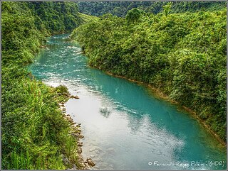
The Motagua River is a 486-kilometre-long (302 mi) river in Guatemala. It rises in the western highlands of Guatemala where it is also called Río Grande, and runs in an easterly direction to the Gulf of Honduras. The final few kilometres of the river form part of the Guatemala–Honduras border. The Motagua River basin covers an area of 12,670 square kilometres (4,890 sq mi) and is the largest in Guatemala.

Grijalva River, formerly known as Tabasco River, is a 480 km (300 mi) long river in southeastern Mexico. It is named after Juan de Grijalva who visited the area in 1518.

The Pasión River is a river located in the northern lowlands region of Guatemala. The river is fed by a number of upstream tributaries whose sources lie in the hills of Alta Verapaz. These flow in a general northerly direction to form the Pasión, which then tends westwards to meet up with the Salinas River at 16°28′52″N90°32′39″W. At this confluence the greater Usumacinta River is formed, which runs northward to its eventual outlet in the Gulf of Mexico. The Pasión River's principal tributaries are the San Juan River, the Machaquila River, and the Cancuén River.

The Petén–Veracruz moist forests is an ecoregion of the tropical and subtropical moist broadleaf forest biome found in Belize, Guatemala, and Mexico.

The Guatemalan Highlands is an upland region in southern Guatemala, lying between the Sierra Madre de Chiapas to the south and the Petén lowlands to the north.
The Central America bioregion is a biogeographic region comprising southern Mexico and Central America.
The Salinas is a river in Guatemala. The river is called Río Negro from its sources in the highlands of Huehuetenango and El Quiché until it reaches the Chixoy hydroelectric dam, where the Río Salama and Rio Carchela converge with the Río Negro. After the Chixoy dam, the river is called Río Chixoy and flows northwards through Alta Verapaz until it reaches the border with Mexico. From there on it continues along the border for 113 kilometres (70 mi) as the Salinas river until it finally converges with the Río de la Pasión to form the Usumacinta river which flows into the Gulf of Mexico.
The Chixoy River or Río Chixoy is a river in Guatemala. The river is called Río Negro from its sources in the highlands of Huehuetenango and El Quiché until it reaches the Chixoy hydroelectric dam, where the Río Salamá and Rio Carchela converge with the Río Negro. After the Chixoy dam, the river is called Río Chixoy and flows northwards, marking the departmental limits between Alta Verapaz and El Quiché, until it reaches the border with Mexico. From there on it continues along the border for another 113 kilometres (70 mi) as the Salinas river until it finally converges with the Río la Pasión to form the Usumacinta river which flows into the Gulf of Mexico.

The Lempa River is a 422-kilometre-long (262 mi) river in Central America.
Guatemala faces substantial resource and institutional challenges in successfully managing its national water resources. Deforestation is increasing as the global demand for timber exerts pressure on the forests of Guatemala. Soil erosion, runoff, and sedimentation of surface water is a result of deforestation from development of urban centers, agriculture needs, and conflicting land and water use planning. Sectors within industry are also growing and the prevalence of untreated effluents entering waterways and aquifers has grown alongside.
Poxte is a river and valley of the Maya Mountains in Guatemala. The valley is noted for numerous Maya sites such as Ixtutz and the Petén Caves. The river is located on the southwest of the Dolores plateau and northwest of Poptún, in the Guatemalan department of Petén. The source of the river is on the same plateau, near the villages of Boca del Monte and Santo Domingo. The river flows westwards through the hamlet of Poxte, it then disappears amongst the karst topography and resumes its course 7 kilometres (4.3 mi) to the west. It continues westwards into the San Juan River, which is a tributary of the Machaquila River. The Machaquila River feeds into the Pasión River, which flows into the Usumacinta River and into the Gulf of Mexico. The upper reaches of the Poxte River shares its drainage with the Mopan River, which flows eastwards into the Caribbean Sea.
