
Xunantunich is an Ancient Maya archaeological site in western Belize, about 70 miles west of Belize City, in the Cayo District. Xunantunich is located atop a ridge above the Mopan River, well within sight of the Guatemala border – which is 0.6 miles (1 km) to the west. It served as a Maya civic ceremonial centre to the Belize Valley region in the Late and Terminal Classic periods. At that time, when the region was at its peak, nearly 200,000 people lived in the Belize Valley.

Benque Viejo del Carmen ("Benque") is the westernmost town in Belize, 130 km (81 mi) by road west and south of Belize City, at the Guatemalan border. San Ignacio lies 13 km to the east and Melchor de Mencos just across the border. The Mopan River runs along the town's north and west edges.

Cayo District is located in the west part of Belize, and it contains the capital, Belmopan. It is the most extensive, second-most populous and third-most densely populated of the six districts of Belize. The district's capital is the town of San Ignacio.
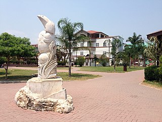
San Ignacio and Santa Elena are towns in western Belize. San Ignacio serves as the cultural-economic hub of Cayo District. It got its start from mahogany and chicle production during British colonisation. Over time it attracted people from the surrounding areas, which led to the diverse population of the town today. San Ignacio is the largest settlement in Cayo District and the second largest in the country, after Belize City.

Cahal Pech is a Maya site located near the town of San Ignacio in the Cayo District of Belize. The site was a palatial, hilltop home for an elite Maya family, and though the most major construction dates to the Classic period, evidence of continuous habitation has been dated to as far back as 1200 BCE during the Early Middle Formative period, making Cahal Pech one of the oldest recognizably Maya sites in Western Belize.
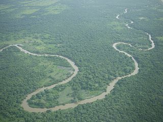
The Belize River runs 290 kilometres (180 mi) through the center of Belize. It drains more than one-quarter of the country as it winds along the northern edge of the Maya Mountains to the sea just north of Belize City. The Belize river valley is largely tropical rainforest.

Actun Tunichil Muknal, also known locally as ATM, is a cave in Belize, near San Ignacio, Cayo District, notable as a Maya archaeological site that includes skeletons, ceramics, and stoneware. There are several areas with skeletal remains in the main chamber. The best known is "The Crystal Maiden", the skeleton of what is believed to be a 17-year-old boy, possibly a sacrifice victim, whose bones have been calcified to a sparkling, crystallized appearance.

The Macal River is a river running through Cayo District in western Belize. Sites along the river include the ancient Mayan town of Cahal Pech and the Belize Botanic Gardens. The Macal River discharges into the Belize River. There are several tributaries to the Macal River including the following streams: Privassion, Rio On, Rio Frio, Mollejon and Cacao Camp.
The Petén Basin is a geographical subregion of the Maya Lowlands, primarily located in northern Guatemala within the Department of El Petén, and into the state of Campeche in southeastern Mexico.
Chaa Creek is a tributary of the Macal River in the Cayo District in western Belize. One of the official gauging stations of the Macal is located near the confluence with Chaa Creek.
Chiquibul National Park is Belize's largest national park. It is 1,073 km2 (414 sq mi) in size. The park is located in Belize's Cayo District. The national park surrounds Caracol, a Mayan city. Caracol has been designated as an archaeological reserve and is not included within the park's total area. Chiquibul Forest Reserve is adjacent to the park.
The Mopan people are an Indigenous, sub-ethnic group of the Maya peoples. They are native to regions of Belize and Guatemala.
Water resources management in Belize is carried out by the Water and Sewerage Authority (WASA) in most cases. One of the primary challenges the country is facing with regard to water resources management, however, is the lack of coordinated and comprehensive policies and institutions. Furthermore, there are various areas of water management that are not well addressed at all such as groundwater data and provision of supply. Data on irrigation and drainage is not adequately available either. Demand on water resources is growing as the population increases, new economic opportunities are created, and the agriculture sector expands. This increased demand is placing new threats on the quality and quantity of freshwater resources. Other constant challenge for management entities are the constant threat of floods from tropical storms and hurricanes. The Belize National Emergency Management Organization (NEMO) is charged with flood management as they occur but it is unclear what institution has responsibility for stormwater infrastructures.

Sacul is an archaeological site of the Maya civilization located in the upper drainage of the Mopan River, in the Petén department of Guatemala. The city occupied an important trade route through the Maya Mountains. The main period of occupation dates to the Late Classic Period. In the late 8th century AD through to the early 9th century, Sacul was one of the few kingdoms in the southeastern Petén region to use its own Emblem Glyph, together with Ixtutz and Ucanal.
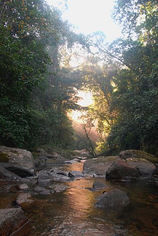
Bladen Nature Reserve in Belize is a landscape of caves, sinkholes, streams and rivers, old growth rainforest and an abundance of highly diverse flora and fauna which includes a great deal of rare and endemic species.

Bullet Tree Falls is a village located along the Mopan River in Cayo District, Belize. It lies approximately five kilometers northwest of San Ignacio. According to the 2010 census, Bullet Tree Falls has a population of 2,124 people in 426 households. The population consists mainly of Spanish-speaking mestizos, along with a smaller number of Maya and Creoles. The village is governed by a seven-person village council.
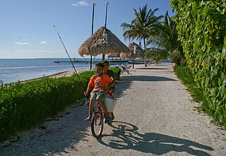
Hispanic and Latin American Belizeans are Belizeans of full or partial Hispanic and Latin American descent. Currently, they account for around 52.9% of Belize's population.
The Chiquibul Forest Reserve (CFR) lies within Belize's Greater Mayan Mountains.
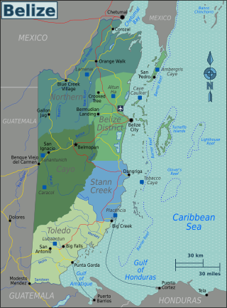
Buenavista del Cayo is a classic period Mayan urban center located in the Mopan River Valley of Belize. The site dates to 300-900AD and was used as a marketplace for merchants to sell material goods. Data suggests that the plazas were in use from the Middle Preclassic through the Terminal Classic Periods. The Maya lowlands fostered a diverse economy of individuals with different economic goals. Buenavista del Cayo attracted both merchants and consumers from other settlements in the surrounding valley. Evidence found at the site suggests that both practical and prestige items were sold at the marketplace, indicating the presence of both wealthy and poor individuals. Distinct platforms found in the plazas along with the differentiation of goods by material type support the theory that the site was used as a central marketplace in the Maya lowlands.


