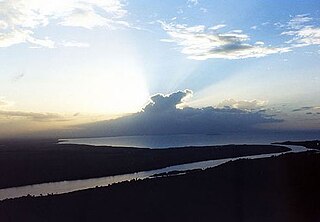
The San Juan River, also known as El Desaguadero, is a 192-kilometre (119 mi) river that flows east out of Lake Nicaragua into the Caribbean Sea. A large section of the border between Nicaragua and Costa Rica runs on the southern bank of the river. It was part, with the lake, of a proposed route for a Nicaragua Canal in the 19th century. The idea of the project has been revived in the last decade, including the possibility of other routes within the country. The Ecocanal project has obtained a Concession from the National Assembly of Nicaragua to re-open the San Juan River to commercial barge traffic.

The Naso or Teribe people are an indigenous people of Panama and Costa Rica. They primarily live in northwest Panama in the Bocas del Toro Province. There are roughly 3,500 people who belong to the Naso tribe. It is one of the few Native American indigenous groups or tribes that continues to have a monarchy.
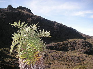
Chirripó National Park is a national park of Costa Rica, encompassing parts of three provinces: San José, Limón and Cartago. It was established in 1975.
Pococí is a canton in the Limón province of Costa Rica. The head city is in Guápiles district, which houses many of the canton's services and businesses.
Buenos Aires is a canton in the Puntarenas province of Costa Rica. The head city is in Buenos Aires district.

The following is an alphabetical list of topics related to the Republic of Costa Rica.
The Cañas–Jerez Treaty between Costa Rica and Nicaragua was enacted April 15, 1858 as a solution to the growing border tension between the two countries. The treaty was negotiated between Máximo Jerez representing Nicaragua and José María Cañas representing Costa Rica. It established a border between the two countries that skirts the southern edge of Lake Nicaragua, then moves east along the San Juan River for the last third of the division, following it north from where it forks from the Rio Colorado. The treaty puts the border on the right bank of the river, giving the river to Nicaragua, but provides commercial navigation rights to Costa Rica.
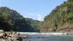
Térraba River, in the southern Brunca region of Costa Rica, is the largest river in that country.
Costa Rica is divided into three major drainage basins encompassing 34 watersheds with numerous rivers and tributaries, one major lake used for hydroelectric generation, and two major aquifers that serve to store 90% of the municipal, industrial, and agricultural water supply needs of Costa Rica. Agriculture is the largest water user demanding around 53% of total supplies while the sector contributes 6.5% to the Costa Rica GDP. About a fifth of land under cultivation is being irrigated by surface water. Hydroelectric power generation makes up a significant portion of electricity usage in Costa Rica and much of this comes from the Arenal dam.

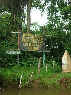
Isla Calero is the largest island in Costa Rica, as well as along the San Juan River, which marks the border between Nicaragua and Costa Rica. The island lies between the San Juan, the Río Colorado of Costa Rica, and the Caribbean Sea. The entire island has an area of 151.6 km2 (58.5 sq mi).

The Nicaragua–Costa Rica San Juan River border dispute was a series of periodical conflicts between the Costa Rica and Nicaragua over the correct delimitation of their common border at its east-end, and the interpretation of the navigation rights on the San Juan River established in the Cañas-Jerez Treaty of 1858.

Indigenous people of Costa Rica, or Native Costa Ricans, are the people who lived in what is now Costa Rica prior to European and African contact and the descendants of those peoples. About 114,000 indigenous people live in the country, comprising 2.4% of the total population. Indigenous Costa Ricans strive to keep their cultural traditions and language alive.
San Vito, originally named San Vito de Java, is a district and head city of the Coto Brus canton, in the Puntarenas province of Costa Rica. It is located about 271 kilometres (168 mi) southeast of the capital San José, and close to the Panama border.
The Costa Rica–Nicaragua border is the 309 kilometres (192 mi) long international border, extending east–west, between the Caribbean Sea (E) and the Pacific Ocean (W) it separates the northern part of Costa Rica from the Southern part of Nicaragua. It passes near Lake Nicaragua. The southern bank of the River San Juan lies on the border for much of its length.
Colorado is a district of the Pococí canton, in the Limón province of Costa Rica. It is at the northeastern border of Costa Rica where it meets Nicaragua and the Caribbean Sea.

The Huetares were an important indigenous group of Costa Rica, who in the mid-16th century lived in the center of what is now the country. They are also mentioned with the name of güetares or pacacuas. Huetares were the most powerful and best organized indigenous nation in Costa Rica upon the arrival of the Spaniards. During the 16th century, various chieftains dominated from the Costa Rican Pacific coast to the Atlantic Slope. The Spanish chronicles mention a myriad of towns and the kings that ruled them, among them the Garabito Empire, located on the Central Pacific Slope and the Tárcoles River basin, to the Virilla River and the Cordillera Central; the kingdom of Pacaca, in the current canton of Mora, and the Lordship of el El Guarco, in the current Guarco Valley, in the Cartago Province, to the plains of the Central Caribbean and Chirripó. Their culture belonged to the Intermediate Area, and it stood out mainly for their works in stone, such as metates, sculptures, tables and ceremonial altars; and the non-practice of anthropophagy or cannibalism. Its language, the Huetar language, one of the so-called Chibcha languages, became the Lingua franca of the country. Although this language is extinct, it survives in a large number of place names in Costa Rica such as Aserrí, Tucurrique or Barva.