The Rio Grande is one of the principal rivers in the southwestern United States and northern Mexico. The Rio Grande begins in south-central Colorado in the United States and flows to the Gulf of Mexico. After passing through the length of New Mexico along the way, it forms part of the Mexico–United States border. According to the International Boundary and Water Commission, its total length was 1,896 miles (3,051 km) in the late 1980s, though course shifts occasionally result in length changes. Depending on how it is measured, the Rio Grande is either the fourth- or fifth-longest river system in North America.

The Río de la Plata, called River Plate in British English and the Commonwealth and La Plata River in other English-speaking countries, is the estuary formed by the confluence of the Uruguay River and the Paraná River at Punta Gorda. It empties into the Atlantic Ocean and forms a funnel-shaped indentation on the southeastern coastline of South America. Depending on the geographer, the Río de la Plata may be considered a river, an estuary, a gulf, or a marginal sea. It is the widest river in the world, with a maximum width of 220 kilometres (140 mi).

The Pecos River originates in north-central New Mexico and flows into Texas, emptying into the Rio Grande. Its headwaters are on the eastern slope of the Sangre de Cristo mountain range in Mora County north of Pecos, NM, at an elevation of over 12,000 feet (3,700 m) feet. The river flows for 926 miles (1,490 km) before reaching the Rio Grande near Del Rio. Its drainage basin encompasses about 44,300 square miles (115,000 km2).

Amazonas is a state of Brazil, located in the North Region in the northwestern corner of the country. It is the largest Brazilian state by area and the 9th largest country subdivision in the world, and the largest in South America, being greater than the areas of Uruguay, Paraguay, and Chile combined. Mostly located in the Southern Hemisphere, it is the third largest country subdivision in the Southern Hemisphere after the Australian states of Western Australia and Queensland. Entirely in the Western Hemisphere it is the fourth largest in the Western Hemisphere after Greenland, Nunavut and Alaska, being slightly larger than Quebec. It would be the sixteenth largest country in land area, slightly larger than Mongolia. Neighbouring states are Roraima, Pará, Mato Grosso, Rondônia, and Acre. It also borders the nations of Peru, Colombia and Venezuela. This includes the Departments of Amazonas, Vaupés and Guainía in Colombia, as well as the Amazonas state in Venezuela, and the Loreto Region in Peru.
The Uruguay River is a major river in South America. It flows from north to south and forms parts of the boundaries of Brazil, Argentina, and Uruguay, separating some of the Argentine provinces of La Mesopotamia from the other two countries. It passes between the states of Santa Catarina and Rio Grande do Sul in Brazil; forms the eastern border of the provinces of Misiones, Corrientes, and Entre Ríos in Argentina; and makes up the western borders of the departments of Artigas, Salto, Paysandú, Río Negro, Soriano, and Colonia in Uruguay.

Entre Ríos is a central province of Argentina, located in the Mesopotamia region. It borders the provinces of Buenos Aires (south), Corrientes (north) and Santa Fe (west), and Uruguay in the east.

Ocho Rios is a town in the parish of Saint Ann on the north coast of Jamaica, and is more widely referred to as Ochi by locals. Beginning as a sleepy fishing village, Ocho Rios has seen explosive growth in the last decade to become a popular tourist destination featuring duty-free shopping, a cruise-ship terminal, world-renowned tourist attractions and several beaches and acclaimed resorts. In addition to being a port of call for cruise ships, Ocho Rios also hosts cargo ships at the Reynolds Pier for the exportation of sugar, limestone, and in the past, bauxite. The estimated population of the town in 2011 was 16,671, which is nearly 10% of the total population of St. Ann. The town is served by both the Donald Sangster International Airport and the Ian Fleming International Airport. Scuba diving and other water sports are offered in the town's vicinity.
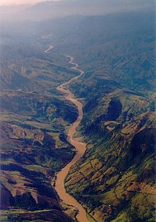
The Cauca River is a river in Colombia that lies between the Occidental and Central cordilleras. From its headwaters in southwestern Colombia near the city of Popayán, it joins the Magdalena River near Magangué in Bolívar Department, and the combined river eventually flows out into the Caribbean Sea. It has a length of 965 km (600 mi) to its junction with the Magdalena, for a total length of 1,350 km (840 mi). from origin to seamouth. The river is under the supervision of the Corporación Regional del Cauca and the Corporación Autonoma Regional del Valle del Cauca, and is navigable for 640 km (400 mi) above its junction with the Magdalena.

The Paraná River is a river in south Central South America, running through Brazil, Paraguay, and Argentina for some 4,880 kilometres (3,030 mi). It is second in length only to the Amazon River among South American rivers. The name Paraná is an abbreviation of the phrase "para rehe onáva", which comes from the Tupi language and means "like the sea". It merges first with the Paraguay River and then farther downstream with the Uruguay River to form the Río de la Plata and empties into the Atlantic Ocean.

The Río Tinto is a river in southwestern Spain that rises in the Sierra Morena mountains of Andalusia. It flows generally south-southwest, reaching the Gulf of Cádiz at Huelva. The Rio Tinto river has a unique red and orange colour derived from its chemical makeup that is extremely acidic and with very high levels of iron and heavy metals.
The Spanish–Portuguese treaty of 1750 or Treaty of Madrid was a document signed in the Spanish capital by Ferdinand VI of Spain and John V of Portugal on 13 January 1750, to end armed conflict over a border dispute between the Spanish and Portuguese empires in South America in the vicinity of the Uruguay River, an area known as the Banda Oriental. The treaty established borders between the Spanish and Portuguese empires, ceding much of what is today's country of Brazil to the Portuguese.
Banda Oriental, or more fully Banda Oriental del Uruguay, was the name of the South American territories east of the Uruguay River and north of Río de la Plata that comprise the modern nation of Uruguay; the modern state of Rio Grande do Sul, Brazil; and some of the modern state of Santa Catarina, Brazil. It was the easternmost territory of the Viceroyalty of the Río de la Plata.

The Bogotá River is a major river of the Cundinamarca department of Colombia, crossing the region from the northeast to the southwest and passing along the western limits of Bogotá. The large population and major industrial base in its watershed have resulted in extremely severe pollution problems for the river.

The Minho or Miño is the longest river in Galicia, sharing the border with Portugal, with a length of 340 kilometres (210 mi). By discharge, it is the fourth river of the Iberian peninsula, after the Douro, Ebro and Tagus.

The Río de la Plata basin, more often called the River Plate basin in scholarly writings, sometimes called the Platine basin or Platine region, is the 3,170,000-square-kilometre (1,220,000 sq mi) hydrographical area in South America that drains to the Río de la Plata. It includes areas of southeastern Bolivia, southern and central Brazil, the entire country of Paraguay, most of Uruguay, and northern Argentina. Making up about one fourth of the continent's surface, it is the second largest drainage basin in South America and one of the largest in the world.

Bueno River is a river in southern Chile. It originates in Ranco Lake and like most of Chile rivers it drains into the Pacific Ocean at the southern boundary of the Valdivian Coastal Reserve. Its lower flow forms the border between Osorno Province and Ranco Province. Traditionally it marks also the northern boundary of the indigenous Huilliche territory known as Futahuillimapu. The river passes through Río Bueno commune and city that takes name from the river.

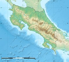
Río Cuarto is a canton in the Alajuela province of Costa Rica. The head city is in Río Cuarto district.

Guacimal is a district of the Puntarenas canton, in the Puntarenas province of Costa Rica.
National Tertiary Route 606, or just Route 606 is a National Road Route of Costa Rica, located in the Guanacaste, Puntarenas provinces. It is known as Carretera a Monteverde, between Route 1 in Puntarenas province and Monteverde. It is the main access road to the dairy farms and tourist-attraction rain forests of Monteverde.