
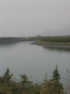
The Selawik River is a stream, 140 miles (230 km) long, in the northwestern part of the U.S. state of Alaska. Originating in the Purcell Mountains near the Zane Hills, it flows generally west through the Selawik National Wildlife Refuge to Selawik Lake, which empties into the Kotzebue Sound in the Chukchi Sea. The river is approximately at the latitude of the Arctic Circle.

The Noatak River is a stream in the northwestern part of the U.S. state of Alaska.
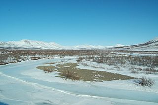
The Chandalar River is a 100-mile (160 km) tributary of the Yukon River in the U.S. state of Alaska. Its peak flow, recorded by the United States Geological Survey (USGS) between 1964 and 1974 at a stream gauge at Venetie, was 62,800 cubic feet per second (1,780 m3/s) on June 9, 1968.

The John River is a 125-mile (201 km) tributary of the Koyukuk River in the northern part of the U.S. state of Alaska. It was named after John Bremner, a prospector and explorer who was one of the first non-native persons to go there. It flows south from Anaktuvuk Pass in Alaska's Brooks Range, into the larger river at a point near Bettles, slightly north of the Arctic Circle.

The Sheenjek River is a 200-mile (320 km) tributary of the Porcupine River in the U.S. state of Alaska. It begins in the eastern part of the Brooks Range and flows southward to meet the larger river northeast of Fort Yukon.

The Tinayguk River is a 44-mile (71 km) tributary of the North Fork Koyukuk River in the U.S. state of Alaska. Heading in the Endicott Mountains of the Brooks Range, the river flows generally west then south to meet the larger river about 80 miles (130 km) north of Bettles.
The Kokolik River is a stream, 200 miles (320 km) long, in the western North Slope of the U.S. state of Alaska. It rises in the De Long Mountains of the western Brooks Range and flows generally north and northwest into the Kasegaluk Lagoon. The river mouth is 1 mile (1.6 km) east of Point Lay, on the Chukchi Sea of the Arctic Ocean.
The Kuparuk River is a river in Alaska's North Slope that enters a bay on the Beaufort Sea between Beechey Point and Prudhoe Bay. The north-flowing river is about 200 miles (320 km) long, and its delta is about 3 miles (5 km) wide. Its Eskimo name appeared on a map drawn in 1901 by a prospector who spelled it Koopowra, which he translated as Big River.
The Utukok River is a 225-mile (362 km) long stream in the North Slope Borough of the U.S. state of Alaska. It rises in the De Long Mountains at the confluence of Kogruk and Tupik creeks and flows north, northeast, and then northwest. It empties into Kasegaluk Lagoon on the Chukchi Sea of the Arctic Ocean, 20 miles (32 km) southwest of Icy Cape.
The Kukpowruk River is a stream, 160 miles (260 km) long, in the western North Slope Borough of the U.S. state of Alaska. It arises in the De Long Mountains of the western Brooks Range and flows north into Kasegaluk Lagoon of the Chukchi Sea, Arctic Ocean. The river mouth is about 9 miles (14 km) south of Point Lay. Arctic Slope Regional Corporation is the major landowner along the river.
The Kukpuk River is a stream, about 125 miles (201 km) long, in the western North Slope Borough of the U.S. state of Alaska. It flows generally west from the De Long Mountains across the Lisburne Peninsula to Marryat Inlet on the Chukchi Sea. The river mouth is about 12 miles (19 km) northeast of Point Hope.
The Wulik River is a stream, about 80 miles (130 km) long, in the northwestern part of the U.S. state of Alaska. Originating in the De Long Mountains in the North Slope Borough, it flows southwest to Kivalina Lagoon in the Chukchi Sea, east of Kivalina

The Goodhope River is a stream, 46 miles (74 km) long, on the Seward Peninsula in the U.S. state of Alaska. It heads about 5.3 miles (8.5 km) west-southwest of Cloud Lake and flows generally northeast to Goodhope Bay on Kotzebue Sound of the Chukchi Sea. The river mouth is about 27 miles (43 km) west of Cape Deceit and Deering in the Northwest Arctic Borough. The entire course of the river lies within the Bering Land Bridge National Preserve.
The Nugnugaluktuk River is a stream, 26 miles (42 km) long, on the Seward Peninsula in the U.S. state of Alaska. It flows east from within the Nome Census Area to Goodhope Bay, about 37 miles (60 km) northwest of Deering in the Northwest Arctic Borough. The bay is on Kotzebue Sound of the Chukchi Sea. The entire course of the river lies within the Bering Land Bridge National Preserve.
The Tubutulik River is a waterway in the U.S. state of Alaska. The 25-mile (40 km) long river is situated on the Seward Peninsula. It flows southeastwards to the Kwiniuk Inlet at the northwestern end of Norton Bay, 25 miles (40 km) southwest of Koyuk in the Bering Sea. Its Inuit name was reported as "Tubuktulik" in 1849 by Capt. Mikhail Dmitrievich Tebenkov of the Imperial Russian Navy. Exploration for placer gold occurred in the Council district area where the river valley is located, and in 1898, mining commenced. The production was substantial and ranked second only to that of Nome.
The Kougarok (Koo-gah-rok) River is a river on the Seward Peninsula in the U.S. state of Alaska. Formed by the merger of the two smaller streams Macklin Creek and Washington Creek, the main stem is about 45 miles (72 km) long, flowing generally south from near Taylor Airport. It flows into the Kuzitrin River, which flows west into the Imuruk Basin, connected to the bay of Port Clarence on the Bering Sea.
Niukluk River is a waterway in the U.S. state of Alaska. It rises in the Bendeleben Mountains and, after flowing across a broad valley lowland for about 15 miles (24 km), enters a narrower valley, in which it flows for about 20 miles (32 km). Below the mouth of Melsing Creek, the valley broadens out and merges with that of Fish River, to which the Niukluk is tributary. It receives many tributaries, of which the Koksuktapaga, joining it from the south, is the largest. In Niukluk River itself, gold was found at its head, though most abundant below the mouth of American Creek. Just below the mouth of Ophir Creek, a little gold has been rocked out on the bars. The broad gravel flood plain in this part of the basin is said to be auriferous. Below the mouth of Ophir Creek the river has cut a small rock canyon 50 feet (15 m) below an old valley floor, leaving broad benches on either side. These benches are sheeted over by a few feet of gravel.
Nome River is a waterway on the Seward Peninsula in the U.S. state of Alaska. It has its source in a narrow valley in the southern margin of the Kigluaik Mountains, 4.5 miles (7.2 km) west of Salmon Lake.
The Joshua Green River is a stream, 15 miles (24 km) long, in the Aleutians East Borough of the U.S. state of Alaska. It flows generally northwest across the Izembek National Wildlife Refuge from its source in the Aleutian Range of the Alaska Peninsula into Moffet Lagoon, Bristol Bay, on the Bering Sea. The river's mouth is 17 miles (27 km) northeast of Cold Bay.
The Eagle River is a stream, 8 miles (13 km) long, in the borough of Wrangell in the U.S. state of Alaska. Heading at Eagle Lake in the Coast Mountains, it flows northwest through part of the Tongass National Forest into Eagle Bay on the Bradfield Canal. Near the midpoint of its course, the river passes through Little Eagle Lake. On the shore opposite Eagle Bay and the Eagle River mouth, the Harding River enters Bradfield Canal.


