
Barima-Waini is a region of Guyana and is located in the northwest of the country. Barima-Waini has three sub-regions: Mabaruma, Matakai, and Moruca.

The Bolivarian Republic of Venezuela is a federation made up of twenty-three states, a Capital District and the Federal Dependencies, which consist of many islands and islets in the Caribbean Sea. Venezuela claims the disputed Essequibo territory as one of its states, which it calls Guayana Esequiba, but the territory is controlled by Guyana as part of six of its regions.
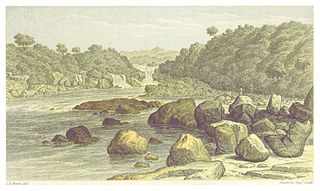
The Courantyne River is a river in northern South America in Suriname and Guyana. It is the longest river in the country and creates the border between Suriname and the East Berbice-Corentyne region of Guyana.

Essequibo Islands-West Demerara is a region of Guyana. It is situated around the Essequibo River, the largest river in Guyana that lies between the Orinoco and Amazon rivers of South America.

Pomeroon-Supenaam is a region of Guyana. It borders the Atlantic Ocean to the north, the region of Essequibo Islands-West Demerara to the east, the region of Cuyuni-Mazaruni to the south and the region of Barima-Waini to the west. Pomeroon-Supenaam contains the town of Anna Regina and the villages of Charity, Pickersgill, Spring Garden and Suddie. In 2012, an Official Census by the Government of Guyana listed the population of the Pomeroon-Supenaam Region at 46,810.
Ituni is a village in the interior of Guyana, at an altitude of 100 metres (331 feet). The area grew as a result of bauxite mining in the area.
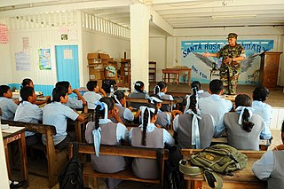
Santa Rosa is a community in the Barima-Waini region of northern Guyana. Santa Rosa mission was established in 1840, and is one of the earliest Catholic Missions in Guyana. The village is part of the North West Amerindian District.

The Wapishana or Wapichan are an indigenous group found in the Roraima area of northern Brazil and southern Guyana.

The Catholic Church in Guyana is part of the worldwide Catholic Church, under the spiritual leadership of the Pope in Rome. Bishops in Guyana are members of Antilles Episcopal Conference. Like most other nations that form the AEC, the Apostolic delegate to the bishops' conference is also the Apostolic nuncio to the country, currently American archbishop Thomas Edward Gullickson.
The Arawak village of Wakapau (or Wakapoa) is located in the Pomeroon-Supenaam Region of Guyana, on the Wakapau River, a tributary on the west bank of the Pomeroon River, 3 kilometres (1.9 mi) from its mouth. The name originates from the Lokono word ‘Wakokwãn’, which means pigeon. The village is composed of twenty inhabited islands. Some of the islands only contain a single family.

Guyana, officially the Co-operative Republic of Guyana, is a country on the northern coast of South America, part of the historic mainland British West Indies. Guyana is an indigenous word which means "Land of Many Waters". Georgetown is the capital of Guyana and is also the country's largest city. Guyana is bordered by the Atlantic Ocean to the north, Brazil to the south and southwest, Venezuela to the west, and Suriname to the east. With a land area of 214,969 km2 (83,000 sq mi), Guyana is the third-smallest sovereign state by area in mainland South America after Uruguay and Suriname, and is the second-least populous sovereign state in South America after Suriname; it is also one of the least densely populated countries on Earth. It has a wide variety of natural habitats and very high biodiversity. The country also hosts a part of the Amazon rainforest, the largest tropical rainforest in the world.

Carolyn Allison Rodrigues-Birkett is a Guyanese politician who was appointed Permanent Representative of Guyana to the United Nations in 2020. She previously served as Director of the Food and Agriculture Organization Liaison Office in Geneva from 2017 to 2020 and Minister of Foreign Affairs of Guyana from 2008 to 2015.
The Amacuro River is a river in South America. It forms part of the northern section of the international boundary between Venezuela and Guyana. It is part of the Orinoco River basin.
The Kaituma River is a river of Guyana in the Barima-Waini region. The mouth is at the upper Barima River, and the area is made up of mostly mangrove swamps.
The Kako River is a river in the Cuyuni-Mazaruni region of Guyana and one of the largest tributaries of the Mazaruni River.
The Ekareku River is a river of Guyana, a tributary of the Wenamu River.
Moraikobai is an Amerindian village located in the Mahaica-Berbice of Guyana.
Rewa is an Amerindian village in the Upper Takutu-Upper Essequibo region of Guyana.
Isseneru is an Amerindian settlement in the Cuyuni-Mazaruni region of Guyana, approximately 15–20 miles west of Kurupung.
