
The Guiana Shield is one of the three cratons of the South American Plate. It is a 1.7 billion-year-old Precambrian geological formation in northeast South America that forms a portion of the northern coast. The higher elevations on the shield are called the Guiana Highlands, which is where the table-like mountains called tepuis are found. The Guiana Highlands are also the source of some of the world's most well-known waterfalls such as Angel Falls, Kaieteur Falls and Cuquenan Falls.

The Dutch began their colonisation of the Guianas, the coastal region between the Orinoco and Amazon rivers in South America, in the late 16th century. The Dutch originally claimed all of Guiana but—following attempts to sell it first to Bavaria and then to Hanau and the loss of sections to Portugal, Britain, and France—the section actually settled and controlled by the Netherlands became known as Dutch Guiana.
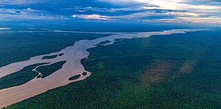
The Essequibo River is the largest river in Guyana, and the largest river between the Orinoco and Amazon. Rising in the Acarai Mountains near the Brazil–Guyana border, the Essequibo flows to the north for 1,014 km (630 mi) through forest and savanna into the Atlantic Ocean. It has a total drainage basin of 156,828 km2 (60,552 sq mi) and an average discharge of 5,650 m3/s (200,000 cu ft/s).

Guyana is divided into 10 regions:

Kaieteur Falls is the largest single-drop waterfall in the world and it is located on the Potaro River in Kaieteur National Park, central Essequibo Territory, Guyana. It is 226 metres (741 ft) high when measured from its plunge over a sandstone and conglomerate cliff to the first break. It then flows over a series of steep cascades that, when included in the measurements, bring the total height to 251 metres (822 ft). While many falls have greater height, few have the combination of height and water volume, and Kaieteur is among the most powerful waterfalls in the world with an average flow rate of 663 cubic metres per second. Kaieteur Falls is about four and a half times the height of Niagara Falls, on the border between Canada and the United States, and about twice the height of Victoria Falls, on the border of Zambia and Zimbabwe in Africa.

Cuyuni-Mazaruni is a region of Guyana. Its capital is Bartica, with villages including Issano, Kartabo, Kamarang, and Imbaimadai.
Potaro-Siparuni is a region of Guyana. It borders the region of Cuyuni-Mazaruni to the north, the regions of Upper Demerara-Berbice and East Berbice-Corentyne to the east, the region of Upper Takutu-Upper Essequibo to the south and Brazil to the west.

Upper Takutu-Upper Esequibo is a region of Guyana. It borders the region of Potaro-Siparuni to the north, the region of East Berbice-Corentyne to the east and Brazil to the south and west. It contains the town of Lethem, and the villages of Aishalton, Nappi and Surama. It is also the largest region of Guyana.

Essequibo was a Dutch colony in the Guianas and later a county on the Essequibo River in the Guiana region on the north coast of South America. It was a colony of the Dutch West India Company between 1616 and 1792 and a colony of the Dutch state from 1792 until 1815. It was merged with Demerara in 1812 by the British who took control. It formally became a British colony in 1815 until Demerara-Essequibo was merged with Berbice to form the colony of British Guiana in 1831. In 1838, it became a county of British Guiana till 1958. In 1966, British Guiana gained independence as Guyana and in 1970 it became a republic as the Co-operative Republic of Guyana. It was located around the lower course of the Essequibo River.

Kaieteur National Park is a national park located in the Potaro-Siparuni Region of Guyana, roughly 633 km south of Georgetown, the nation's capital, closer to the border with Brazil than to the Caribbean coast. It is widely considered the country's only national park, as the capital's National Park is a not a true wilderness reserve. Kaieteur is part of the Guianan moist forests ecoregion. The main tourist attraction in the park is Kaieteur Falls, considered the largest single-drop waterfall anywhere on earth, by volume of water. Orinduik Falls is another water-feature in the park, a series of smaller, cascading waterfalls. There is a popular swimming hole located at Orinduik.
The Potaro River is a river in Guyana that runs from Mount Ayanganna area of the Pakaraima Mountains for approximately 255 km (158 mi) before flowing into the Essequibo River, Guyana's largest river. The renowned Kaieteur Falls is on the Potaro.
The Konawaruk River is a river in Potaro-Siparuni, Guyana. About 60 miles long, it is a tributary of the Essequibo River, joining it just south of the Potaro River mouth at 5°18′N58°55′W.
Tumatumari is a community in the Potaro-Siparuni Region of Guyana, located some 15 km upstream of the confluence of the Potaro and Essequibo Rivers.
Amaila Falls is located on the Kuribrong River, a tributary of the Potaro River in west central Guyana.
Rappu Falls is a waterfall on the Essequibo River, Guyana, approximately 17 km north of the confluence with the Rupununi River.

The Guyana–Venezuela territorial dispute is an ongoing territorial dispute between Guyana and Venezuela over the Essequibo region, also known as Esequibo or Guayana Esequiba in Spanish, a 159,500 km2 (61,600 sq mi) area west of the Essequibo River. The territory, excluding the Venezuelan-controlled Ankoko Island, is controlled by Guyana as part of six of its regions, based on the 1899 Paris Arbitral Award. It is also claimed by Venezuela as the Guayana Esequiba State. The boundary dispute was inherited from the colonial powers and has persisted following the independence of Venezuela and Guyana.

Guyana, officially the Co-operative Republic of Guyana, is a country on the northern coast of South America, part of the historic mainland British West Indies. Guyana is an indigenous word which means "Land of Many Waters". Georgetown is the capital of Guyana and is also the country's largest city. Guyana is bordered by the Atlantic Ocean to the north, Brazil to the south and southwest, Venezuela to the west, and Suriname to the east. With a land area of 214,969 km2 (83,000 sq mi), Guyana is the third-smallest sovereign state by area in mainland South America after Uruguay and Suriname, and is the second-least populous sovereign state in South America after Suriname; it is also one of the least densely populated countries on Earth. It has a wide variety of natural habitats and very high biodiversity. The country also hosts a part of the Amazon rainforest, the largest tropical rainforest in the world.
The Kurupung River is a tributary of the middle Mazaruni River in Guyana.
The Arnik River is a river of Guyana, a tributary of the Potaro River.
