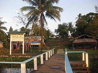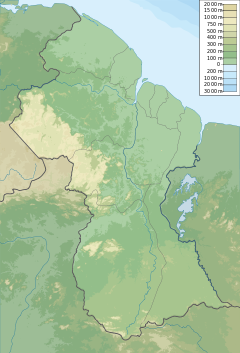
Port Kaituma is a small village within the Barima-Waini administrative region of Guyana. It became known internationally as a gateway village to the Peoples Temple settlement in nearby Jonestown. It has long been a hub for mining in the area.

Mahaica-Berbice is a region of Guyana, bordering the Atlantic Ocean to the north, the region of East Berbice-Corentyne to the east, the region of Upper Demerara-Berbice to the south and the region of Demerara-Mahaica to the west.

Charity is a small township in Guyana, located in the Pomeroon-Supenaam Region No.2, which is part of the Essequibo County.

The Guyana Defence Force (GDF) is the military of Guyana, established in 1965. It has military bases across the nation. The Commander-in-Chief of the Defence Force is always the incumbent President of Guyana.
Arakaka is a community in the Barima-Waini region of Guyana, standing on the Barima River and 12 miles southerly of Port Kaituma, at an altitude of 63 metres (209 feet).
The Abary River is a small river in northern Guyana that drains into the Atlantic Ocean.

Kabakaburi is an Amerindian village in the Pomeroon-Supenaam Region of Guyana on the Pomeroon River, 56 km (35 mi) from its mouth. The village was founded in 1845 by William Henry Brett on the location where Fort Durban used to be.
The Mahaica River is a small river in northern Guyana that drains into the Atlantic Ocean. The village of Mahaica is found at its mouth.
Adventure is a village located in the Pomeroon-Supenaam Region of Guyana, on the Atlantic coast, at sea level, one mile south of Onderneeming.
Esau and Jacob is a village in the Mahaica-Berbice Region of Guyana. One of the oldest villages on the Mahaicony River, Esau and Jacob was named by Dutch settlers after the pair of twins in the Bible.

Mahaicony is a community that is made up of several villages in East Coast Demerara, Mahaica-Berbice, Guyana. Mahaicony's physical boundaries on the coast is from De Hoop village in the west to Calcutta village in the east.
Belladrum is a small community in the Mahaica-Berbice Region of Guyana, on the Atlantic coast, about 15 kilometres (9 mi) east of Mahaicony.

The Sea Wall is a 280-mile seawall that runs along much of Guyana's coastline, including all of the coastline in the capital city of Georgetown. It protects settlements in the coastal areas of Guyana, most of which are below sea level at high tide.

Clonbrook is a village in the Demerara-Mahaica region of Guyana. The village itself has a population of about 1,193 as of 2012. The village is located along the East Coast Highway and is about 16.5 miles from Georgetown and about 6 miles from Mahaica. It is bordered in the east by the village of Bee Hive and by Ann's Grove in the west.
The Guyana Mayors Cup is a major knockout regional football tournament in Guyana. It was created in 1999.
Albion is a village in East Berbice-Corentyne, Guyana.
Stewartville is a village district in Guyana on the Atlantic coast of West Demerara, just east of the mouth of the Essequibo River. There are four sections in the village: Stewartville Housing Scheme, Sarah Lodge, Stewartville Old Road and Stewartville Sea View.
St. Cuthbert's Mission is an Amerindian village on the Mahaica River in the Demerara-Mahaica region of Guyana. It comprises approximately 200 households. St. Cuthbert's is regarded by many people in Guyana as the "cultural capital" for Amerindians.
Fairview (Kurupukari) is an indigenous settlement on the Essequibo River, in the Upper Demerara-Berbice region of Guyana. It is the entry point to the Iwokrama Forest. Former president David A. Granger once referred to Iwokrama as the "green heart of Guyana."
Morawhanna is a small Atlantic coast village in Guyana, on the left side of the Barima River and in close proximity to Venezuela.


