Lethem is a town in Guyana, located in the Upper Takutu-Upper Essequibo region. It is the regional capital of Upper Takutu-Upper Essequibo.
Upper Takutu-Upper Esequibo is a region of Guyana. It borders the region of Potaro-Siparuni to the north, the region of East Berbice-Corentyne to the east and Brazil to the south and west. It contains the town of Lethem, and the villages of Aishalton, Nappi and Surama. It is also the largest region of Guyana.
Aishalton is an Amerindian village that is situated in the Rupununi savannah of southern Guyana, in the Upper Takutu-Upper Essequibo Region of the country.
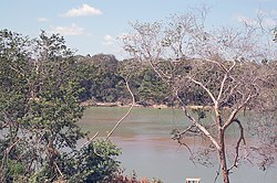
The Kwitaro River is a tributary of the Rupununi River in Guyana.
Surama is an Amerindian village in the North Rupununi area and the Upper Takutu-Upper Essequibo Region of Guyana, with a population of 274 people as of 2012.
Fairview (Kurupukari) is an indigenous settlement on the Essequibo River, in the Upper Demerara-Berbice region of Guyana. It is the entry point to the Iwokrama Forest. Former president David A. Granger once referred to Iwokrama as the "green heart of Guyana."

Annai Airport is an airport serving the village of Annai, in the Upper Takutu-Upper Essequibo Region of Guyana. The runway has 640 metres (2,100 ft) of asphalt paving, with the remainder grass.

Sydney Charles Allicock is a Guyanese politician. He was minister of Indigenous People's Affairs in Guyana from 2015-2020, and was vice-president of Guyana from 2015-2020.
Rewa is an Amerindian village in the Upper Takutu-Upper Essequibo region of Guyana.
Hiawa is an indigenous village of Macushi Amerindians in the Upper Takutu-Upper Essequibo Region of Guyana. It is located in the Rupununi savannah. Hiawa is considered a satellite of Nappi.

Yupukari is an indigenous village of Macushi and Wapishana Amerindians in the Upper Takutu-Upper Essequibo Region of Guyana. It is located between the Kanuku and Pakaraima Mountains along the Rupununi River.
St. Ignatius is an Amerindian village in the Upper Takutu-Upper Essequibo region of Guyana, near the regional capital Lethem and the border of Brazil. It was originally a mission founded by Jesuit priests to serve the Amerindians in the Rupununi savannah.
Karaudarnau is an indigenous village of Wapishana Amerindians in the Upper Takutu-Upper Essequibo Region of Guyana. It is located in the Rupununi savannah on the Rupununi River.
Sand Creek is a village in the Upper Takutu-Upper Essequibo Region of Guyana. Sand Creek is inhabited by Wapishana Amerindians. It is located on the Rupununi River. The main language spoken in the village is Wapishana with English as secondary language.
Awarewaunau is a village in the Upper Takutu-Upper Essequibo Region of Guyana. Awarewaunau is inhabited by Wapishana Amerindians.
Katoonarib is a village in the Upper Takutu-Upper Essequibo Region of Guyana. Katoonarib is inhabited by Wapishana, Macushi and other Amerindians. It is located near the Rupununi River. The main language spoken in the village is Wapishana with English as secondary language.
Toka is an indigenous village of Macushi Amerindians in the Upper Takutu-Upper Essequibo Region of Guyana. It is located in the North Rupununi Wetlands.
Nappi is an indigenous village of Macushi Amerindians in the Upper Takutu-Upper Essequibo Region of Guyana. It is located in the Rupununi savannah along the Nappi and Maipaima creeks on the edge of the Kanuku Mountains.
Sawariwau is a village in the Upper Takutu-Upper Essequibo Region of Guyana. Sawariwau is inhabited by Wapishana Amerindians. It is located about 70 miles (110 km) south of Lethem in the Rupununi savannah. The main language spoken in the village is Wapishana.
Maruranau is an indigenous village of Wapishana Amerindians in the Upper Takutu-Upper Essequibo Region of Guyana. It is located in the Rupununi savannah near the Kwitaro River on the edge of the Kanuku Mountains. A minority of Taruma also inhabit the village.