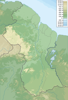
The Berbice River, located in eastern Guyana, is one of the country's major rivers. It rises in the highlands of the Rupununi region and flows northward for 595 kilometres (370 mi) through dense forests to the coastal plain. The river's tidal limit is between 160 and 320 km (99–199 mi) from the sea.

Barima-Waini is a region of Guyana and is located in the northwest of the country. Barima-Waini has three sub-regions: Mabaruma, Matakai, and Moruca.

The Demerara River is a river in eastern Guyana that rises in the central rainforests of the country and flows to the north for 346 kilometres until it reaches the Atlantic Ocean. Georgetown, Guyana's largest seaport and capital, is situated on the east bank of the river's mouth. The river divides Essequibo Islands-West Demerara on the west bank from Demerara-Mahaica to the east.

Berbice is a region along the Berbice River in Guyana, which was between 1627 and 1792 a colony of the Dutch West India Company and between 1792 and 1815 a colony of the Dutch state. After having been ceded to the United Kingdom of Great Britain and Ireland in the latter year, it was merged with Demerara-Essequibo to form the colony of British Guiana in 1831. It became a county of British Guiana in 1838 till 1958. In 1966, British Guiana gained independence as Guyana and in 1970 it became a republic as the Co-operative Republic of Guyana.

Charity is a small township in Guyana, located in the Pomeroon-Supenaam Region No.2, which is part of the Essequibo County.

Potaro-Siparuni is a region of Guyana. It borders the region of Cuyuni-Mazaruni to the north, the regions of Upper Demerara-Berbice and East Berbice-Corentyne to the east, the region of Upper Takutu-Upper Essequibo to the south and Brazil to the west.

Afro-Guyanese are generally descended from the enslaved people brought to Guyana from the coast of West Africa to work on sugar plantations during the era of the Atlantic slave trade. Coming from a wide array of backgrounds and enduring conditions that severely constrained their ability to preserve their respective cultural traditions contributed to the adoption of Christianity and the values of British colonists.

The Potaro River is a river in Guyana that runs from Mount Ayanganna area of the Pakaraima Mountains for approximately 255 km (158 mi) before flowing into the Essequibo River, Guyana's largest river. The renowned Kaieteur Falls is on the Potaro.

Kabakaburi is an Amerindian village in the Pomeroon-Supenaam Region of Guyana on the Pomeroon River, 56 km (35 mi) from its mouth. The village was founded in 1845 by William Henry Brett on the location where Fort Durban used to be.
The Arawak village of Wakapau (or Wakapoa) is located in the Pomeroon-Supenaam Region of Guyana, on the Wakapau River, a tributary on the west bank of the Pomeroon River, 3 kilometres (1.9 mi) from its mouth. The name originates from the Lokono word ‘Wakokwãn’, which means pigeon. The village is composed of twenty inhabited islands. Some of the islands only contain a single family.
The Mahaica River is a small river in northern Guyana that drains into the Atlantic Ocean. The village of Mahaica is found at its mouth.

The Guyana–Venezuela territorial dispute is an ongoing territorial dispute between Guyana and Venezuela over the Essequibo region, also known as Esequibo or Guayana Esequiba in Spanish, a 159,500 km2 (61,600 sq mi) area west of the Essequibo River. The territory, excluding the Venezuelan-controlled Ankoko Island, is controlled by Guyana as part of six of its regions, based on the 1899 Paris Arbitral Award. It is also claimed by Venezuela as the Guayana Esequiba State. The boundary dispute was inherited from the colonial powers and has persisted following the independence of Venezuela and Guyana.

Guyana, officially the Co-operative Republic of Guyana, is a country on the northern coast of South America, part of the historic mainland British West Indies. Guyana is an indigenous word which means "Land of Many Waters". Georgetown is the capital of Guyana and is also the country's largest city. Guyana is bordered by the Atlantic Ocean to the north, Brazil to the south and southwest, Venezuela to the west, and Suriname to the east. With a land area of 214,969 km2 (83,000 sq mi), Guyana is the third-smallest sovereign state by area in mainland South America after Uruguay and Suriname, and is the second-least populous sovereign state in South America after Suriname; it is also one of the least densely populated countries on Earth. It has a wide variety of natural habitats and very high biodiversity. The country also hosts a part of the Amazon rainforest, the largest tropical rainforest in the world.

The people of Guyana, or Guyanese, come from a wide array of backgrounds and cultures including aboriginal natives, African and Indian origins, as well as a minority of Chinese and European descendant peoples. Demographics as of 2012 are Indo-Guyanese 39.8%, Afro-Guyanese 30.1%, mixed race 19.9%, Amerindian 10.5%, other 1.5%. As a result, Guyanese do not equate their nationality with race and ethnicity, but with citizenship. Although citizens make up the majority of Guyanese, there is a substantial number of Guyanese expatriates, dual citizens and descendants living worldwide, chiefly elsewhere in the Anglosphere.
The Kaituma River is a river of Guyana in the Barima-Waini region. The mouth is at the upper Barima River, and the area is made up of mostly mangrove swamps.
The Kako River is a river in the Cuyuni-Mazaruni region of Guyana and one of the largest tributaries of the Mazaruni River.
The Kuribrong River is a river of Guyana, a tributary of the Potaro River 2 miles north east of Potaro Landing.

The Tigri Area is a wooded area that has been disputed by Guyana and Suriname since around 1840. It involves the area between the Upper Corentyne River, the Coeroeni River, and the Kutari River. This triangular area is known as the New River Triangle in Guyana. In 1969 the conflict ran high on, and since then it has been controlled by Guyana and claimed by Suriname. In 1971, both governments agreed that they would continue talks over the border issue and withdraw their military forces from the disputed triangle. Guyana has never held upon this agreement.

Indigenous peoples in Guyana, Native Guyanese or Amerindian Guyanese are Guyanese people who are of indigenous ancestry. They comprise approximately 9.16% of Guyana's population. Amerindians are credited with the invention of the canoe, as well as Cassava-based dishes and Guyanese pepperpot, the national dish of Guyana. Amerindian languages have also been incorporated in the lexicon of Guyanese Creole.


