The John Day River is a tributary of the Columbia River, approximately 284 miles (457 km) long, in northeastern Oregon in the United States. It is known as the Mah-Hah River by the Cayuse people. Undammed along its entire length, the river is the fourth longest free-flowing river in the contiguous United States. There is extensive use of its waters for irrigation. Its course furnishes habitat for diverse species, including wild steelhead and Chinook salmon runs. However, the steelhead populations are under federal Endangered Species Act (ESA) protections, and the Chinook salmon have been proposed for such protection.

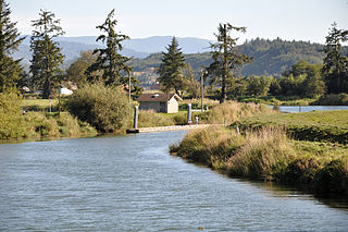
Coos Bay is an estuary where the Coos River enters the Pacific Ocean, the estuary is approximately 12 miles long and up to two miles wide. It is the largest estuary completely within Oregon state lines. The Coos Bay watershed covers an area of about 600 square miles and is located in northern Coos County, Oregon, in the United States. The Coos River, which begins in the Oregon Coast Range, enters the bay from the east. From Coos River, the bay forms a sharp loop northward before arching back to the south and out to the Pacific Ocean. Haynes Inlet enters the top of this loop. South Slough branches off from the bay directly before its entrance into the Pacific Ocean. The bay was formed when sea levels rose over 20,000 years ago at the end of the Last Glacial Maximum, flooding the mouth of the Coos River. Coos Bay is Oregon's most important coastal industrial center and international shipping port, with close ties to San Francisco, the Columbia River, Puget Sound and other major ports of the Pacific rim.

The Siletz River flows about 67 miles (108 km) to the Pacific Ocean through coastal mountains in the U.S. state of Oregon. Formed by the confluence of its north and south forks near Valsetz in Polk County, it winds through the Central Oregon Coast Range. The river, draining a watershed of 373 square miles (970 km2), empties into Siletz Bay, south of Lincoln City in Lincoln County. Although the river travels 67 miles (108 km) in river miles, its winding course begins only about 20 miles (32 km) east of the ocean, and its mouth and source latitudes are almost identical.

The Siuslaw River is a river, about 110 miles (177 km) long, that flows to the Pacific Ocean coast of Oregon in the United States. It drains an area of about 773 square miles (2,000 km2) in the Central Oregon Coast Range southwest of the Willamette Valley and north of the watershed of the Umpqua River.
The Trask River is in northwestern Oregon in the United States. It drains a mountainous timber-producing area of the Northern Oregon Coast Range west of Portland into Tillamook Bay and the Pacific Ocean. It is one of five rivers—the Tillamook, the Trask, the Wilson, the Kilchis, and the Miami—that flow into the bay.

The Wilson River, about 33 miles (53 km) long, flows from the Northern Oregon Coast Range to Tillamook Bay in the U.S. state of Oregon. Formed by the confluence of its Devil's Lake Fork and its South Fork, it runs generally west through the Tillamook State Forest to its mouth near the city of Tillamook. It is one of five rivers—the Tillamook, the Trask, the Wilson, the Kilchis, and the Miami—that flow into the bay.

The Eel River is a major river, about 196 miles (315 km) long, in northwestern California. The river and its tributaries form the third-largest watershed entirely in California, draining a rugged area of 3,684 square miles (9,540 km2) in five counties. The river flows generally northward through the Coast Ranges west of the Sacramento Valley, emptying into the Pacific Ocean about 10 miles (16 km) downstream from Fortuna and just south of Humboldt Bay. The river provides groundwater recharge, recreation, and industrial, agricultural and municipal water supply.

The Bull Run River is a 21.9-mile (35.2 km) tributary of the Sandy River in the U.S. state of Oregon. Beginning at the lower end of Bull Run Lake in the Cascade Range, it flows generally west through the Bull Run Watershed Management Unit (BRWMU), a restricted area meant to protect the river and its tributaries from contamination. The river, impounded by two artificial storage reservoirs as well as the lake, is the primary source of drinking water for the city of Portland, Oregon.

The Zigzag River is a tributary, about 12 miles (19 km) long, of the Sandy River in the U.S. state of Oregon. The Zigzag and one of its major tributaries, the Little Zigzag River, drain the Zigzag Glacier on Mount Hood, a high volcanic peak in the Cascade Range. Their waters flow westward to meet the Sandy River near the community of Zigzag. The river's flow ranges from 200 to 1,000 cubic feet per second.
Oak Grove Fork Clackamas River is a 21-mile (34 km) tributary of the Clackamas River in the U.S. state of Oregon. From its headwaters in the Warm Springs Indian Reservation near Abbot Pass in the Cascade Range, the river flows generally west through Mount Hood National Forest in Clackamas County to the unincorporated community of Ripplebrook. Here it enters the main stem of the Clackamas River. Oak Grove Fork feeds Timothy Lake and Lake Harriet, two artificial impoundments built along its course to control water flows to hydroelectric plants.

Coyote Creek is a principal tributary of the San Gabriel River in northwest Orange County and southeast Los Angeles County, California. It drains a land area of roughly 41.3 square miles (107 km2) covering nine major cities, including Brea, Buena Park, Cerritos, Fullerton, Hawaiian Gardens, La Habra, Lakewood, La Palma, and Long Beach. Some major tributaries of the creek in the highly urbanized watershed include Brea Creek, Fullerton Creek, and Carbon Creek. The mostly-flat creek basin is separated by a series of low mountains, and is bounded by several small mountain ranges, including the Chino Hills, Puente Hills, and West Coyote Hills.

The South Fork Bull Run River is a tributary, about 6 miles (9.7 km) long, of the Bull Run River in the U.S. state of Oregon. Part of the system that provides drinking water to the city of Portland, it flows generally west through a protected part of the Mount Hood National Forest in Clackamas County. It joins the Bull Run River at Bull Run Reservoir 2, about 8 miles (13 km) from the larger stream's confluence with the Sandy River.
The North Fork Bull Run River is a tributary, about 6 miles (10 km) long, of the Bull Run River in the U.S. state of Oregon. Part of the system that provides drinking water to the city of Portland, it flows generally south through a protected part of the Mount Hood National Forest in Multnomah County. It joins the Bull Run River at Bull Run Reservoir 1.

Big Butte Creek is a 12-mile-long (19 km) tributary of the Rogue River in the U.S. state of Oregon. It drains approximately 245 square miles (635 km2) of Jackson County. Its two forks, the North Fork and the South Fork, both begin high in the Cascade Range near Mount McLoughlin. Flowing predominantly west, they meet near the city of Butte Falls. The main stem flows generally northwest until it empties into the Rogue Falls was incorporated in 1911, and remains the only incorporated town within the watershed's boundaries.
The North Fork Malheur River is a 59-mile (95 km) tributary of the Malheur River in eastern Oregon in the United States. Rising in Big Cow Burn in the Blue Mountains, it flows generally south to join the larger river at Juntura. The upper 25.5 miles (41.0 km) of the river have been designated Wild and Scenic. This part of the river basin offers camping, hiking, and fishing opportunities in a remote forest setting. The lower river passes through Beulah Reservoir, which stores water for irrigation and has facilities for boaters.

The Millicoma River is a coast stream, about 8.5 miles (13.7 km) long, east of Coos Bay in the U.S. state of Oregon. Formed by the confluence of the East Fork Millicoma River and the West Fork Millicoma River at Allegany, it meanders across relatively flat land to meet the South Fork Coos River, with which it forms the Coos River.

The East Fork Millicoma River is a tributary, about 24 miles (39 km) long, of the Millicoma River in the U.S. state of Oregon. Rising in eastern Coos County, it flows generally west to the community of Allegany, where it joins the West Fork Millicoma River to form the Millicoma. In turn, the Millicoma, which is only about 9 miles (14 km) long, joins the South Fork Coos River to form the Coos River. The Coos River, itself only about 5 miles (8 km) long, empties into the eastern end of Coos Bay, which connects to the Pacific Ocean.

The West Fork Millicoma River is a tributary, about 34 miles (55 km) long, of the Millicoma River in the U.S. state of Oregon. Rising in northeastern Coos County near the Douglas County line, it flows generally southwest through the Elliott State Forest of the Southern Oregon Coast Range to the community of Allegany. There it joins the East Fork Millicoma River to form the Millicoma. In turn, the Millicoma, which is only about 9 miles (14 km) long, joins the South Fork Coos River to form the Coos River. The Coos River, itself only about 5 miles (8 km) long, empties into the eastern end of Coos Bay, which connects to the Pacific Ocean.
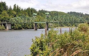
The South Fork Coos River is a tributary, about 32 miles (51 km) long, of the Coos River in the U.S. state of Oregon. Formed by the confluence of the Williams River and Tioga Creek, it begins in eastern Coos County near the Douglas County line and flows generally northwest through the Southern Oregon Coast Range. East of the city of Coos Bay, it joins the Millicoma River to form the Coos River. This larger river, only about 5 miles (8 km) long, empties into the eastern end of Coos Bay, which connects to the Pacific Ocean.

The Williams River is a tributary, about 21 miles (34 km) long, of the South Fork Coos River in the U.S. state of Oregon. Formed by the confluence of Lost Creek and Little Cow Creek, it begins in western Douglas County near the Coos County line and flows generally northwest through the Southern Oregon Coast Range. In eastern Coos County, it joins Tioga Creek to form the South Fork Coos River about 32 miles (51 km) from its confluence with the Millicoma River.