| Sabanas River | |
|---|---|
| Native name | Rio Sabanas (Spanish) |
| Location | |
| Country | Panama |
| Physical characteristics | |
| Mouth | |
• coordinates | 8°25′05″N78°05′17″W / 8.418141°N 78.088027°W Coordinates: 8°25′05″N78°05′17″W / 8.418141°N 78.088027°W |
| Sabanas River | |
|---|---|
| Native name | Rio Sabanas (Spanish) |
| Location | |
| Country | Panama |
| Physical characteristics | |
| Mouth | |
• coordinates | 8°25′05″N78°05′17″W / 8.418141°N 78.088027°W Coordinates: 8°25′05″N78°05′17″W / 8.418141°N 78.088027°W |

The Guiana Shield is one of the three cratons of the South American Plate. It is a 1.7 billion-year-old Precambrian geological formation in northeast South America that forms a portion of the northern coast. The higher elevations on the shield are called the Guiana Highlands, which is where the table-like mountains called tepuis are found. The Guiana Highlands are also the source of some of the world's most well-known waterfalls such as Angel Falls, Kaieteur Falls and Kuquenan Falls.

Sabana Grande is a town and municipality of Puerto Rico located north of Lajas and Guánica; south of Maricao; east of San Germán; and west of Yauco. Sabana Grande is spread over seven barrios and Sabana Grande Pueblo. It is part of the San Germán-Cabo Rojo Metropolitan Statistical Area.

Elías Piña is a westernmost province which composing one of the 32 provinces of the Dominican Republic. It is divided into 6 municipalities and its capital city is Comendador. It is bordered by the provinces of Dajabón to the north-west, Santiago Rodríguez to the north-east, San Juan to the east, Independencia to the south and the Nord-Est department of Haiti to the west.

Canaima National Park is a 30,000 km2 (12,000 sq mi) park in south-eastern Venezuela that roughly occupies the same area as the Gran Sabana region. It is located in Bolívar State, reaching the borders with Brazil and Guyana.
Estadio Nacional is the name used for:
Palenque was a Maya city state in southern Mexico that flourished in the 7th century.
La Gran Sabana is a region in southeastern Venezuela, part of the Guianan savanna ecoregion.

Dajabón is a municipality and capital of the Dajabón province in the Dominican Republic. Located on the northwestern border with Haiti. It is a market town with a population of about 26,000, north of the Cordillera Central mountain range.

Sabanas de San Ángel, Spanish for Savannas of Saint Angel, is a town and municipality of the Colombian Department of Magdalena. Founded around 1607 with the name San Antoñito by the Spanish Colonizers as a pathway town in the route between La Guajira Department and the Magdalena River. On June 24, 1999 the municipality is created with the name of Sabanas de San Angel that segregated from the municipalities of Ariguaní, Pivijay, Chibolo and Plato.
Sabana Grande may refer to:

Handroanthus chrysanthus, formerly classified as Tabebuia chrysantha, also known as araguaney in Venezuela, as guayacán in Colombia, Panama, and Ecuador, as tajibo in Bolivia, and as ipê-amarelo in Brazil, is a native tree of the intertropical broadleaf deciduous forests of South America above the Tropic of Capricorn. On May 29, 1948, Handroanthus chrysanthus was declared the National Tree of Venezuela due to its status as an emblematic native species of extraordinary beauty. Its deep yellow resembles that of the Venezuelan flag.

The Bogotá savanna is a montane savanna, located in the southwestern part of the Altiplano Cundiboyacense in the center of Colombia. The Bogotá savanna has an extent of 4,251.6 square kilometres (1,641.6 sq mi) and an average altitude of 2,650 metres (8,690 ft). The savanna is situated in the Eastern Ranges of the Colombian Andes.
San Jose Villa de Allende is a town and municipal seat of the municipality of Villa de Allende. It is the fifth largest town in the municipality. It is located 70 kilometers to the west of the city of Toluca. Villa de Allende was named in honor of Ignacio Allende, a hero of the Mexican War of Independence.

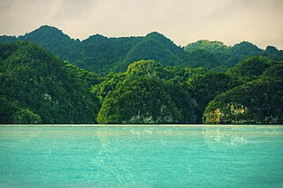
Los Haitises National Park is a national park located on the remote northeast coast of the Dominican Republic that was established in 1976. It consists of a limestone karst plateau with conical hills, sinkholes and caverns, and there is a large area of mangrove forest on the coast. Other parts of the park are clad in subtropical humid forest and the area has an annual precipitation of about 2,000 mm (79 in). The park contains a number of different habitats and consequently has a great diversity of mammals and birds, including some rare species endemic to the island. Some of the caverns contain pictograms and petroglyphs. The park has become a popular ecotourism destination but the number of tourists allowed to visit is limited.
Luis Ricauter Jaramillo is a football midfielder who currently plays in Panama for Liga Panameña de Fútbol team Chorrillo.
Grande River is the name of the following rivers:

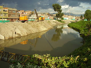
The Tunjuelo or Tunjuelito River is a river on the Bogotá savanna and a left tributary of the Bogotá River. The river, with a length of 73 kilometres (45 mi) originates in the Sumapaz Páramo and flows northward through the Usme Synclinal to enter the Colombian capital Bogotá. There, the river is mostly canalised flowing westward into the Bogotá River. It is one of the three main rivers of the city, together with the Fucha and Juan Amarillo Rivers.

The Soacha River is a river on the Bogotá savanna and a left tributary of the Bogotá River.

The Río Frío is a river on the Bogotá savanna and a right tributary of the Bogotá River. The river, in a basin of 6,008.69 hectares (23.1997 sq mi), originates on the Páramo de Guerrero in Zipaquirá at an altitude of 3,700 metres (12,100 ft). It flows through the municipalities Tabio and Cajicá and into the Bogotá River in the south of Chía, at 2,650 metres (8,690 ft) above sea level.