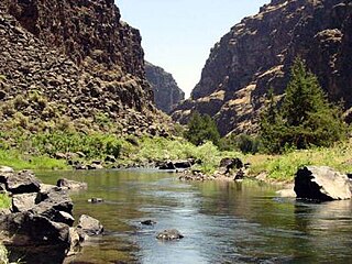
The Bruneau River is a 153-mile-long (246 km) tributary of the Snake River, in the U.S. states of Idaho and Nevada. It runs through a narrow canyon cut into ancient lava flows in southwestern Idaho. The Bruneau Canyon, which is up to 1,200 feet (370 m) deep and 40 miles (64 km) long, features rapids and hot springs, making it a popular whitewater trip.

The geography of North Carolina falls naturally into three divisions — the Appalachian Mountains in the west, the central Piedmont Plateau, and the eastern Atlantic Coastal Plain. North Carolina covers 53,819 square miles (139,391 km2) and is 503 miles (810 km) wide by 150 miles (241 km) long. The physical characteristics of the state vary from the summits of the Smoky Mountains, an altitude of near seven thousand feet (2,130 m) in the west, sloping eastward to sea level along the coast and beaches of the Atlantic Ocean.

The San Miguel River is a tributary of the Dolores River, approximately 81 miles (130 km) long, in southwestern Colorado in the United States. It rises in the San Juan Mountains southeast of Telluride and flows northwest, along the southern slope of the Uncompahgre Plateau, past the towns of Placerville and Nucla and joins the Dolores in western Montrose County approximately 15 miles (24 km) east of the state line with Utah.

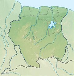
Saramacca is a district of Suriname, in the north. Saramacca's capital city is Groningen, with other towns and cities including Batavia, Kampong Baroe, Uitkijk, Maho and Boskamp. Saramacca has a population of 17,480 and an area of 3,636 km2.

The Calapooya Mountains are a mountain range in Lane and Douglas counties of southwestern Oregon in the United States. The range runs for approximately 60 miles (97 km) west from the Cascade Range between Eugene on the north and Roseburg on the south.

The Skykomish River is a 29-mile (47 km) long river in the U.S. state of Washington which drains the west side of the Cascade Mountains in the southeast section of Snohomish County and the northeast corner of King County. The river starts with the confluence of the North Fork Skykomish River and South Fork Skykomish River approximately one mile west of Index, then flowing northwesterly towards Puget Sound. It is joined by the Sultan River and the Wallace River at Sultan. It then meets the Snoqualmie River to form the Snohomish River at Monroe. The Snohomish River continues along the river valley eventually dumping into Port Gardner Bay on Possession Sound.
The Kwinti are a Maroon people, descendants of runaway African slaves, living in the forested interior of Suriname on the bank of the Coppename River, and the eponymous term for their language, which has fewer than 300 speakers. Their language is an English-based creole with Dutch, Portuguese and other influences. It is similar to the languages spoken by the Aluku and Paramaccan Maroons, and split from Sranan Tongo in the middle 18th century. The Kwinti had a population of about 300 in 2014 and adhere to the Moravian Church.
The Wilhelminagebergte is a mountain range in the district of Sipaliwini in central Suriname. It extends about 113 km (70 mi) from west to east. It is named after Queen Wilhelmina. The Wilhelminagebergte is part of the Tumucumaque Uplands of the Guiana Shield. It belongs to the very ancient (Precambrian) Guiana Highlands. Most of it is in the Central Suriname Nature Reserve.

Saramacca River is a river in Suriname. The Arawaks named this river "Surama", and today's name "Saramacca" is probably derived from it. It originates in the Wilhelmina Mountains and flows northwards and enters the Atlantic Ocean together with the Coppename River. It has a river basin of 9.400 km2 and length of 255 km. The Saramacca River is used for water transport. Scientific exploration of the river began in the 1770s.

The geography of New York (state) varies widely. Most of New York is dominated by farms, forests, rivers, mountains, and lakes. New York's Adirondack Park is larger than any U.S. National Park in the contiguous United States. Niagara Falls, on the Niagara River as it flows from Lake Erie to Lake Ontario, is a popular attraction. The Hudson River begins near Lake Tear of the Clouds and flows south through the eastern part of the state without draining lakes George or Champlain. Lake George empties at its north end into Lake Champlain, whose northern end extends into Canada, where it drains into the Richelieu River and then the St. Lawrence. Four of New York City's five boroughs are on the three islands at the mouth of the Hudson River: Manhattan Island, Staten Island, and Brooklyn and Queens on Long Island.

Fossá is the name of several rivers in Iceland that are known for their waterfalls. The most well-known is Fossárdalur, which runs from Þingvellir towards the southern side of Hvalfjörður. This river is characterized by numerous waterfalls, with the most popular one located near Route 47, where car parking is available.

Kabalebo is a resort in Suriname, located in the Sipaliwini District. Its population at the 2012 census was 2,291.

Boven Coppename is a resort in Suriname, located in the Sipaliwini District. Its population at the 2012 census was 539. The resort is mainly inhabited by indigenous people of the Tiriyó, and Maroons of the Kwinti tribe. The main village is Bitagron. Other villages include Corneliskondre and Donderskamp.

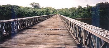
The Coppename Bridge is a bridge over the Coppename River in Suriname, part of the East-West Link.
The (northern) East-West Link is a road in Suriname between Albina in the eastern part of the country to Nieuw Nickerie in the western part, via the capital city of Paramaribo. The southern East-West Link connects Paramaribo with Apoera via Bitagron. Construction of the road link started in the 1960s.
The Bakhuis Mountains are a mountain range in central Suriname, spanning 110 kilometres. The mountain range form of the Northern part of the Wilhelmina Mountains, and the mountains and its village were named after the Dutch explorer and Royal Dutch East Indies Army officer Louis August Bakhuis. It is situated in the Sipaliwini Savanna District of Suriname. The Bakhuys Airstrip is nearby the village.
Tulymsky Kamen is a mountain range in North Ural. Located in northeastern portion of Krasnovishersky District, Perm Krai, Russia, the range stretches about 24 km north–south. At 1,496 m elevation, it is also the highest point of Perm Krai.

The Colorado River is a major river of the western United States and northwest Mexico in North America. Its headwaters are in the Rocky Mountains where La Poudre Pass Lake is its source. Located in north central Colorado it flows southwest through the Colorado Plateau country of western Colorado, southeastern Utah and northwestern Arizona where it flows through the Grand Canyon. It turns south near Las Vegas, Nevada, forming the Arizona–Nevada border in Lake Mead and the Arizona–California border a few miles below Davis Dam between Laughlin, Nevada and Needles, California before entering Mexico in the Colorado Desert. Most of its waters are diverted into the Imperial Valley of Southern California. In Mexico its course forms the boundary between Sonora and Baja California before entering the Gulf of California. This article describes most of the major features along the river.
The Emma Range is a mountain range in the Sipaliwini District of Suriname. It is named after Emma of the Netherlands. Mountains on this range include the Hendriktop and Kleine Hendriktop. The range is located between the drainage basin of the Saramacca and the Coppename River. The range is about 30 km long, and has no significant human population.
The Coesewijne River is a blackwater river in Suriname. It is a tributary of the Coppename River and flows into the Coppename south of Boskamp. The river has its source in the Goliath Mountain.