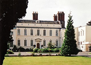
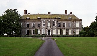
Acton Reynald Hall is a 19th-century country house at Acton Reynald, Moreton Corbet, Shropshire, England. It is a Grade II* listed building. [1]
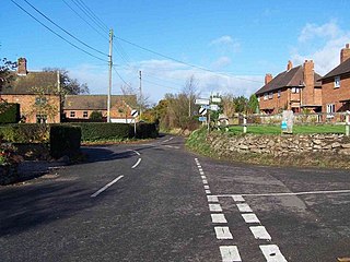
Acton Reynald is a village in the north of Shropshire, England. The village is perhaps more of a hamlet in that it does not contain a public house, Post Office, or any other features typically associated with villages. It is in close proximity to the A49 which runs from Ross-on-Wye on the Welsh border to Bamber Bridge in Lancashire. The village backs on to RAF Shawbury and the village of Moreton Corbet to its east.
Moreton Corbet is a village in the civil parish of Moreton Corbet and Lee Brockhurst in Shropshire, England. The village's toponym refers to the Corbet baronets, the local landowners.
Shropshire is a county in England, bordering Wales to the west, Cheshire to the north, Staffordshire to the east, and Worcestershire and Herefordshire to the south. Shropshire Council was created in 2009, a unitary authority taking over from the previous county council and five district councils. The borough of Telford and Wrekin has been a separate unitary authority since 1998 but continues to be included in the ceremonial county.
The Corbet family abandoned nearby Moreton Corbet Castle as a residence in about 1800 after their 17th-century hall had been enlarged and improved for their occupation. Sir Andrew Corbet retained architect John Hiram Haycock (1759–1830), who created the new mansion in a Neo-Jacobean style. [1] The seven-bayed, three-storey eastern entrance front retains three bays and a Tuscan portico dating from 1610 and 1625. [2] The main block, dating from about 1800, was later extended by service wings in about 1840 and other improvements in 1893. [1]
There have been six baronetcies created for members of the Corbet family, four in the Baronetage of England, one in the Baronetage of Great Britain and one in the Baronetage of the United Kingdom. All creations are extinct. The recipients were descendants of the ancient Norman family of Corbet which held substantial estates in Shropshire including Wattlesborough, Caus Castle, Moreton Corbet Castle and Acton Reynald Hall.
Moreton Corbet Castle is an English Heritage property located near the village of Moreton Corbet, Shropshire, England, 8 miles northeast of Shrewsbury. It is a Grade I listed building. The ruins are from two different eras: a medieval stronghold and an Elizabethan era manor house. The buildings have been out of use since the 18th century.
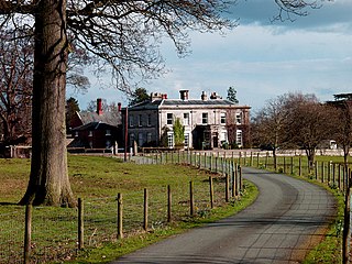
John Hiram Haycock (1759-1830) was an architect who built many notable buildings in Shropshire and Montgomeryshire. He was the son of William Haycock (1725-1802), a carpenter and joiner of Shrewsbury. J H Haycock was apprenticed to his father and became a freeman of the Shrewsbury Carpenters’ and Bricklayers’ Company in 1796. From about 1814 John Hiram Haycock worked in partnership with his son Edward Haycock, Sr. In 1824 he became the Shropshire County Surveyor.
The whole of the village of Acton Reynald together with several farms was demolished in the 1840s to facilitate the creation of the park.
From about 1919 until 1995 the house was occupied by a girls' school. It is now once again a private residence.
There are over 20,000 Grade II* listed buildings in England. This article comprises a list of these buildings in the county of Shropshire Council.
Moreton Corbet and Lee Brockhurst is a civil parish in Shropshire, England. It contains 45 listed buildings that are recorded in the National Heritage List for England. Of these, three are listed at Grade I, the highest of the three grades, two are at Grade II*, the middle grade, and the others are at Grade II, the lowest grade. The parish contains the villages and smaller settlements of Acton Reynald, Moreton Corbet, Lee Brockhurst, and Preston Brockhurst, and the surrounding countryside. Most of the listed buildings are houses and cottages, farmhouses and farm buildings and associated structures, the earliest of which are timber framed. The other listed buildings include churches, memorials, a ruined castle and mansion, country houses and associated structures, a former watermill, a bridge, and two mileposts.
Upton Magna is a village and civil parish in Shropshire, England. Nearby are the villages of Uffington, Rodington and Withington, as well as the wooded Haughmond Hill. The nearest town to Upton Magna is Shrewsbury, just 2.4 miles (3.9 km) to the west.
Moreton Corbet and Lee Brockhurst is a civil parish in Shropshire, England.
Stanton upon Hine Heath is a village and parish in Shropshire, England. The River Roden flows through the village.
Sibdon Carwood is a hamlet and small parish in Shropshire, England. To its east is the small market town of Craven Arms.
Haughton Hall is an early 18th-century country house situated at Haughton Lane, Shifnal, Shropshire, England now converted for use as a hotel. It is a Grade II* listed building.
Mawley Hall is a privately owned 18th-century country mansion near Cleobury Mortimer, Shropshire, England. It is a Grade I listed building.
The Corbet family is an English family of Anglo-Norman extraction that became one of the most powerful and richest of the landed gentry in Shropshire. Corbet is supposed to have been first recorded in Pays de Caux, Normandy, as the name of a Norman baron named "Corbet le Normand" who was born in the early 11th century. The name Corbet derives from the Anglo-Norman French word corb, meaning "crow." It is a diminutive form, hence meaning "little crow". The modern French word corbeau is generally translated as "crow". Variants of the name include: Corbet, Corbett, Corbitt, Corbit, Corbetts, Corbete, Corben and possibly the variant of Corbin. It has cognates in other languages: the Spanish name Cuervo, for example, which generally means a raven or rook. The underlying derivation is from the Latin word corvus, crow. Generally it is thought to be a jocular reference to a person who was thought to resemble a crow: in hair colour, tone of voice or shape of nose. However, the Scandinavians believed that a raven on the battlefield was a beneficial omen and ensured victory.
Sir Andrew Corbet (1580–1637) was an English politician of Shropshire landed gentry background who sat in the House of Commons at various times between 1624 and 1629. A Puritan sympathiser, he at first supported the government but became an increasingly vocal opponent of Charles I's policies and ministers.
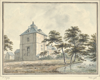
Wattlesborough Tower is a ruined fortified 13th-century manor house or Tower House in Shropshire. It is situated close to the boundary with Powys in Wales. Wattlesborough is a former township within the present parish of Alberbury. The castle is a Grade 1 listed scheduled monument. The Tower comprises a square two-storey tower above an undercroft surrounded by a moated enclosure with a fishpond. The Leighton family inherited Wattlesborough in 1471 and used it as their chief residence until circa 1711. At that time an adjoining farm building was constructed and named Wattlesborough Hall.
Richard Corbet was an English landowner and politician who represented Shropshire in the parliaments of 1558 and 1563.
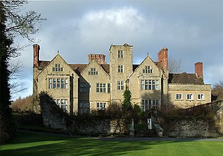
Shipton Hall is a large Elizabethan country house in the village of Shipton, Shropshire, England, which lies in the Corvedale valley some 7 miles south-west of Much Wenlock. It is a Grade I listed building.
Aldenham Park is a late 17th-century country house in Morville, near Bridgnorth, Shropshire, England which stands in 12 hectares of parkland. It is a Grade II* listed building.
Acton Burnell Hall is a 19th-century country house, now used as a private school, located near the village of Acton Burnell, Shropshire, England.
Styche Hall is a country house near Market Drayton, Shropshire. It was home to the Clive family and is a Grade II listed building.
Coordinates: 52°48′17″N2°41′30″W / 52.8047°N 2.6917°W
A geographic coordinate system is a coordinate system that enables every location on Earth to be specified by a set of numbers, letters or symbols. The coordinates are often chosen such that one of the numbers represents a vertical position and two or three of the numbers represent a horizontal position; alternatively, a geographic position may be expressed in a combined three-dimensional Cartesian vector. A common choice of coordinates is latitude, longitude and elevation. To specify a location on a plane requires a map projection.