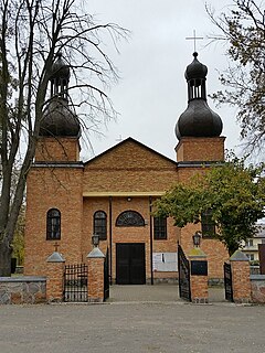
Szikszó is a small town in Borsod-Abaúj-Zemplén county, Northern Hungary, 15 kilometres from county capital Miskolc.

Grosvenor Road station was a railway station in London located at the north end of Grosvenor Bridge on the approach tracks to Victoria station.
On 2 September 1861, near Kentish Town station in London, 16 people were killed and 317 injured, when an excursion train operated by the North London Railway collided with a freight train operated by the London and North Western Railway.

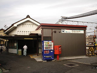
Nishi-Biwajima Station is a railway station operated by the private railway operator Meitetsu, located in Kiyosu, Aichi, Japan. It is located 71.6 rail kilometers from the terminus of the Nagoya Main Line at Toyohashi Junction.
Dąbrówka is a village in the administrative district of Gmina Kowal, within Włocławek County, Kuyavian-Pomeranian Voivodeship, in north-central Poland.
Siedliszcze-Kolonia is a village in the administrative district of Gmina Siedliszcze, within Chełm County, Lublin Voivodeship, in eastern Poland.

Krasne is a village in the administrative district of Gmina Supraśl, within Białystok County, Podlaskie Voivodeship, in north-eastern Poland. It lies approximately 4 kilometres (2 mi) south-west of Supraśl and 13 km (8 mi) north-east of the regional capital Białystok.

Godzięby is a village in the administrative district of Gmina Krośniewice, within Kutno County, Łódź Voivodeship, in central Poland. It lies approximately 6 kilometres (4 mi) south of Krośniewice, 13 km (8 mi) west of Kutno, and 51 km (32 mi) north of the regional capital Łódź.

Rük is a village in the Quba Rayon of Azerbaijan. The village forms part of the municipality of Söhüb.

Karxulu is a village in the Jabrayil Rayon of Azerbaijan.
Kopanina is a settlement in the administrative district of Gmina Gorzkowice, within Piotrków County, Łódź Voivodeship, in central Poland.

Ruda is a village in the administrative district of Gmina Dobryszyce, within Radomsko County, Łódź Voivodeship, in central Poland. It lies approximately 4 kilometres (2 mi) east of Dobryszyce, 9 km (6 mi) north of Radomsko, and 71 km (44 mi) south of the regional capital Łódź.

Kęszyce-Wieś is a village in the administrative district of Gmina Bolimów, within Skierniewice County, Łódź Voivodeship, in central Poland. It lies approximately 8 kilometres (5 mi) north of Bolimów, 21 km (13 mi) north of Skierniewice, and 62 km (39 mi) north-east of the regional capital Łódź.

Nowe Kęszyce is a village in the administrative district of Gmina Bolimów, within Skierniewice County, Łódź Voivodeship, in central Poland. It lies approximately 8 kilometres (5 mi) north of Bolimów, 22 km (14 mi) north of Skierniewice, and 62 km (39 mi) north-east of the regional capital Łódź.

Sierosławice is a village in the administrative district of Gmina Końskie, within Końskie County, Świętokrzyskie Voivodeship, in south-central Poland. It lies approximately 5 kilometres (3 mi) west of Końskie and 40 km (25 mi) north-west of the regional capital Kielce.

Daniszewo is a village in the administrative district of Gmina Bulkowo, within Płock County, Masovian Voivodeship, in east-central Poland. It lies approximately 31 kilometres (19 mi) east of Płock and 71 km (44 mi) north-west of Warsaw.

Żelków is a village in the administrative district of Gmina Skórzec, within Siedlce County, Masovian Voivodeship, in east-central Poland. It lies approximately 6 kilometres (4 mi) west of Siedlce and 82 km (51 mi) east of Warsaw.
Budki Piaseckie is a village in the administrative district of Gmina Teresin, within Sochaczew County, Masovian Voivodeship, in east-central Poland.

Lądy is a settlement in the administrative district of Gmina Tczew, within Tczew County, Pomeranian Voivodeship, in northern Poland. It lies approximately 8 kilometres (5 mi) north-east of Tczew and 27 km (17 mi) south-east of the regional capital Gdańsk.

Zacisze is a village in the administrative district of Gmina Węgorzewo, within Węgorzewo County, Warmian-Masurian Voivodeship, in northern Poland, close to the border with the Kaliningrad Oblast of Russia. It lies approximately 14 kilometres (9 mi) south-west of Węgorzewo and 82 km (51 mi) north-east of the regional capital Olsztyn.


