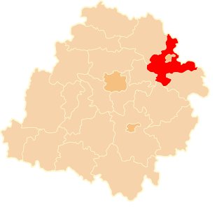
Bù Đăng is a rural district of Bình Phước Province in the Southeast region of Vietnam. As of 2003 the district had a population of 108,855. The district covers an area of 1488 km². The district capital lies at Đức Phong.

Dolgo Polje is a district of the City Municipality of Celje and a neighborhood of the city of Celje in central-eastern Slovenia.

Mioarele is a commune in Argeș County, in southern central Romania. It is composed of five villages: Aluniș, Chilii, Cocenești, Mățău and Suslănești.

Oraczew is a village in the administrative district of Gmina Witonia, within Łęczyca County, Łódź Voivodeship, in central Poland. It lies approximately 5 kilometres (3 mi) south-west of Witonia, 10 km (6 mi) north of Łęczyca, and 42 km (26 mi) north of the regional capital Łódź.

Kavdadıq is a village in the Qubadli Rayon of Azerbaijan.

Faliszew is a village in the administrative district of Gmina Przedbórz, within Radomsko County, Łódź Voivodeship, in central Poland. It lies approximately 10 kilometres (6 mi) north of Przedbórz, 35 km (22 mi) east of Radomsko, and 76 km (47 mi) south-east of the regional capital Łódź.

Łazy is a village in the administrative district of Gmina Łuków, within Łuków County, Lublin Voivodeship, in eastern Poland. It lies approximately 3 kilometres (2 mi) east of Łuków and 75 km (47 mi) north of the regional capital Lublin.
Celiny Włościańskie is a village in the administrative district of Gmina Stanin, within Łuków County, Lublin Voivodeship, in eastern Poland.

Marszowice is a village in the administrative district of Gmina Gdów, within Wieliczka County, Lesser Poland Voivodeship, in southern Poland. It lies approximately 15 kilometres (9 mi) south-east of Wieliczka and 27 km (17 mi) south-east of the regional capital Kraków.

Cieklińsko is a village in the administrative district of Gmina Ruda Maleniecka, within Końskie County, Świętokrzyskie Voivodeship, in south-central Poland. It lies approximately 2 kilometres (1 mi) south-east of Ruda Maleniecka, 15 km (9 mi) south-west of Końskie, and 39 km (24 mi) north-west of the regional capital Kielce.

Boków is a village in the administrative district of Gmina Stąporków, within Końskie County, Świętokrzyskie Voivodeship, in south-central Poland. It lies approximately 11 kilometres (7 mi) north of Stąporków, 13 km (8 mi) east of Końskie, and 40 km (25 mi) north of the regional capital Kielce.

Karolinów is a village in the administrative district of Gmina Krasocin, within Włoszczowa County, Świętokrzyskie Voivodeship, in south-central Poland. It lies approximately 5 kilometres (3 mi) north-east of Krasocin, 16 km (10 mi) north-east of Włoszczowa, and 32 km (20 mi) west of the regional capital Kielce.

Karolew is a village in the administrative district of Gmina Pniewy, within Grójec County, Masovian Voivodeship, in east-central Poland. It lies approximately 14 kilometres (9 mi) north-west of Grójec and 40 km (25 mi) south-west of Warsaw.

Bronisławki is a village in the administrative district of Gmina Gostyń, within Gostyń County, Greater Poland Voivodeship, in west-central Poland. It lies approximately 7 kilometres (4 mi) west of Gostyń and 59 km (37 mi) south of the regional capital Poznań.

Sierowo is a village in the administrative district of Gmina Kołczygłowy, within Bytów County, Pomeranian Voivodeship, in northern Poland. It lies approximately 6 kilometres (4 mi) east of Kołczygłowy, 17 km (11 mi) north-west of Bytów, and 87 km (54 mi) west of the regional capital Gdańsk.

Łąkie is a settlement in the administrative district of Gmina Przywidz, within Gdańsk County, Pomeranian Voivodeship, in northern Poland. It lies approximately 7 kilometres (4 mi) south-west of Przywidz, 28 km (17 mi) west of Pruszcz Gdański, and 34 km (21 mi) south-west of the regional capital Gdańsk.

Frank is a village in the administrative district of Gmina Kaliska, within Starogard County, Pomeranian Voivodeship, in northern Poland. It lies approximately 2 kilometres (1 mi) south-east of Kaliska, 21 km (13 mi) west of Starogard Gdański, and 59 km (37 mi) south-west of the regional capital Gdańsk.
Wierzchląd is a village in the administrative district of Gmina Stargard, within Stargard County, West Pomeranian Voivodeship, in north-western Poland.
Đồng Phú is a rural district (huyện) of Bình Phước Province in the Đông Nam Bộ region of Vietnam. As of 2003 the district had a population of 75,573. The district covers an area of 929 km². The district capital lies at Tân Phú.
Rynhach is a commune (selsoviet) in Novoselytsia Raion, Chernivtsi Oblast, Ukraine. It is composed of two villages, Rynhach and Shishkivtsi.


