Adams Street Bridge | |
|---|---|
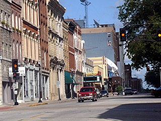
 The bridge in 2015 | |
| Coordinates | 41°52′46″N87°38′17″W / 41.87934°N 87.638091°W |
| Location | |
 | |
The Adams Street Bridge is a bridge that spans the Chicago River in downtown Chicago, Illinois. [1]
Adams Street Bridge | |
|---|---|
| The bridge in 2015 | |
| Coordinates | 41°52′46″N87°38′17″W / 41.87934°N 87.638091°W |
| Location | |
| | |
The Adams Street Bridge is a bridge that spans the Chicago River in downtown Chicago, Illinois. [1]

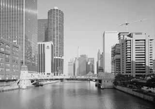
The Chicago River is a system of rivers and canals with a combined length of 156 miles (251 km) that runs through the city of Chicago, including its center. Though not especially long, the river is notable because it is one of the reasons for Chicago's geographic importance: the related Chicago Portage is a link between the Great Lakes and the Mississippi River Basin, and ultimately the Gulf of Mexico.
Quincy is a city in and the county seat of Adams County, Illinois, United States, located on the Mississippi River. The population was 39,463 as of the 2020 census, down from 40,633 in 2010. The Quincy micropolitan area had 114,649 residents.

Yorkville is a city within the Chicago Metropolitan Area and is the county seat of Kendall County, Illinois, United States. It is a southwest suburb/exurb of Chicago, Illinois. The population was 23,835 as of the 2022 census.

Michigan Avenue is a north-south street in Chicago that runs at 100 east on the Chicago grid. The northern end of the street is at DuSable Lake Shore Drive on the shore of Lake Michigan in the Gold Coast Historic District. The street's southern terminus is at Sibley Boulevard in the southern suburb of Dolton, but like many other Chicago streets, it exists in several disjointed segments.
Adams Bridge or variations may refer to:

Goose Island is a 160-acre (65 ha) artificial island in Chicago, Illinois, formed by the North Branch of the Chicago River on the west and the North Branch Canal on the east. It is about 1.5 miles (2.4 km) long and 0.5 miles (0.80 km) across at its widest point.

Illinois Route 29 is a two to four lane state highway that runs south from U.S. Route 6/Illinois Route 89 at Spring Valley to U.S. Route 51/Illinois Route 16 at Pana, running through Pekin, Peoria and Springfield. The nearest major north–south highway, Interstate 39, runs parallel to Illinois 29, but approximately fifty miles to the east. Illinois 29 is 175.36 miles (282.21 km) long.

Columbus Drive is a north–south street in Chicago, Illinois, which bisects Grant Park. It is 300 East in Chicago's street numbering system. Its south end is an interchange with Lake Shore Drive at Soldier Field. After intersecting Illinois Street, it becomes Fairbanks Court and continues to the north, terminating at Chicago Avenue.

LaSalle Street is a major north-south street in Chicago named for René-Robert Cavelier, Sieur de La Salle, a 17th century French explorer of the Illinois Country. The portion that runs through the Chicago Loop is considered to be Chicago's financial district.

U.S. Route 66 was a United States Numbered Highway in Illinois that connected St. Louis, Missouri, and Chicago, Illinois. The historic Route 66, the Mother Road or Main Street of America, took long distance automobile travelers from Chicago to Southern California. The highway had previously been Illinois Route 4 and the road has now been largely replaced with Interstate 55 (I-55). Parts of the road still carry traffic and six separate portions of the roadbed have been listed on the National Register of Historic Places.

U.S. Route 24 (US 24) in the U.S. state of Illinois is a major arterial road that runs from the Missouri state line at the Mississippi River in Quincy to Sheldon. This is a distance of 255.13 miles (410.59 km).

The Dearborn Street Bridge over the Chicago River was built in 1962. It connects the Near North Side with "The Loop." The American Institute of Steel Construction honored the bridge with the 1963 "Most Beautiful Steel Bridge" award in the Movable Span category. The first drawbridge was built at Dearborn street in 1834 when Chicago had a population of 350. It was the primary crossing point over the Chicago River for the original town.
The Clark Street Bridge is a bascule bridge that spans the Chicago River in downtown Chicago, connecting the Near North Side with The Loop via Clark Street.

The La Salle Street Bridge is a single-deck double-leaf trunnion bascule bridge spanning the main stem of the Chicago River in Chicago, Illinois, that connects the Near North Side with the Loop area. It was constructed in 1928 at a cost of $2,500,000 by the Strobel Steel Constructing Company.

The Monroe Street Bridge is a bascule bridge that crosses the Chicago River in downtown Chicago, Illinois. It was constructed by Burns & McDonnell.

The Bataan-Corregidor Memorial Bridge, also known as the State Street Bridge, is a bridge that carries State Street across the Chicago River in downtown Chicago, Illinois, United States.
The Van Buren Street Bridge is a bascule bridge that spans the Chicago River in downtown Chicago, Illinois, United States. It is the sixth bridge at this location and carrying this name, and was completed in 1956. It replaced an 1895 Rolling Lift-type bascule bridge designed by William Scherzer.

The Taylor Street Bridge was the first Scherzer rolling lift bascule bridge built in Chicago, Illinois.
Crossings of the South Branch Chicago River | ||||
|---|---|---|---|---|
| ||||
| Authority control databases: Geographic |
|---|
| | This article about a bridge in Illinois is a stub. You can help Wikipedia by expanding it. |