Jackson Boulevard Bridge | |
|---|---|
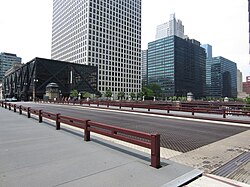
 The bridge in 2023 | |
| Coordinates | 41°52′41″N87°38′16″W / 41.87807°N 87.63770°W |
| Carries | Pedestrians, bicycles, motor vehicles |
| Crosses | South Branch of the Chicago River |
| Locale | Chicago Loop |
| Named for | Andrew Jackson, after the street on which it resides [1] |
| Owner | City of Chicago |
| Maintained by | Chicago Department of Transportation |
| NBI number | 16602627329 |
| Preceded by | Adams Street Bridge |
| Followed by | Van Buren Street Bridge |
| Characteristics | |
| Design | Double-leaf bascule bridge |
| Material | Steel |
| Total length | 273 feet (83 m) |
| Width | 64 feet (20 m) |
| Longest span | 202 feet (62 m) |
| No. of spans | 1 main & 3 approach |
| Clearance below | 15.74 feet (4.80 m) |
| No. of lanes | 3 (one-way eastbound) |
| History | |
| Engineering design by | Strauss Bascule Bridge Company |
| Constructed by |
|
| Construction end | 1915 |
| Construction cost | $400,600 [2] |
| Opened | 29 January 1916 |
| Rebuilt | 1993 |
| Replaces | 1888 swing bridge |
| Statistics | |
| Daily traffic | |
| Location | |
 | |
| References | |
| historicbridges.org [4] | |
The Jackson Boulevard Bridge is a Pratt deck truss, fixed-trunnion, bascule bridge that spans the Chicago River at Jackson Boulevard in downtown Chicago. [4] [5] It was built in 1915 and is 273 feet in length. [4]