Related Research Articles

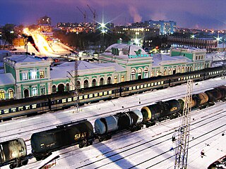
Samara, formerly known as Kuybyshev during Soviet rule, is the largest city and administrative centre of Samara Oblast in Russia. The city is located at the confluence of the Volga and the Samara rivers, with a population of over 1.14 million residents, up to 1.22 million residents in the urban agglomeration, not including Novokuybyshevsk, which is not conurbated. The city covers an area of 541.382 square kilometers (209.029 sq mi), and is the eighth-largest city in Russia and tenth agglomeration, the third-most populous city on the Volga, as well as the Volga Federal District.

Samara Oblast is a federal subject of Russia. Its administrative center is the city of Samara. From 1935 to 1991, it was known as Kuybyshev Oblast. As of the 2021 Census, the population of the oblast was 3,172,925.

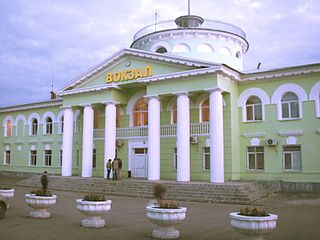
Tolyatti or Togliatti, known before 1964 as Stavropol, is a city in Samara Oblast, Russia. It is the largest city in Russia which is neither the administrative center of a federal subject, nor the largest city of a subject. Population: 684,709 (2021 Census); 719,632 (2010 Census); 702,879 (2002 Census); 630,543 (1989 Soviet census).
Syzran is the third largest city in Samara Oblast, Russia, located on the right bank of Saratov Reservoir of the Volga River. Population: 165,725 (2021 Census); 178,750 (2010 Census); 188,107 (2002 Census); 174,335 (1989 Soviet census).
Alexeyevsky District is the name of several administrative and municipal districts in Russia. The districts' name generally derives from or is related to the male first name Alexey.

Chapayevsk is a town in Samara Oblast, Russia, located 40 kilometers (25 mi) from the city of Samara, on the right bank of the Chapayevka River. Population: 72,692 (2010 Census); 73,912 (2002 Census); 97,984 (1989 Soviet census).
Novokuybyshevsk is a city in Samara Oblast, Russia, located on the eastern bank of the Volga River, 6 kilometers (3.7 mi) away from it. Population: 108,438 (2010 Census); 112,973 (2002 Census); 112,987 (1989 Soviet census).

Kinel is a city in Samara Oblast, Russia, located on the Bolshoy Kinel River near its confluence with the Samara River, 41 kilometers (25 mi) east of Samara. Population: 34,491 (2010 Census); 34,385 (2002 Census); 33,412 (1989 Soviet census).
Promyshlenny City District is the name of several city divisions in Russia. The name literally means "industrial".
Bezenchuksky District is an administrative and municipal district (raion), one of the twenty-seven in Samara Oblast, Russia. It is located in the west of the oblast. The area of the district is 1,988.8 square kilometers (767.9 sq mi). Its administrative center is the urban locality of Bezenchuk. Population: 42,095 ; 43,571 (2002 Census); 44,003 (1989 Soviet census). The population of Bezenchuk accounts for 54.5% of the district's total population.

Bogatovsky District is an administrative and municipal district (raion), one of the twenty-seven in Samara Oblast, Russia. It is located in the east of the oblast. The area of the district is 824 square kilometers (318 sq mi). Its administrative center is the rural locality of Bogatoye. As of the 2010 Census, the total population of the district was 14,142, with the population of Bogatoye accounting for 41.9% of that number.

Bolshechernigovsky District is an administrative and municipal district (raion), one of the twenty-seven in Samara Oblast, Russia. It is located in the south of the oblast. The area of the district is 2,805.9 square kilometers (1,083.4 sq mi). Its administrative center is the rural locality of Bolshaya Chernigovka. As of the 2010 Census, the total population of the district was 20,477, with the population of Bolshaya Chernigovka accounting for 33.2% of that number.

Borsky District is an administrative and municipal district (raion), one of the twenty-seven in Samara Oblast, Russia. It is located in the east of the oblast. The area of the district is 2,103 square kilometers (812 sq mi). Its administrative center is the rural locality of Borskoye. Population: 24,433 ; 24,743 (2002 Census); 25,294 (1989 Soviet census). The population of Borskoye accounts for 36.6% of the district's total population.

Kamyshlinsky District is an administrative and municipal district (raion), one of the twenty-seven in Samara Oblast, Russia. It is located in the northeast of the oblast. The area of the district is 823.5 square kilometers (318.0 sq mi). Its administrative center is the rural locality of Kamyshla. Population: 11,420 ; 11,868 (2002 Census). The population of Kamyshla accounts for 42.8% of the district's total population.

Koshkinsky District is an administrative and municipal district (raion), one of the twenty-seven in Samara Oblast, Russia. It is located in the north of the oblast. The area of the district is 1,750 square kilometers (680 sq mi). Its administrative center is the rural locality of Koshki. Population: 24,194 ; 25,239 (2002 Census); 34,766 (1989 Soviet census). The population of Koshki accounts for 32.9% of the district's total population.
Pestravsky District is an administrative and municipal district (raion), one of the twenty-seven in Samara Oblast, Russia. It is located in the southwest of the oblast. The area of the district is 1,960 square kilometers (760 sq mi). Its administrative center is the rural locality of Pestravka. Population: 17,779 ; 18,340 (2002 Census); 18,815 (1989 Soviet census). The population of Pestravka accounts for 37.0% of the district's total population.

Stavropolsky District is an administrative and municipal district (raion), one of the twenty-seven in Samara Oblast, Russia. It is located in the west of the oblast. The area of the district is 3,662 square kilometers (1,414 sq mi). Its administrative center is the city of Tolyatti. Population: 54,181 ; 45,167 (2002 Census); 40,347 (1989 Soviet census).

Syzransky District is an administrative and municipal district (raion), one of the twenty-seven in Samara Oblast, Russia. It is located in the west of the oblast. The area of the district is 1,887 square kilometers (729 sq mi). Its administrative center is the city of Syzran. As of the 2010 Census, the total population of the district was 25,947.

Volzhsky District is an administrative and municipal district (raion), one of the twenty-seven in Samara Oblast, Russia. It is located in the center of the oblast. The area of the district is 2,481 square kilometers (958 sq mi). Its administrative center is the city of Samara. Population: 83,377 ; 77,621 (2002 Census); 64,974 (1989 Soviet census).

Yelkhovsky District is an administrative and municipal district (raion), one of the twenty-seven in Samara Oblast, Russia. It is located in the north of the oblast. The area of the district is 1,201 square kilometers (464 sq mi). Its administrative center is the rural locality of Yelkhovka. Population: 10,046 ; 10,187 (2002 Census). The population of Yelkhovka accounts for 32.5% of the district's total population.
References
- ↑ "Samara City Charter".
- ↑ "OKATO 36 401".
- ↑ "Samara Oblast Charter".
- ↑ "Establishment of urban boundaries in Samara, Samara Oblast". Archived from the original on 2016-03-24.
- ↑ "Law of Samara Region, March 30, 2015".
- ↑ "History of Administrative divisions of Samara, Samara Province". Archived from the original on 2018-01-12.
- ↑ "1979 Russian census in Samara".