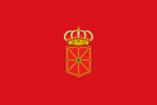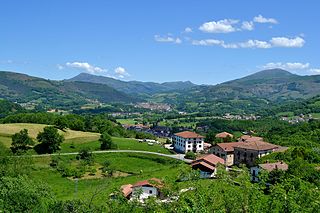
Navarre, officially the Chartered Community of Navarre, is a landlocked foral autonomous community and province in northern Spain, bordering the Basque Autonomous Community, La Rioja, and Aragon in Spain and Nouvelle-Aquitaine in France. The capital city is Pamplona. The present-day province makes up the majority of the territory of the medieval Kingdom of Navarre, a long-standing Pyrenean kingdom that occupied lands on both sides of the western Pyrenees, with its northernmost part, Lower Navarre, located in the southwest corner of France.

The Basque Country is the name given to the home of the Basque people. The Basque Country is located in the western Pyrenees, straddling the border between France and Spain on the coast of the Bay of Biscay.

Lower Navarre is a traditional region of the present-day French département of Pyrénées-Atlantiques. It corresponds to the northernmost region of the Kingdom of Navarre during the Middle Ages. After the Spanish conquest of Iberian Navarre (1512–24), this merindad was restored to the rule of the native king, Henry II. Its capitals were Saint-Jean-Pied-de-Port and Saint-Palais. In the extreme north there was the little sovereign Principality of Bidache, with an area of 1,284 km2 (496 sq mi) and a decreasing population of 44,450, 25,356.

Labourd is a former French province and part of the present-day Pyrénées Atlantiques département of Nouvelle-Aquitaine region. It is one of the traditional Basque provinces, and identified as one of the territorial component parts of the Basque Country by many, especially by the Basque nationalists.

The Kingdom of Navarre, originally the Kingdom of Pamplona occupied lands on both sides of the western Pyrenees, with its northernmost areas originally reaching the Atlantic Ocean, between present-day Spain and France.

Ainhoa is a commune in the Pyrénées-Atlantiques department in the Nouvelle-Aquitaine region in southwestern France. It is a member of Les Plus Beaux Villages de France Association.

Baztan is a municipality from the Chartered Community of Navarre, northern Spain. It is located 58 km (36 mi) from Pamplona, the capital of Navarre. It is the largest municipality in Navarre, with around 376.8 km2 and just over 8,000 inhabitants.

Ochagavía or Otsagabia is a town and municipality in the province and autonomous community of Navarre, northern Spain. It is situated in the north of the Valley of Salazar, near the Irati Forest and not far from the border with France.

Uharte-Arakil is a town and municipality located in the province and autonomous community of Navarre, northern Spain.

Getaria is a town on the Urola coast, in the province of Gipuzkoa, in the autonomous community of the Basque Country, in northern Spain. It borders Zarautz to the east and Zumaia to the west.

La Bastide-Clairence is a commune in the Pyrénées-Atlantiques department in the Nouvelle-Aquitaine region of south-western France.

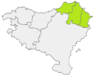
The French Basque Country, or Northern Basque Country, is a region lying on the west of the French department of the Pyrénées-Atlantiques. Since 1 January 2017, it constitutes the Basque Municipal Community presided over by Jean-René Etchegaray.

Hernani is a town and municipality located in the province of Gipuzkoa, Basque Autonomous Community, Spain. The town sits on the left bank of the Urumea river. It is located at a distance of 9.2 km from San Sebastián. The municipality of Hernani occupies an area of approximately 40 square kilometres and is bordered by San Sebastián, Astigarraga, Arano, Elduayen, Errenteria, Lasarte-Oria and Urnieta.

Campoo is a comarca (district) of Cantabria (Spain) located in the High Ebro. With an area of slightly more than 1,000 km2, it includes the municipalities of Hermandad de Campoo de Suso, Campoo de Enmedio, Campoo de Yuso, Valdeolea, Valdeprado del Río, Valderredible, Reinosa, Las Rozas de Valdearroyo, Santiurde de Reinosa, Pesquera, and San Miguel de Aguayo. The local inhabitants are called Campurrians . Its highest elevation is the Cuchillón peak, and the lowest is Pesquera, with the capital, Reinosa at 850 m.

The Salazar Valley is a valley in the east of the Foral Community of Navarre in Spain. It lies within the Merindad of Zangoza-Sangüesa and within that, the Comarca of Roncal-Salazar. The Sierra de Abodi, part of the Western Pyrenees, forms the natural boundary in the north. There is a ski resort in Abodi.

Navarro-Aragonese was a Romance language once spoken in a large part of the Ebro River basin, south of the middle Pyrenees; the dialects of the modern Aragonese language, spoken in a small portion of that territory, and the Navarrese dialect can be seen as its last remaining forms. The areas where Navarro-Aragonese was spoken might have included most of Aragon, southern Navarre, and La Rioja. It was also spoken across several towns of central Navarre in a multilingual environment with Occitan, where Basque was the native language.

The Battle of Orbaizeta was fought from 15 to 17 October 1794 during the War of the Pyrenees, between the French Army of the western Pyrenees led by Bon-Adrien Jeannot de Moncey and Spanish forces under the command of Pedro Téllez-Girón, 9th Duke of Osuna. Part of the wider French Revolutionary Wars, this engagement was fought over a wide area to the northwest and northeast of Pamplona in Navarre and ended in a French victory. The Spanish defenders gave up territory to the north of Pamplona, including a number of strategic locations.

The physical geography of the Basque Country is very diverse despite the small size of the region. The territory hosts a blend of green and brown to yellowish tones, featuring hilly terrain altogether. The Basque Country spreads from the rough coastal landscape to the semi-desert of the Bardenas on the south-eastern fringes of Navarre.
Ostabarret is a central region of the traditional province of Basse-Navarre in the far south of France. It corresponds to the valley of the upper reaches of the river Bidouze. It is hilly, open country, characterized by low mountains and round hills between 160 and 650 metres in elevation. The region takes its name from the village of Ostabat.

The Sierra de Leyre or Sierra de Leire is a mountain range in Navarre (Spain). It is the first pre-Pyrenean mountain range and is located in the northeast of the Comunidad Foral. It is 30 km long and has an east–west orientation.


