
Beddgelert is a village and community in the Snowdonia area of Gwynedd, Wales. The population of the community taken at the 2021 census was 460. This includes Nantmor and Nant Gwynant. It is reputed to be named after the legendary hound Gelert. The community is large and sparsely populated and covers 86 square kilometres.

Afon Rheidol is a river in Ceredigion, Wales, 19 miles (31 km) in length. The source is Plynlimon. Receiving an average annual rainfall of 40 inches (1.02 m), Plynlimon is also the source of both the Wye and the Severn.

Carnedd Llewelyn, also spelled Carnedd Llywelyn, is a mountain massif in the Carneddau range in Snowdonia, north-west Wales. It is the highest point of the Carneddau at 1,064m (3,491ft) and the second highest peak by relative height in Wales, 49th in the British Isles and lies on the border between Gwynedd and Conwy.
The Croesor Tramway was a Welsh, 2 ft narrow gauge railway line built to carry slate from the Croesor slate mines to Porthmadog. It was built in 1864 without an Act of Parliament and was operated using horse power.

The Llanberis Pass in Snowdonia carries the main road (A4086) from the south-east to Llanberis, over Pen-y-Pass, between the mountain ranges of the Glyderau and the Snowdon massif. At the bottom of the pass is the small village of Nant Peris.

The River Dyfi, also known as the River Dovey, is an approximately 30-mile (48-kilometre) long river in Wales.

The Afon Colwyn is a small river in Gwynedd, north-west Wales, a tributary of the Afon Glaslyn.

Sarn Helen refers to several stretches of Roman road in Wales. The 160-mile (260 km) route, which follows a meandering course through central Wales, connects Aberconwy in the north with Carmarthen in the west. Despite its length, academic debate continues as to the precise course of the Roman road. Many sections are now used by the modern road network while other parts are still traceable. However, there are sizeable stretches that have been lost and are unidentifiable.

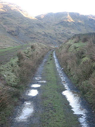
Nant Gwynant is a valley in northern Wales. The A498 road descends 600 feet (180 m) into the valley in about two miles (3 km) from Pen-y-Gwryd; it follows the Nant Cynnyd, the Afon Glaslyn and alongside Llyn Gwynant, then beside the Nant Gwynant river to Llyn Dinas and passing below Dinas Emrys to Beddgelert. The road continues through the Aberglaslyn Pass to Porthmadog.

The A498 is a 16-mile road between Pen-y-Gwryd and Porthmadog in North Wales.

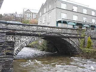
Penmachno is a village in the isolated upland Machno valley, 4 miles (6 km) south of Betws-y-Coed in the county of Conwy, North Wales. The B4406 road runs through part of the village. The village is at the confluence of the Glasgwm and Machno rivers. It has a five-arched, stone bridge dating from 1785. The village has been referred to as Pennant Machno, Llandudclyd and Llan dutchyd in historical sources.
The Afon Crafnant is a tributary of the River Conwy, which is the main river of the Conwy valley in north-west Wales.
The River Rhythallt is a river in Gwynedd, North Wales whose source is Llyn Padarn. It flows in a northwesterly direction past the village of Brynrefail, Gwynedd and changes its name to Afon Seiont downstream of Pont Rhythallt in Llanrug. The Afon Seiont eventually reaches the sea at Caernarfon. The river has a broad flood plain which occasionally threatens homes in the village of Cwm-y-glo.

The River Gavenny or sometimes the Gavenny River is a short river in Monmouthshire in south Wales. It rises 1 mile (1.6 km) southwest of the village of Llanvihangel Crucorney from springs near Penyclawdd Court, supplemented by springs in Blaen-Gavenny Wood and tributary streams there and within the Woodland Trust-owned Great Triley Wood. It flows south for about 4 miles (6.4 km) to its confluence with the River Usk towards the eastern end of Castle Meadows at Abergavenny. The town derives its English-language name from the Gavenny's confluence with the River Usk. Of the buildings on the banks of the river, the Gothic Decorated style church of St Teilo at Llantilio Pertholey is especially notable. Parts of the church date from the thirteenth century with multiple additions since. Blaengavenny Farm, the name of which signifies the 'head of the Gavenny', is a sixteenth-century farmhouse near the river's source.
Afon Llafar is a river in the Carneddau, Snowdonia. It rises where many streams flow down the slopes of Yr Elen, Carnedd Llewelyn and Carnedd Dafydd to join together in the valley below the cliffs of Ysgolion Duon. It is one of several similarly named streams in Wales. The river flows north-west along Cwm Pen-llafar, with Caseg River joining it near Gerlan, and discharges into the River Ogwen in the heart of Bethesda. Afon Llafar has the same etymology as the River Laver in North Yorkshire, England, with both being derived from Brittonic laβar, meaning "talkative, boastful".

The Afon Dwyfor is a river in Gwynedd, north-west Wales, in total the river is 12+1⁄2 miles (20.1 km) in length. It rises in Cwm Dwyfor at the head of Cwm Pennant, gathers to itself numerous streams which drain the surrounding mountains from Mynydd Graig Goch in the west to Moel Hebog in the east, then flows southwest towards Dolbenmaen and out of the Snowdonia National Park.

Duhonw is a rural community in Powys, Wales, to the south of Builth Wells, in the historic county of Breconshire. Covering an area of 4,376 hectares (16.90 sq mi) and including scattered farms and dwellings, it is bounded to its north by the Afon Irfon, to its south by Mynydd Epynt and Banc y Celyn (472m) and to its east the rivers Duhonw and Wye. Llangammarch Wells' is to its west.

Tref Alaw is a community in Anglesey, north Wales. The community takes in the area west and south west of the Llyn Alaw, a man made reservoir which is also the largest body of water on the island. The community consists of a wide network of dispersed farms, and five settlements. Two small villages, close to each other in the centre of the community area are Llanddeusant and Elim. Llantrisant is a hamlet a mile or so to the south-west of Elim. In the north west is the small village of Llanbabo, and in the far south is the tiny hamlet of Llechgynfarwy, of which the principal building is St Cynfarwy's Church. At the 2001 census the community had a population of 606 inhabitants, reducing to 581 at the 2011 census.

Bro Machno is a community in Conwy County Borough, in Wales, formed from the former civil parish of Penmachno. It covers the Penmachno Valley, through which runs the Afon Machno, and includes the villages of Penmachno and Cwm Penmachno. To the south west borders Gwynedd, and is located 4.8 miles (7.7 km) south of Betws-y-Coed, 21.8 miles (35.1 km) north west of Corwen, and 19.4 miles (31.2 km) south of Conwy. The whole of the community is within the Snowdonia national park, while much of it forms part of Gwydir Forest. According to the 2011 census, the population of the Bro Machno Parish was 617, of whom 342 (55%) were able to speak Welsh and 214 (34%) had no skills in Welsh.
The Afon Gwyrfai is a short river in Gwynedd, Wales. For half of its length it flows through Snowdonia National Park. Exiting Llyn y Gader it flows north through the small village of Rhyd-ddu to enter the southeastern end of Llyn Cwellyn. Downstream of the lake it flows northwest past Betws Garmon, leaving the national park and continues to the southern edge of Waunfawr. It then turns slightly west to flow on to Bontnewydd beyond which it turns slightly south to enter Foryd Bay. The tidal channel within the bay flows north into the western end of the Menai Strait. Principal tributary streams include the Afon Treweunydd which contributes water from the reservoir of Llyn Ffynnon-y-gwas and from the lakes of Llyn Glas, Llyn Coch and Llyn Nadroedd in Cwm Clogwyn immediately west of the summit of Snowdon. The tidal channel of the Gwyrfai within Foryd Bay also accepts the flow of the left bank tributaries, the Afon Foryd, Afon Rhyd and Afon Carrog. The river is shadowed by the line of the Welsh Highland Railway for much of its length, and by which it is crossed four times.

