North Londonderry was a United Kingdom Parliament constituency in Ireland.

Ballyrashane is a small village and civil parish outside Coleraine, County Londonderry, Northern Ireland. The civil parish of Ballyrashane covers areas of County Antrim, as well as County Londonderry. It is part of Causeway Coast and Glens district.

Tamlaght, also Tamlaght O'Crilly, is a small village, townland and civil parish in County Londonderry, Northern Ireland. In the 2001 Census it had a population of 123 people. It is situated within Mid-Ulster District.

Aghadowey is a townland in east County Londonderry, Northern Ireland. It lies in Aghadowey civil parish, and is part of Causeway Coast and Glens district. It is close to the county boundary with County Antrim.

Ballylifford is a townland in County Londonderry, Northern Ireland. It is within the civil parish of Ballinderry, on the western shores of Lough Neagh, and is part of Mid-Ulster District. Many of the houses in the area have been built along Ballinderry Bridge Road.
Glebe is an area of land within an ecclesiastical parish used to support a parish priest.

Aghalurcher is a civil parish located mainly in the barony of Magherastephana in County Fermanagh and partly in the barony of Clogher in County Tyrone, Northern Ireland.
Craigmore may refer to one of the following places:
Errigal civil parish is located in County Londonderry, Northern Ireland.
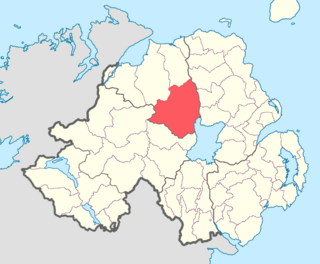
Loughinsholin is a barony in County Londonderry, Northern Ireland. Its southeast borders the northwest shore of Lough Neagh, and itself is bordered by seven other baronies: Dungannon Upper to the south; Strabane Upper to the west; Keenaght and Coleraine to the north; Kilconway, Toome Upper, and Toome Lower to the east. It was formed largely on the extent of the northern part of the medieval Irish túath of Uí Tuirtri.

Drumsamney is a townland lying within the civil parish of Kilcronaghan, County Londonderry, Northern Ireland. It lies in the south-east of the parish on the boundary of the civil parish of Desertmartin, and is bounded by the townlands of; Annagh & Moneysterlin, Ballinderry, Killynumber, Dromore, and Gortamney. In the Plantation of Ulster it was given as a glebe to the Drapers Company.
Glenconkeyne is an early-modern Irish district in what is now southern County Londonderry in Northern Ireland. Glenconkeyne formed the western portion of the former barony of Loughinsholin in Mid Ulster, with the ancient districts of Clandonnell, Killetra, and Tomlagh comprising the rest. The area Glenconkeyne covered corresponds to the present-day parishes of Ballynascreen, Desertmartin, and Kilcronaghan.
Glenkeen is a civil parish in County Tipperary.
Finvoy is a hamlet and civil parish in County Antrim, Northern Ireland. It is situated in the historic barony of Kilconway. The hamlet had a population of 187 people in the 2011 Census.

Derryloran is a civil parish mainly in County Tyrone, Northern Ireland, with some areas in County Londonderry. It is situated in the historic baronies of Dungannon Upper in County Tyrone and Loughinsholin in County Londonderry. It is also a townland of 174 acres.
Tullyniskan is a civil parish in Northern Ireland, in the traditional county of County Tyrone, Ireland. It has an area of 18.1 square kilometres.
