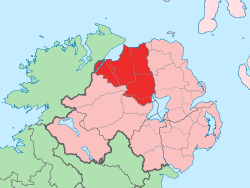
Since 1972, the counties in Northern Ireland, including Londonderry, have no longer been used by the state as part of the local administration. Following further reforms in 2015, the area is now governed under three different districts: Derry and Strabane, Causeway Coast and Glens and Mid-Ulster. Despite no longer being used for local government and administrative purposes, it is sometimes used in a cultural context in All-Ireland sporting and cultural events (i.e. Derry GAA).
Since 1981, it has become one of four counties in Northern Ireland that has a Catholic majority (55.56% according to the 2001 Census[5] and 61.3% according to the 2021 Census[6]). The county flower is the purple saxifrage.[7]
As with the city, its name is subject to the Derry/Londonderry name dispute, with the form "Londonderry" generally preferred by unionists and "Derry" by nationalists. Unlike with the city, however, there has never been a County Derry. County Londonderry was formed mostly from the old County Coleraine (see below).[11][12][13][14][15] British authorities use the name "Londonderry", while "Derry" is used by the Republic of Ireland.
History
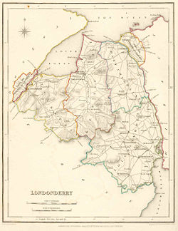
A cannon sits atop the historic Derry Walls, which look over Derry City.Map of County Londonderry, 1837
Prehistoric
The county has a significant of megalithic structures from prehistoric times, including Ballygroll Prehistoric Landscape, as well as numerous others. The most significant site however is Mountsandel, located near Coleraine in County Londonderry is "perhaps the oldest recorded settlement within Ireland".[16][17]
County Coleraine and the Plantation of Ulster
At an early period, what became the county of Coleraine was inhabited by the O'Cahans, who were tributary to the O'Neills. Towards the close of the reign of Elizabeth I their territory was seized by England, with the purpose of checking the power of the O'Neills, and was made the county of Coleraine, named after the regional capital.
A short description of County Coleraine is given in Harris's Hibernica, and also in Captain Pynnar's Survey of the Escheated Counties of Ulster, Anno 1618:
The county of Coleraine,* otherwise called O'Cahan's country, is divided, as Tyrone, by ballyboes and doth contain, as appeareth by the survey, 547 ballyboes, or 34,187 acres, every ballyboe containing 60 acres or thereabouts.
On 2 March 1613, James I granted a charter to The Honourable The Irish Society to undertake the plantation of a new county.[18] This county was named Londonderry, a combination of London (in reference to the Livery Companies of the Irish Society) and Derry (then name of the city). This charter declared that the "City of Londonderry" and everything contained within the new county:
shall be united, consolidated, and from hence-forth for ever be one entire County of itself, distinct and separate from all our Counties whatsoever within our Kingdom of Ireland-and from henceforth for ever be named, accounted and called, the County of Londonderry.[18]
Derry, the largest city in County Londonderry
This new county would comprise the then County Coleraine—which consisted of the baronies of Tirkeeran, Coleraine, and Keenaght—and at the behest of The Irish Society the following additional territory was added: all but the south-west corner of the barony of Loughinsholin, then a part of County Tyrone, as it had sufficient wood for construction; the North East Liberties of Coleraine, which was part of County Antrim and the City of Londonderry and its Liberties, which were in County Donegal, so that they could control both banks of the River Foyle and River Bann.[18][19][20]
The Irish Society was made up of the twelve main livery companies of London, which themselves were composed of various guilds. Whilst The Irish Society as a whole was given possession of the city of Londonderry and Coleraine, the individual companies were each granted an estimated 3,210 acres (5.02sqmi; 13.0km2) throughout the county. These companies and the sites of their headquarters were:[21][22]
Clothworkers, based at Killowen and Clothworker's Hall (present-day Articlave) in the barony of Coleraine;
Drapers, based at Draper's Hall, later called Drapers Town (present-day Moneymore) in the barony of Loughinsholin;[23]
Fishmongers, based at Artikelly and Fishermonger's Hall (present-day Ballykelly) in the barony of Keenaght;
Goldsmiths, based at Goldsmith's Hall (present-day Newbuildings) in the barony of Tirkeeran;
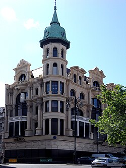
Austins, Derry, Formerly the world's oldest independent department store.Grocers, based at Grocer's Hall, alias Muff (present-day Eglinton) in the barony of Tirkeeran;
Haberdashers, based at Habberdasher's Hall (present-day Ballycastle) in the barony of Keenaght;
Ironmongers, based at Ironmonger's Hall (present-day townland of Agivey) in the barony of Coleraine;
Mercers, based at Mercer's Hall (present-day townland of Movanagher) in the barony of Coleraine;
Merchant Taylors, based at Merchant Taylor's Hall (present-day Macosquin) in the barony of Coleraine;
Salters, based at Salter's Hall (present-day Magherafelt) and Salters Town in the barony of Loughinsholin;
Skinners, based at Skinner's Hall (present-day Dungiven) in the barony of Keenaght;
Vintners, based at Vintner's Hall, later called Vintner's Town (present-day Bellaghy) in the barony of Loughinsholin.
The highest point in the county is the summit of Sawel Mountain (678 metres (2,224ft)) on the border with County Tyrone. Sawel is part of the Sperrin Mountains, which dominate the southern part of the county. To the east and west, the land falls into the valleys of the Bann and Foyle rivers respectively; in the south-east, the county touches the shore of Lough Neagh, which is the largest lake in Ireland; the north of the county is distinguished by the steep cliffs, dune systems, and remarkable beaches of the Atlantic coast.
The county is home to a number of important buildings and landscapes, including the well-preserved 17th-century city walls of Derry; the National Trust–owned Plantationestate at Springhill; Mussenden Temple on the Atlantic coast; the dikes, artificial coastlines and the bird sanctuaries on the eastern shore of Lough Foyle; and the visitor centre at Bellaghy Bawn, close to the childhood home of Nobel laureate Seamus Heaney. In the centre of the county are the old-growth deciduous forests at Banagher and Ness Wood, where the Burntollet River flows over the highest waterfalls in Northern Ireland.
It is one of four counties in Northern Ireland which currently has a majority of the population from a Catholic community background, according to the 2021 census. At the time of the 2021 census there were 252,231 residents of County Londonderry.[2] Of these: 61.3% were from a Catholic background, 32.5% were from a Protestant and Other Christian (including Christian related), 0.9% were from other religions, and 5.3% had no religious background.[6]
The county is served by Londonderry Port, now operating as Foyle Port, located on Lough Foyle at Lisahally. It is the United Kingdom's most westerly port. The main port for the city of Derry, it used to be located in the city centre, however it relocated to Lisahally in 1993.[38] The port is used by DuPont to import raw materials for their manufacturing process and by the nearby Coolkeeragh power station to import fuel oil for their turbines. Lisahally Terminal has 440 metres (1,440 ft) of quay and can facilitate vessels up to 62,000 GT. Primarily a bulk port and major importer of oil, coal, animal feed, fertiliser and plywood. The port also accepts cruise ships at the city centre berths and at its commercial port at Lisahally.
The county also has a regular ferry service, the Lough Foyle Ferry, providing a seasonal daily shuttle service between Magilligan Point, County Londonderry and Greencastle, County Donegal. The ferry typically operates throughout the spring and summer season.
Education
Ulster University, Magee
Government-funded education up to secondary school level is administered by the Education Authority (EA), sponsored by the Department of Education. The EA is divided into sub-regions:
Western region: Derry, Limavady;
North Eastern region: Coleraine, Magherafelt;
Southern region: Cookstown.
For Catholic grant-maintained schools administration is by the Derry Diocesan Education Office.
The oak leaf which represents the county's nickname.
In Gaelic games, the GAA county of Derry is more or less coterminous with the former administrative county of Londonderry, although teams from the neighbouring counties of Tyrone, Donegal and Antrim have occasionally played in Derry competitions, and vice versa. The Derry teams wear the colours red and white. There are many club teams competing in up to five leagues and three championships. The county team has won one All-Ireland Senior Football Championship (in 1993) and five National League titles. Hurling is also widely played but is not as popular as football.[citation needed] However, the county team is generally regarded as one of the top hurling sides in Ulster[citation needed] and in 2006 won the Nicky Rackard Cup – the third tier hurling competition in Ireland.
Cricket is popular in the north-west of Ireland, with 11 of the 20 senior clubs in the North West Cricket Union located in County Londonderry: Limavady, Eglinton, Glendermott, Brigade, Killymallaght, Ardmore, Coleraine, Bonds Glen, Drummond, Creevedonnell and The Nedd.[citation needed]
In rowing, Richard Archibald from Coleraine along with his Irish teammates qualified for the Beijing 2008 Olympics by finishing second in the lightweight fours final in Poznań, thus qualifying for the Beijing 2008 Olympics. Another Coleraine rower Alan Campbell is a World Cup gold medallist in the single sculls in 2006.
Media
The county currently has four main radio stations:
↑Northern Ireland General Register Office (1975). "Table 1: Area, Buildings for Habitation and Population, 1971". Census of Population 1971; Summary Tables(PDF). Belfast: HMSO. p.1. Archived(PDF) from the original on 23 July 2019. Retrieved 28 August 2019.
↑Derry City Council: Re Application for Judicial Review[2007] NIHC 5(QB)
↑A.E.P. Collins (1983), "Excavations at Mount Sandel, Lower Site", Ulster Journal of Archaeology vol. 46 pp1-22. JSTOR previewArchived 4 February 2016 at the Wayback Machine .
123Notes on the Place Names of the Parishes and Townlands of the County of Londonderry, 1925, Alfred Moore Munn, Clerk of the Crown and Peace of the City and County of Londonderry
↑Lee, JJ (1981). "On the accuracy of the Pre-famine Irish censuses". In Goldstrom, J. M.; Clarkson, L. A. (eds.). Irish Population, Economy, and Society: Essays in Honour of the Late K. H. Connell. Oxford, England: Clarendon Press.
This page is based on this Wikipedia article Text is available under the CC BY-SA 4.0 license; additional terms may apply. Images, videos and audio are available under their respective licenses.