
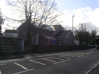
Derry, officially Londonderry, is the second-largest city in Northern Ireland and the fifth-largest city on the island of Ireland. The old walled city lies on the west bank of the River Foyle, which is spanned by two road bridges and one footbridge. The city now covers both banks.

Omagh is the county town of County Tyrone, Northern Ireland. It is situated where the rivers Drumragh and Camowen meet to form the Strule. Northern Ireland's capital city, Belfast, is 68 miles (109.5 km) to the east of Omagh, and Derry is 34 miles (55 km) to the north.

Bushmills is a village on the north coast of County Antrim, Northern Ireland. Bushmills had a population of 1,295 in the 2011 Census. It is located 60 miles (97 km) from Belfast, 11 miles (18 km) from Ballycastle and 9 miles (14 km) from Coleraine. The village owes its name to the River Bush and to a large watermill that was built there in the early 17th century. It is home to the Old Bushmills Distillery, which produces Irish whiskey, and is near the Giant's Causeway.

Letterkenny, nicknamed 'the Cathedral Town', is the largest and most populous town in County Donegal, a county in Ulster, the northern province in Ireland. Letterkenny lies on the River Swilly in East Donegal in the north-west of Ulster, and has a population of 19,274. It is the 36th largest settlement in all of Ireland by population, and is the 15th largest settlement by population in the province of Ulster. Along with the nearby city of Derry, Letterkenny is considered a regional economic gateway for the north-west of Ireland. Letterkenny acts as an urban gateway to the Ulster Gaeltacht, similar to Galway's relationship to the Connemara Gaeltacht.

Camus or Camas is a small village in the Connemara Gaeltacht of County Galway, Ireland. It is between Casla and An Teach Dóite, and is divided into Camas Uachtair and Camas Íochtair, as well as several other townlands, such as Scríob, Gleann Trasna, Leitir Móir, and Doire Bhainbh.

Letterbreen is a hamlet in County Fermanagh, Northern Ireland. It is 5 miles southwest of Enniskillen on the main route to Sligo. It lies in the foothills of Belmore Mountain.

Ballykelly is a village and townland in County Londonderry, Northern Ireland. It lies 3 miles (4.8 km) west of Limavady on the main Derry to Limavady A2 road and is 15 miles (24 km) east of Derry. It is designated as a Large Village and in 2011 the population of Ballykelly was 2,107. It lies within Causeway Coast and Glens district.

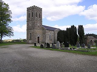
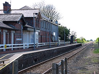
Swatragh is a small village and townland in County Londonderry, Northern Ireland. Swatragh is on the main A29 road north of Maghera, and is situated within Mid-Ulster District. The population was 438 in the 2011 Census. The village has three churches: one Roman Catholic, one Church of Ireland, and one Presbyterian. The Catholic and Church of Ireland churches are listed buildings. St John's is the local primary school.
Newbuildings or New Buildings is a large village in County Londonderry, Northern Ireland. It lies close to the banks of the River Foyle and 3 mi (5 km) south of the city of Derry. It had a population of 3,381 in the 2011 Census. It is within Derry and Strabane district.

Claudy is a village and townland in County Londonderry, Northern Ireland. It lies in the Faughan Valley, 6 miles (9.7 km) southeast of Derry, where the River Glenrandal joins the River Faughan. It is situated in the civil parish of Cumber Upper and the historic barony of Tirkeeran. It is also part of Derry and Strabane district.
Cloughmills or Cloghmills is a village in County Antrim, Northern Ireland. Ballymoney is 9 miles to the north-west and Ballymena is 10 miles to the south. It had a population of 1,309 people in the 2011 Census. It is in Causeway Coast and Glens District Council.

Garvagh is a village in County Londonderry, Northern Ireland. It is on the banks of the Agivey River, 18 kilometres (11 mi) south of Coleraine on the A29 route. In the 2001 Census it had a population of 1,288. It is situated within Causeway Coast and Glens district.

Greysteel or Gresteel is a village in County Londonderry, Northern Ireland. It lies 9 miles (14 km) to the east of Derry and 7 miles (11 km) to the west of Limavady on the main A2 coast road between Limavady and Derry, overlooking Lough Foyle. It is designated as a Large Village and in the 2001 Census it had a population of 1,229 people, an increase of almost 20% compared to 1991. It is situated within Causeway Coast and Glens district.
Strathfoyle is a village in County Londonderry, Northern Ireland It is about 5 miles (8.0 km) north east of Derry. It was newly built in different phases between the late 1950s and the early 1960s, with many new recent additions to the village, including Westlake, Butler's Wharf and Old Fort. In the 2001 Census it had a population of 1,581 people. It is within the Derry Urban Area and the Derry City Council area. The village has a small retail outlet, a Roman Catholic chapel, a library, youth club and a post office. The small retail unit was constructed in 2005 following years of under-investment in the area and pressure by local community leaders to provide more facilities for its residents.
Lettermullen,, is a small island and village on the coast of southern Connemara in County Galway, Ireland. It is about 58 km (36 mi) west of Galway city, at the far western end of Galway Bay, Lettermullen is the westernmost of three islands; Lettermullen, Gorumna and Lettermore, along with smaller islands collectively known as Ceantar na nOileán connected to the mainland by the bridges and causeways of R374. Lettermullen is in the parish of Kilcummin, barony of Moycullen, and province of Connaught. It forms one side of Kiegall Bay, and its northern end is part of the shore of Casheen Bay. The island comprises about 100 hectares of arable and pasture land. The inhabitants are chiefly employed in herring and cod fisheries and in the collection of seaweed for manure.
Killaloo is a townland and hamlet in County Londonderry, Northern Ireland. It is about six miles southeast of Derry, on the main Derry to Belfast road. In the 2001 Census Killaloo had a population of 75 people. It is situated within Derry and Strabane district.
Derrynaflaw, also known as Dernaflaw, is a small village and townland in County Londonderry, Northern Ireland. It is about 2 kilometres west of Dungiven on the A6 Foreglen Road. It is designated as a Hamlet and in the 2001 Census it had a population of 168 people. It lies within Causeway Coast and Glens district.

Knockloughrim or Knockcloghrim is a small village near Maghera in County Londonderry, Northern Ireland. In the 2001 Census it had a population of 186 people. Knockloughrim lies within the civil parish of Termoneeny and is part of the former barony of Loughinsholin. It is situated within the Mid Ulster District Council area.
Bellarena (derived from French belle "beautiful" + Latin arena "sand, strand"; is a small village and townland in County Londonderry, Northern Ireland. It is on the A2 coastal road between Limavady and Coleraine, 6 miles north of Limavady. The land was settled in the mid-17th century by a Northamptonshire gentleman, William Gage, who bought the lease of the estate – then called Ballymargy from the Irish meaning "town of the market" – from the Lord Bishop of Derry. In the 2001 census the population was 291. The village lies within Causeway Coast and Glens District Council area and the Binevenagh Area of Outstanding Natural Beauty, with open views eastwards to the scarp slope of Binevenagh. The village gets its name from the Earl Bishop of Derry.

Altnagelvin is a townland in County Londonderry, Northern Ireland. It is also the name of an electoral ward in Derry and Strabane district. Formerly a small village, it has been absorbed into the Waterside neighbourhood of Derry. Within Altnagelvin is Altnagelvin Area Hospital, a large hospital which serves the most of the county.

