County Armagh | |
---|---|
Nickname: The Orchard County | |
Country | United Kingdom |
Region | Northern Ireland |
Province | Ulster |
Established | 1584/5 |
County town | Armagh |
Area | |
• Total | 512 sq mi (1,327 km2) |
• Rank | 27th |
Highest elevation | 1,880 ft (573 m) |
Population (2021) | 194,394 |
• Rank | 10th [2] |
• Density | 380/sq mi (146/km2) |
Time zone | UTC±0 (GMT) |
• Summer (DST) | UTC+1 (BST) |
Postcode area | |
Contae Ard Mhacha is the Irish name; Coontie Armagh [3] and Coontie Airmagh [4] are Ulster Scots spellings. |
County Armagh (Irish : Contae Ard Mhacha) is one of the six counties of Northern Ireland and one of the traditional thirty-two counties of Ireland. It is located in the province of Ulster and adjoins the southern shore of Lough Neagh. It borders the Northern Irish counties of Tyrone to the west and Down to the east. The county borders Louth and Monaghan to the south and southwest, which are in the Republic of Ireland. It is named after its county town, Armagh, which derives from the Irish Ard Mhacha, meaning "Macha's height". Macha was a sovereignty goddess in Irish mythology and is said to have been buried on a wooded hill around which the town of Armagh grew. [5] County Armagh is colloquially known as the "Orchard County" because of its many apple orchards. [6]
The county covers an area of 1,327 km2 (512 sq mi), making it the smallest of Northern Ireland's six counties by size and the sixth-smallest county on the island of Ireland. With a population of 194,394 as of the 2021 census, [7] it is the fourth-most populous county in both Northern Ireland and Ulster. It is the 10th most populous of Ireland's 32 traditional counties, as well as the fifth-most densely populated. In addition to the city of Armagh and the western portion of the city of Newry, notable towns in the county include Lurgan, Portadown and Craigavon.
The name Armagh derives from the Irish Ard Macha, meaning Macha's height/Macha's high place. Macha is a mythological figure who is mentioned in The Book of the Taking of Ireland . Macha is also said to have been responsible for the construction of the hill site of Emain Macha (now Navan Fort near Armagh City) to serve as the capital of the Ulaid kings (who give their name to Ulster) and is believed to be the high place from which the county takes its name.
From its highest point at Slieve Gullion, in the south of the county, Armagh's land falls away from its rugged south with Carrigatuke, Lislea and Camlough mountains, to rolling drumlin country in the middle and west of the county and finally flatlands in the north where rolling flats and small hills reach sea level at Lough Neagh.
County Armagh's boundary with Louth is marked by the rugged Ring of Gullion rising in the south of the county whilst much of its boundary with counties Monaghan and Down goes unnoticed with seamless continuance of drumlins and small lakes. The River Blackwater marks the border with County Tyrone and Lough Neagh otherwise marks out the county's northern boundary.
There are also a number of uninhabited islands in the county's section of Lough Neagh: Coney Island Flat, Croaghan Flat, Padian, Phil Roe's Flat and the Shallow Flat.
Despite lying in the east of Ireland, Armagh enjoys an oceanic climate strongly influenced by the Gulf Stream with damp mild winters, and temperate, wet summers. Overall temperatures rarely drop below freezing during daylight hours, though frost is not infrequent in the months November to February. Snow rarely lies for longer than a few hours even in the elevated south-east of the county. Summers are mild and wet and although with sunshine often interspersed with showers, daylight lasts for almost 18 hours during high-summer.
On 22 July 2021 the record for highest outside air temperature ever measured in Northern Ireland was set in Armagh City when a reading of 31.4°C was registered at Armagh Observatory's weather station. [8]
Climate data for County Armagh | |||||||||||||
---|---|---|---|---|---|---|---|---|---|---|---|---|---|
Month | Jan | Feb | Mar | Apr | May | Jun | Jul | Aug | Sep | Oct | Nov | Dec | Year |
Mean daily maximum °C | 7 | 7.6 | 9.7 | 12.2 | 15.2 | 17.7 | 19.6 | 19.2 | 16.6 | 13 | 9.5 | 7.6 | 12.9 |
Mean daily minimum °C | 1.7 | 1.7 | 2.9 | 4 | 6.3 | 9.1 | 11.4 | 11 | 9 | 6.7 | 3.5 | 2.4 | 5.8 |
Average precipitation mm | 79.8 | 57.5 | 64.9 | 55.4 | 54.4 | 55.7 | 52.3 | 71.9 | 67.1 | 81.1 | 72.1 | 83.4 | 759.4 |
Mean daily maximum °F | 45 | 45.7 | 49.5 | 54.0 | 59.4 | 63.9 | 67.3 | 66.6 | 61.9 | 55 | 49.1 | 45.7 | 55.2 |
Mean daily minimum °F | 35.1 | 35.1 | 37.2 | 39 | 43.3 | 48.4 | 52.5 | 52 | 48 | 44.1 | 38.3 | 36.3 | 42.4 |
Average precipitation inches | 3.14 | 2.26 | 2.56 | 2.18 | 2.14 | 2.19 | 2.06 | 2.83 | 2.64 | 3.19 | 2.84 | 3.28 | 29.90 |
Source: [9] |
Year | Pop. | ±% |
---|---|---|
1653 | 5,904 | — |
1659 | 6,748 | +14.3% |
1821 | 197,427 | +2825.7% |
1831 | 220,134 | +11.5% |
1841 | 232,393 | +5.6% |
1851 | 196,084 | −15.6% |
1861 | 190,086 | −3.1% |
1871 | 179,260 | −5.7% |
1881 | 163,177 | −9.0% |
1891 | 143,289 | −12.2% |
1901 | 125,392 | −12.5% |
1911 | 120,291 | −4.1% |
1926 | 110,070 | −8.5% |
1937 | 108,815 | −1.1% |
1951 | 114,154 | +4.9% |
1961 | 117,594 | +3.0% |
1966 | 125,164 | +6.4% |
1971 | 133,969 | +7.0% |
1981 | 133,230 | −0.6% |
1991 | 141,585 | +6.3% |
2001 | 162,957 | +15.1% |
2011 | 174,792 | +7.3% |
2021 | 194,394 | +11.2% |
[10] [11] [12] [13] [14] [15] |
Ancient Armagh was the territory of the Ulaid (also known as Voluntii, Ultonians, Ulidians, Ulstermen) before the fourth century AD. It was ruled by the Red Branch, whose capital was Emain Macha (or Navan Fort) near Armagh. The site, and subsequently the city, were named after the goddess Macha. The Red Branch play an important role in the Ulster Cycle, as well as the Cattle Raid of Cooley. However, they were eventually driven out of the area by the Three Collas, who invaded in the 4th century and held power until the 12th. The Clan Colla ruled the area known as Airghialla or Oriel for these 800 years.
The chief Irish clans of the county were descendants of the Collas, the O'Hanlons and Mac Cana, and the Uí Néill, the O'Neills of Fews. Armagh was divided into several baronies: Armagh was held by the O'Rogans, Lower Fews was held by O'Neill of the Fews, and Upper Fews were under governance of the O'Larkins, who were later displaced by the MacCanns. Oneilland East was the territory of the O'Garveys, who were also displaced by the MacCanns. Oneilland West, like Oneilland East, was once O'Neill territory, until it was then held by the MacCanns, who were Lords of Clanbrassil. Upper and Lower Orior were O'Hanlon territory. Tiranny was ruled by Ronaghan. Miscellaneous tracts of land were ruled by O'Kelaghan. The area around the base of Slieve Gullion near Newry also became home to a large number of the Clan McGuinness as they were dispossessed of hereditary lands held in the County Down.
St. Patrick is considered the first bishop of the Diocese of Armagh. County Armagh is presently one of four counties of Northern Ireland to have a majority of the population from a Catholic background, according to the 2011 census.
During the 17th and 18th centuries, County Armagh was a major center of guerrilla warfare, cattle raiding, and brigandage by local Rapparees; including Count Redmond O'Hanlon, Cormacke Raver O'Murphy, and Séamus Mór Mac Murchaidh. [16]
The southern part of the county has been a stronghold of support for the IRA, earning it the nickname "Bandit Country". [17] South Armagh is predominantly nationalist, with much of the population being opposed to any form of British presence, especially that of a military nature. The most prominent opposition to British rule was the Provisional IRA South Armagh Brigade. [18]
On 10 March 2009, the CIRA claimed responsibility for the fatal shooting of a PSNI officer in Craigavon, County Armagh—the first police fatality in Northern Ireland since 1998. The officer was fatally shot by a sniper as he and a colleague investigated "suspicious activity" at a house nearby when a window was smashed by youths causing the occupant to phone the police. The PSNI officers responded to the emergency call, giving a CIRA sniper the chance to shoot and kill officer Stephen Carroll. [19] [20]
The county was administered by Armagh County Council from 1899 until the abolition of county councils in Northern Ireland in 1973. [21]
County Armagh remains officially used for purposes such as a Lieutenancy area – the county retains a lord lieutenant who acts as representative of the British Monarch in the county. [22]
Currently the county is covered for local government purposes by four district councils, namely Armagh City and District Council, most of Craigavon Borough Council, approximately the western third of Newry and Mourne District Council and a part of Dungannon and South Tyrone Borough Council, centred around Peatlands Park.
Armagh ceased to serve as an electoral constituency in 1983 but remains the core of the Newry and Armagh constituency represented at Westminster and the Newry and Armagh constituency represented in the Northern Ireland Assembly. County Armagh also remains as a district for legal and property purposes; however, its baronies no longer have any administrative use.
The -XZ suffix is currently used on vehicle registration plates for vehicles registered in County Armagh. Other suffixes have been -IB and -LZ. These marks are followed by up to four numbers, e.g., JLZ 6789
As of the 2021 Census, County Armagh recorded a population of 194,394. [7] It is one of four counties in Northern Ireland with a Catholic majority, with 58% of the population coming from a Catholic community background. Around 10% of the population was born outside the United Kingdom and Ireland, mainly immigrants from the European Union and concentrated in the Craigavon urban area (Lurgan, Portadown and Craigavon).
Religion or religion brought up in | Number | (%) |
---|---|---|
Catholic | 113,093 | 58.2 |
Protestant and Other Christian | 66,021 | 34.0 |
None (no religion) | 13,018 | 6.7 |
Other religion | 2,262 | 1.2 |
Total | 194,394 | 100.0 |
Religion | Number | (%) |
---|---|---|
Christian | 166,538 | 85.7 |
Catholic | 107,058 | 55.1 |
Church of Ireland | 24,437 | 12.6 |
Presbyterian | 17,560 | 9.0 |
Methodist | 4,194 | 2.2 |
Other Christian (including Christian related) | 13,290 | 6.8 |
Protestant and Other Christian: Total | 59,481 | 30.6 |
Other | 2,037 | 1.0 |
Islam | 882 | 0.5 |
Hinduism | 168 | 0.09 |
Other religions | 986 | 0.5 |
None/not stated | 25,820 | 13.3 |
No religion | 22,944 | 11.8 |
Religion not stated | 2,876 | 1.5 |
Total | 194,394 | 100.0 |
Ethnic group | Number | (%) |
---|---|---|
White: Total | 188,347 | 96.9 |
White: British/Irish/Northern Irish/English/Scottish/Welsh (with or without non-UK or Irish national identities) | 172,923 | 89.0 |
White: Other | 14,542 | 7.5 |
White: Irish Traveller | 675 | 0.3 |
White: Roma | 207 | 0.1 |
Asian or Asian British: Total | 2,445 | 1.3 |
Asian/Asian British: Indian | 615 | 0.3 |
Asian/Asian British: Chinese | 589 | 0.3 |
Asian/Asian British: Filipino | 405 | 0.2 |
Asian/Asian British: Pakistani | 192 | 0.01 |
Asian/Asian British: Arab | 107 | 0.055 |
Asian/Asian British: Other Asian | 537 | 0.3 |
Black or Black British: Total | 1,597 | 0.8 |
Black/Black British: Black African | 1,086 | 0.6 |
Black/Black British: Black Other | 511 | 0.2 |
Mixed: Total | 1,480 | 0.8 |
Other: Any other ethnic group: Total | 522 | 0.3 |
Total | 194,394 | 100.0 |
Country of birth | Number | (%) |
---|---|---|
United Kingdom and Ireland | 175,548 | 90.3 |
Northern Ireland | 162,213 | 83.4 |
England | 5,931 | 3.1 |
Scotland | 1,071 | 0.6 |
Wales | 234 | 0.1 |
Republic of Ireland | 6,099 | 3.1 |
Europe | 14,440 | 7.4 |
European Union | 13,946 | 7.2 |
Other non-EU countries | 494 | 0.2 |
Rest of World | 4,406 | 2.3 |
Middle East and Asia | 2,356 | 1.2 |
Africa | 921 | 0.5 |
North America, Central America and Caribbean | 649 | 0.3 |
Antarctica, Oceania and Other | 250 | 0.1 |
South America | 230 | 0.1 |
Total | 194,394 | 100.0 |
Main language | Usual residents aged 3+ | (%) |
---|---|---|
English | 171,713 | 92.0 |
Polish | 3,818 | 2.0 |
Lithuanian | 2,860 | 1.5 |
Portuguese | 1,745 | 0.9 |
Bulgarian | 1,575 | 0.8 |
Romanian | 725 | 0.4 |
Irish | 564 | 0.3 |
All other languages | 3,677 | 2.0 |
Total (usual residents aged 3+) | 186,677 | 100.0 |
Ability in Irish | Number | (%) |
---|---|---|
Speaks, reads, writes and understands Irish | 9,803 | 5.3 |
Speaks and reads but does not write Irish | 1,206 | 0.6 |
Speaks but does not read or write Irish | 4,952 | 2.7 |
Understands but does not read, write or speak Irish | 13,150 | 7.0 |
Other combination of skills | 2,553 | 1.4 |
Has some knowledge of Irish: Total | 31,665 | 17.0 |
No ability in Irish | 155,012 | 83.0 |
Total (usual residents aged 3+) | 186,677 | 100.0 |
Ability in Ulster Scots | Number | (%) |
---|---|---|
Speaks, reads, writes and understands Ulster Scots | 1,653 | 0.9 |
Speaks and reads but does not write Ulster Scots | 723 | 0.4 |
Speaks but does not read or write Ulster Scots | 1,795 | 1.0 |
Understands but does not read, write or speak Ulster Scots | 8,813 | 4.7 |
Other combination of skills | 1,310 | 0.7 |
Has some knowledge of Ulster Scots: Total | 14,294 | 7.7 |
No ability in Ulster Scots | 172,383 | 92.3 |
Total (usual residents aged 3+) | 186,677 | 100.0 |
National identity | Number | % |
---|---|---|
Irish only | 75,841 | 39.0% |
British only | 48,076 | 24.7% |
Northern Irish only | 32,569 | 16.8% |
British and Northern Irish only | 11,039 | 5.7% |
Irish and Northern Irish only | 3,327 | 1.7% |
British, Irish and Northern Irish only | 1,521 | 0.8% |
British and Irish only | 773 | 0.4% |
Other identity | 21,248 | 10.9% |
Total | 194,394 | Total |
All Irish identities | 82,057 | 42.2% |
All British identities | 62,771 | 32.3% |
All Northern Irish identities | 49,424 | 25.4% |
Large towns(population of 18,000 or more and under 75,000 at 2001 Census) [27]
Medium towns(population of 10,000 or more and under 18,000 at 2001 Census) [27]
Small towns(population of 4,500 or more and under 10,000 at 2001 Census) [27]
Intermediate settlements(population of 2,250 or more and under 4,500 at 2001 Census) [27] Villages(population of 1,000 or more and under 2,250 at 2001 Census) [27]
| Small villages or hamlets(population of fewer than 1,000 at 2001 Census) [27]
|
Baronies Parishes Townlands |
County Armagh is traversed by two major highways – the M1 linking Belfast to Dungannon crosses the north of the county whilst the A1/N1 from Belfast to Dublin runs in the far south east. Other major roads in the county include the A3 and A29.
Armagh once had a well-developed railway network with connections to, among others, Armagh City, Culloville, Goraghwood, Markethill, Vernersbridge, Tynan (see History of rail transport in Ireland ) but today only Newry (Bessbrook), Portadown, Poyntzpass, Scarva, and Lurgan are served by rail.
There is a possible railway re-opening from Portadown railway station to Armagh railway station in the future. [28] Government Minister for the Department for Regional Development, Danny Kennedy MLA indicates railway restoration plans of the line from Portadown to Armagh. [29]
Ulsterbus provides the most extensive public transport system within the county, including frequent bus transfers daily from most towns to Belfast. Northern Ireland Railways / Iarnród Éireann's Enterprise service provides connections to Dublin in little over an hour and Belfast in little over forty minutes, several times daily.
County Armagh is traversed by the Ulster Canal and the Newry Canal which are not fully open to navigation.
In association football, the NIFL Premiership, which operates as the top division, has one team in the county: Glenavon, with Portadown, Annagh United, Armagh City, Dollingstown, Loughgall and Lurgan Celtic competing in the NIFL Championship, which operates as levels two and three.
The Armagh County Board of the Gaelic Athletic Association or Armagh GAA organises Gaelic games in the county.
County Antrim is one of the six counties of Northern Ireland, located within the historic province of Ulster. Adjoined to the north-east shore of Lough Neagh, the county covers an area of 3,086 square kilometres (1,192 sq mi) and has a population of 651,321, as of the 2021 census. County Antrim has a population density of 211 people per square kilometre or 546 people per square mile. It is also one of the thirty-two traditional counties of Ireland.
County Down is one of the six counties of Northern Ireland, one of the nine counties of Ulster and one of the traditional thirty-two counties of Ireland. It covers an area of 961 sq mi (2,490 km2) and has a population of 552,261. It borders County Antrim to the north, the Irish Sea to the east, County Armagh to the west, and County Louth across Carlingford Lough to the southwest.
Lurgan is a town in County Armagh, Northern Ireland, near the southern shore of Lough Neagh and roughly 18 miles (29 km) southwest of Belfast. The town is linked to Belfast by both the M1 motorway and the Belfast–Dublin railway line. Lurgan had a population of about 28,634 at the 2021 UK census, and falls within the Armagh, Banbridge and Craigavon district. For certain purposes, Lurgan is treated as part of the "Craigavon Urban Area", along with neighbouring Craigavon and Portadown.
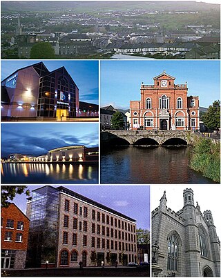
Newry is a city in Northern Ireland, standing on the Clanrye river in counties Down and Armagh. It is near the border with the Republic of Ireland, on the main route between Belfast and Dublin. The population was 27,913 in 2021.
Portadown is a town in County Armagh, Northern Ireland. The town sits on the River Bann in the north of the county, about 24 mi (39 km) southwest of Belfast. It is in the Armagh City, Banbridge and Craigavon Borough Council area and had a population of about 32,000 at the 2021 Census. For some purposes, Portadown is treated as part of the "Craigavon Urban Area", alongside Craigavon and Lurgan.
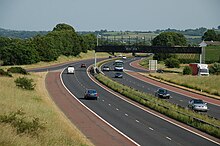
Craigavon is a town in northern County Armagh, Northern Ireland. Its construction began in 1965 and it was named after the first Prime Minister of Northern Ireland: James Craig, 1st Viscount Craigavon. It was intended to be the heart of a new linear city incorporating Lurgan and Portadown, but this plan was mostly abandoned and later described as having been flawed. Among local people today, "Craigavon" refers to the area between the two towns. It is built beside a pair of artificial lakes and is made up of a large residential area (Brownlow), a second smaller one (Mandeville), plus a central area (Highfield) that includes a substantial shopping centre, a courthouse and the district council headquarters. The area around the lakes is a public park and wildlife haven made up of woodland with walking trails. There is also a watersports centre, golf course and ski slope in the area. In most of Craigavon, motor vehicles are completely separated from pedestrians, and roundabouts are used extensively. It hosted the headquarters of the former Craigavon Borough Council.
Armagh is the county town of County Armagh and a city in Northern Ireland, as well as a civil parish. It is the ecclesiastical capital of Ireland – the seat of the Archbishops of Armagh, the Primates of All Ireland for both the Roman Catholic Church and the Church of Ireland. In ancient times, nearby Navan Fort was a pagan ceremonial site and one of the great royal capitals of Gaelic Ireland. Today, Armagh is home to two cathedrals and the Armagh Observatory, and is known for its Georgian architecture.
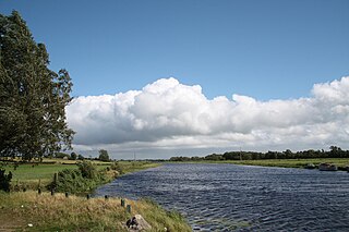
The River Bann is the longest river in Northern Ireland, its length, Upper and Lower Bann combined, being 129 km (80 mi). However, the total length of the River Bann, including its path through the 30 km (19 mi) long Lough Neagh is 159 km (99 mi). Another length of the River Bann given is 90 mi. The river winds its way from the southeast corner of Ulster to the northwest coast, pausing in the middle to widen into Lough Neagh. The River Bann catchment has an area of 5,775 km2. The River Bann has a mean discharge rate of 92 m3/s. According to C. Michael Hogan, the Bann River Valley is a settlement area for some of the first human arrivals in Ireland after the most recent glacial retreat.
Craigavon Borough Council was a local council in counties Armagh, Down and Antrim, in Northern Ireland. It merged with Armagh City and District Council and Banbridge District Council in May 2015 under local government reorganisation in Northern Ireland to become Armagh, Banbridge and Craigavon District Council.
Markethill is a village in County Armagh, Northern Ireland. It is beside Gosford Forest Park. It had a population of 1,647 people in the 2011 census.
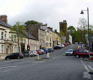
Richhill is a large village and townland in County Armagh, Northern Ireland. It lies between Armagh and Portadown. It had a population of 2,738 people in the 2021 Census.
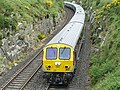
The Belfast–Newry line operates from Lisburn station in County Antrim to Newry in County Down, Northern Ireland. The manager for this line is based at Portadown railway station, although the line extends to the border to include the Scarva and Poyntzpass halts and Newry. Newry is on the fringe of the network, being the last stop before the border with the Republic of Ireland. The line follows the route of the northern half of the main Dublin–Belfast line.
Derrytrasna is a small village and townland in County Armagh, Northern Ireland. The village is on a plateau surrounded mainly by bogland in the north of the county. It lies between Lough Neagh, Lough Gullion and the River Bann.
Bannfoot is a small village in the townland of Derryinver, County Armagh, Northern Ireland. It sits where the Upper Bann flows into Lough Neagh.
Oneilland West is a barony in County Armagh, Northern Ireland. It is also called Clancann, after the Mac Cana clan. It lies in the north of the county on the south-western shore of Lough Neagh and the border of County Tyrone. Oneilland West is bordered by five other baronies: Armagh to the west; Dungannon Middle to the north-west; Oneilland East to the north-east; Orior Lower to the south-east; and Kinelarty to the south.
Oneilland East is a barony in the north-east of County Armagh, Northern Ireland. It is also called Clanbrasil. It lies in the north-east corner of the county, on the south-eastern shore of Lough Neagh and the boundary with County Down. Oneilland East is bordered by three other baronies: Oneilland West to the west; Iveagh Lower to the east; and Orior Lower to the south.
Saint Ailill the Second was the Bishop of Armagh, Ireland from 526 to 536.
The Southern Health and Social Care Trust provides health and social care services in Northern Ireland. It runs Craigavon Area Hospital, Daisy Hill Hospital in Newry, Lurgan Hospital and South Tyrone Hospital as well as Armagh Community Hospital and St Luke's Hospital in Armagh. The trust serves an estimated population of 380,312.
The Mac Cana or MacCan were a Gaelic Irish clan who held lands in Clancann and Clanbrasil in what is now northern County Armagh, and had the title of 'Lords of Clanbrasil'. It is the origin of the surname McCann and Maccan.