Related Research Articles

Warrenpoint is a small port town and civil parish in County Down, Northern Ireland. It sits at the head of Carlingford Lough, south of Newry, and is separated from the Republic of Ireland by a narrow strait. The town is beside the village of Rostrevor and is overlooked by the Mournes and Cooley Mountains. Warrenpoint sprang up within the townland of Ringmackilroy, and is locally nicknamed "The Point".

Kilkeel is a small town, civil parish and townland in County Down, Northern Ireland. It is the southernmost town in Northern Ireland. It lies within the historic barony of Mourne. Kilkeel town is the main fishing port on the Down coast, and its harbour houses one of the largest fishing fleets around the island of Ireland. It had a population of 6,541 people at the 2011 Census. The town contains the ruins of a 14th-century church and fort, winding streets and terraced shops. It lies just south of the Mourne Mountains.
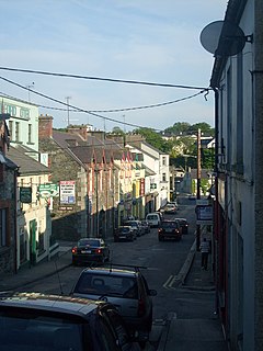
Milford or Millford, historically called Ballynagalloglagh, is a small town and townland in County Donegal, Ireland. The population at the 2016 census was 1,037.

Coosan is a townland and suburb just north of Athlone, County Westmeath in Ireland. The suburb is surrounded on three sides by Lough Ree and on one side by Athlone.

Shercock is a small town situated in the east of County Cavan, Ireland. As of the 2016 census, the population of the town was 588.

Pettigo is a small village on the border of County Donegal, Republic of Ireland and County Fermanagh, Northern Ireland. It is bisected by the Termon River which is part of the border between the Republic of Ireland and Northern Ireland.

Loughgall is a small village, townland and civil parish in County Armagh, Northern Ireland. It is in the historic baronies of Armagh and Oneilland West. It had a population of 282 people in the 2011 Census.

Hollygrove or sometimes Holly Grove is a townland of 283 acres in Athleague parish, Killeroran district, Killian barony, Union of Mountbellew, in County Galway, Ireland. Hollygrove is adjacent to the townland of Coalpits and is on the border of Roscommon and Galway.
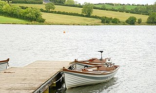
Corbet is a small village and townland in County Down, Northern Ireland, 5 km east of Banbridge. It is situated in the civil parish of Magherally and the historic barony of Iveagh Lower, Lower Half. It lies within the Banbridge District. It had a population of 107 people in the 2011 Census.

Straid is a small village in County Antrim, Northern Ireland, about three miles east of Ballyclare, and about six miles inland from Carrickfergus. It lies at the centre of the townland of Straidlands, in the Civil Parish of Ballynure within the Antrim and Newtownabbey Borough Council area, and in the former barony of Belfast Lower. The village has a congregational church, an Orange hall, and a primary school.

Lough Gowna is a fresh water lake which is the uppermost lake on the River Erne. It is located on the border between County Longford and County Cavan, with the largest part of the lake being in County Longford.
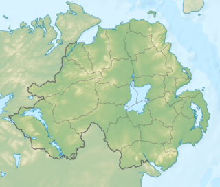
Ballysaggart Lough or Black Lough is a lough in Dungannon, County Tyrone, Northern Ireland. It is within the drainage basin of the River Blackwater which flows out of Lough Neagh. It is part of the waterway created to service mills in nearby Moygashel. The lough has an area of 42.5 acres (17.2 ha). Bally Saggart Lough came under the ownership of Mid Ulster District Council in 2014 and the Council are looking to improve public access to the Lough.

Evish is a small rural community area and townland in County Tyrone, Northern Ireland, 3 miles from Strabane and 7 miles from Plumbridge. It is situated in the barony of Strabane Lower and the civil parish of Camus and covers an area of 870 acres.
Lough Iron is a small lake on the River Inny, in County Westmeath, Ireland.

Ballylough is a small village and townland in County Down, Northern Ireland. It lies roughly 5 miles (8.0 km) north of Newcastle and just east of Castlewellan and northeast of Annsborough.
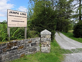
Owengallees is a townland in the civil parish of Templeport, County Cavan, Ireland. It lies in the Roman Catholic parish of Templeport and barony of Tullyhaw.
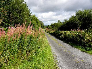
Drumlougher is a townland in the civil parish of Templeport, County Cavan, Ireland. It lies in the Roman Catholic parish of Templeport and barony of Tullyhaw.

Keshcarrigan lough is a mesotrophic freshwater near Keshcarrigan village, in northwest Ireland. Known for quality course fishing, Keshcarrigan lough allows bank fishing from concrete stands on the northern shore, two with wheelchair access. The ecology of Keshcarrigan lough, and other Leitrim waterways, is threatened by curly waterweed, zebra mussel, and freshwater clam invasive species.

Teeboy is a townland in the civil parish of Templeport, County Cavan, Ireland. It lies in the Roman Catholic parish of Corlough and barony of Tullyhaw. The local pronunciation is Tubwee.
References
- ↑ "Tullynawood". www.townlands.ie. Retrieved 27 June 2019.
- ↑ "Coarse Fishing, tullynawood lake, Northern Ireland. Coarse Angling, tullynawood lake, Northern Ireland". www.prebait.com. Retrieved 27 June 2019.
| This article related to the geography of County Armagh, Northern Ireland is a stub. You can help Wikipedia by expanding it. |
