
Kilkeel is a small town, civil parish and townland in County Down, Northern Ireland. It is the southernmost town in Northern Ireland. It lies within the historic barony of Mourne. Kilkeel town is the main fishing port on the Down coast, and its harbour is home to the largest fishing fleet in Northern Ireland. It had a population of 6,633 people at the 2021 census. The town contains the ruins of a 14th-century church and fort, winding streets and terraced shops. It lies just south of the Mourne Mountains.
A townland is a small geographical division of land, historically and currently used in Ireland and in the Western Isles in Scotland, typically covering 100–500 acres (40–202 ha). The townland system is of Gaelic origin, antedating the Norman invasion, and most have names of Irish origin. However, some townland names and boundaries come from Norman manors, plantation divisions, or later creations of the Ordnance Survey. The total number of inhabited townlands in Ireland was 60,679 in 1911. The total number recognised by the Irish Place Names database as of 2014 was 61,098, including uninhabited townlands, mainly small islands.

Newtownabbey is a large settlement north of Belfast city centre in County Antrim, Northern Ireland. It is separated from the rest of the city by Cavehill and Fortwilliam golf course, but it still forms part of the Belfast metropolitan area. It surrounds Carnmoney Hill, and was formed from the merging of several small villages including Whiteabbey, Glengormley and Carnmoney. At the 2021 census, Metropolitan Newtownabbey Settlement had a population of 67,599, making it the third largest settlement in Northern Ireland and seventh on the Island of Ireland. It is part of Antrim and Newtownabbey Borough Council.

Coagh is a small village in County Tyrone, Northern Ireland, five miles (8 km) east of Cookstown. Part of the village also extends into County Londonderry. It had a population of 545 people in the 2001 Census. It owes its existence to George Butle Conyngham of Springhill, and was founded in 1728 when King George II of Great Britain granted Conyngham a market charter allowing the village to host four fairs yearly. It is situated within Mid-Ulster District.
Lambeg is a small village and civil parish in County Antrim, Northern Ireland. Located between Belfast and Lisburn, it was once a small rural village, but is now within the Greater Belfast conurbation. Lambeg is also an electoral ward of Lisburn Council. In the 2001 Census it had a population of 60 people. The civil parish of Lambeg covers areas of County Down as well as County Antrim.

Waterfoot or Glenariff is a small coastal village in County Antrim, Northern Ireland. It is at the foot of Glenariff, one of the Glens of Antrim, within the historic barony of Glenarm Lower and the civil parishes of Ardclinis and Layd. The village is in the townland of Warren, 16 miles (26 km) north-east of Ballymena. The 2001 Census recorded a population of 504 inhabitants.

Tullylish is a small village, townland and civil parish in County Down, Northern Ireland. It sits on the River Bann, along the main road between the towns of Banbridge and Portadown. In the 2001 Census it had a population of 105 people. It lies within the civil parish of Tullylish and Banbridge District.

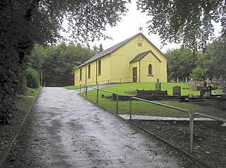
Mullaghbrack, Mullabrack or Mullaghbrac is a small civil parish, townland and village in County Armagh, Northern Ireland. The village of Mullaghbrack is on the road between Markethill and Hamiltonsbawn, just north of Gosford Forest Park. It had a population of 54 people in the 2011 census, down from 75 people as of the 2001 census.
Altmore ) is a hamlet and townland in County Tyrone, Northern Ireland. It is five miles from Carrickmore and four miles from Pomeroy. The townland is actually called Altmore and is situated in the historic barony of Dungannon Middle and the civil parish of Pomeroy and covers an area of 1117 acres.

Naul, is a village, townland, and civil parish at the northern edge of the traditional County Dublin in Ireland. The Delvin River to the north of the village marks the county boundary with County Meath. Naul civil parish is in the historic barony of Balrothery West.

Carnteel ) is a hamlet, townland and civil parish, about 2 miles northeast of Aughnacloy in County Tyrone, Northern Ireland. It is situated in the historic barony of Dungannon Lower.

Effin is a townland and civil parish in County Limerick, Ireland. It is on the R515 road, midway between Kilmallock and Charleville. The population of the parish is about 1,000. Effin is partly in the barony of Costlea, but chiefly in that of Coshma. The parish lies in the Golden Vale, Munster's rich dairyland, and intensive dairying is practised there. The Ballyhoura Mountains, which separate County Limerick from County Cork, are at the southern end of the parish.

Cullyleenan is a townland in the Parish of Tomregan, Barony of Tullyhaw, County Cavan, Ireland.
Derryginny is a townland in the Parish of Tomregan, Barony of Tullyhaw, County Cavan, Ireland.

Mullaghduff is a townland in the Parish of Tomregan, Barony of Tullyhaw, County Cavan, Ireland.
Cloncollow is a townland in the Parish of Tomregan, Barony of Loughtee Lower, County Cavan, Ireland.
Cavanagh is a townland in the civil parish of Tomregan, County Cavan, Ireland. It lies within the former barony of Tullyhaw.
Rakeelan is a townland in the Parish of Tomregan, Barony of Tullyhaw, County Cavan, Ireland.

Inishkeel is a small tidal island and a townland off the coast of County Donegal, Ireland. The closest village on the mainland is Narin.
