Ulster is one of the four traditional or historic Irish provinces. It is made up of nine counties: six of these constitute Northern Ireland ; the remaining three are in the Republic of Ireland.

County Armagh is one of the six counties of Northern Ireland and one of the traditional thirty-two counties of Ireland. It is located in the province of Ulster and adjoins the southern shore of Lough Neagh. It borders the Northern Irish counties of Tyrone to the west and Down to the east. The county borders Louth and Monaghan to the south and southwest, which are in the Republic of Ireland. It is named after its county town, Armagh, which derives from the Irish Ard Mhacha, meaning "Macha's height". Macha was a sovereignty goddess in Irish mythology and is said to have been buried on a wooded hill around which the town of Armagh grew. County Armagh is colloquially known as the "Orchard County" because of its many apple orchards.
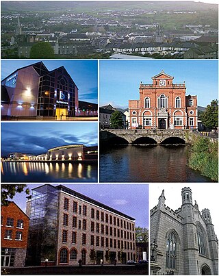
Newry is a city in Northern Ireland, standing on the Clanrye river in counties Down and Armagh. It is near the border with the Republic of Ireland, on the main route between Belfast and Dublin. The population was 27,913 in 2021.
Clogher is a village and civil parish in the border area of south County Tyrone, Northern Ireland. It lies on the River Blackwater, 5.8 miles from the border crossing to County Monaghan. It stands on the townlands of Clogher Demesne and Clogher Tenements. The 2011 Census recorded a population of 717. The civil parish of Clogher covers areas of County Fermanagh as well as County Tyrone.
Benburb ) is a village and townland in County Tyrone, Northern Ireland. It lies 7.5 miles from Armagh and 8 miles from Dungannon. The River Blackwater runs alongside the village as does the Ulster Canal.

Shercock ; Irish: Searcóg) is a small town and civil parish in the east of County Cavan, Ireland. As of the 2016 census, the population of the town was 588.

The N12 road is one of the shortest national primary roads in the Republic of Ireland, running 6.87 km (4.27 mi) from outside Monaghan to the border with County Armagh, Northern Ireland, at Ardgonnell Bridge outside Middletown. The N12 is part of an overall route running from Cavan Town to Belfast.

Loughgall is a small village, townland and civil parish in County Armagh, Northern Ireland. It is in the historic baronies of Armagh and Oneilland West. It had a population of 282 people in the 2011 Census. Loughgall was named after a small nearby loch. The village is surrounded by orchards.

Scotshouse is a small agricultural village in the parish of Currin in County Monaghan, Ireland. It is roughly three miles east of where the counties of Cavan, Fermanagh and Monaghan meet. Scotshouse is about 7 kilometres (4 mi) from Clones, 18 km (11 mi) from Cavan town and 27 km (17 mi) away from Monaghan town.

Blackwatertown is a small village in County Armagh, Northern Ireland. It sits on the River Blackwater, in the townland of Lisbofin, at the border with County Tyrone. The village is around 8 kilometres (5 mi) north of Armagh city, and the villages of Benburb and Moy are nearby. Blackwatertown had a population of 376 in the 2011 Census. The River Blackwater enters Lough Neagh west of Derrywarragh Island and is navigable from Maghery to Blackwatertown.

Camlough is a village west of Newry in County Armagh, Northern Ireland. The village is named after a lake, known as the Cam Lough. South of the village is Camlough Mountain, part of the Ring of Gullion and is designated an Area of Outstanding Natural Beauty. Camlough had a population of 1,074 at the 2011 Census.

Tydavnet, officially Tedavnet , is a village in northern County Monaghan, Ireland, and also the name of the townland and civil parish in which the village sits. Both the Church of Ireland and Catholic church have Tydavnet named as a parish and in both cases, the geographical area is almost identical. The village is located on the R186 regional road.

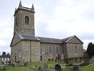
Augher is a small village in south County Tyrone, Northern Ireland. It lies just 6 miles to the border with County Monaghan and is 16 miles south of Dungannon. It is situated in the historic barony of Clogher and the civil parish of Clogher. The 2001 Census recorded a population of 399. The town gives its name to the local Gaelic Football Club.

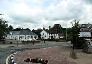
Caledon is a small village and townland in County Tyrone, Northern Ireland. It is in the Clogher Valley on the banks of the River Blackwater, 10 km from Armagh. It lies in the southeast of Tyrone and near the borders of County Armagh and County Monaghan. It is situated in the historic barony of Dungannon Lower and the civil parish of Aghaloo. In the 2001 Census it had a population of 387 people. It is a designated conservation area. It was historically known as Kinnaird.

Ballyhaise is a village in County Cavan, Ireland. It is situated approximately 7 km (4.3 mi) north-northeast of Cavan and 11 km, via the N54, from the border with County Fermanagh in Northern Ireland. The River Annalee flows near the village.
Dorsey or Dorsy is a small village and townland between Belleeks and Cullyhanna in County Armagh, Northern Ireland. It has an estimated population of 130 to 160 people.
Inniskeen, officially Inishkeen, is a small village, townland and parish in County Monaghan, Ireland, close to the County Louth and County Armagh borders. The village is located about 17 kilometres (11 mi) from Dundalk, 11 km (7 mi) from Carrickmacross, and 5 km (3 mi) from Crossmaglen. Seven townlands of this Roman Catholic Diocese of Clogher parish lie within County Louth.

Middletown Eoghan Rua Gaelic Athletic Club, also known as Eoghan Ruadh, is a GAA club from Middletown, County Armagh, Northern Ireland. The club fields teams from under-10 level to senior level in Gaelic football, hurling and camogie; all teams use the club colours of black and white with the males playing with vertical stripes. Middletown has won many county championship and league titles, and has been successful in All Ireland club championships. The club plays at P.J. O'Neill Park.

Drum is a village and townland in the west of County Monaghan in the Republic of Ireland. It is notable for being one of the only Protestant-majority settlements in the Republic of Ireland.
Killykeskeame is a townland in the Civil Parish of Killeevan, in the Barony of Dartree, County Monaghan. It consists of 126.49 acres. The name Killykeskeame is an anglicisation of the Gaelic "Cill Choiscéim" which means the 'Church of the Footstep', referencing a medieval chapel that once was located in the townland.


