
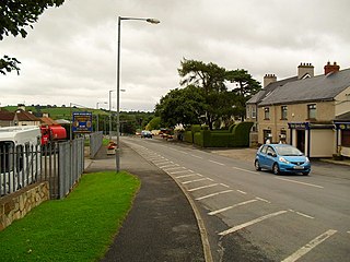
Portadown is a town in County Armagh, Northern Ireland. The town sits on the River Bann in the north of the county, about 24 miles (39 km) southwest of Belfast. It is in the Armagh City, Banbridge and Craigavon Borough Council area and had a population of about 32,000 at the 2021 Census. For some purposes, Portadown is treated as part of the "Craigavon Urban Area", alongside Craigavon and Lurgan.

Armagh is a city and the county town of County Armagh, in Northern Ireland, as well as a civil parish. It is the ecclesiastical capital of Ireland – the seat of the Archbishops of Armagh, the Primates of All Ireland for both the Roman Catholic Church and the Church of Ireland. In ancient times, nearby Navan Fort was a pagan ceremonial site and one of the great royal capitals of Gaelic Ireland. Today, Armagh is home to two cathedrals and the Armagh Observatory, and is known for its Georgian architecture.

Keady is a town and civil parish in County Armagh, Northern Ireland. It is south of Armagh and near the border with the Republic of Ireland. It is situated mainly in the historic barony of Armagh with six townlands in the barony of Tiranny. It had a population of 3,051 people in the 2011 Census.

Camlough is a village west of Newry in County Armagh, Northern Ireland. The village is named after a lake, known as the Cam Lough. South of the village is Camlough Mountain, part of the Ring of Gullion and is designated an Area of Outstanding Natural Beauty. Camlough had a population of 1,074 at the 2011 Census.

Ballymoyer or Ballymyre is a civil parish in the historic barony of Fews Upper, County Armagh, Northern Ireland, 3 miles north-east of Newtownhamilton.

Tydavnet, officially Tedavnet , is a village in northern County Monaghan, Ireland, and also the name of the townland and civil parish in which the village sits. Both the Church of Ireland and Catholic church have Tydavnet named as a parish and in both cases, the geographical area is almost identical. The village is located on the R186 regional road.
Mountnorris is a small village and townland in County Armagh, Northern Ireland. The village also extends into the townland of Tullyherron. It lies about six miles south of Markethill. It is within the Armagh, Banbridge and Craigavon local government area. It had a population of 155 people in the 2011 Census. Ulsterbus offers 1 stop in mountnorris. (2001 Census: 165 people

Mullaghbrack, Mullabrack or Mullaghbrac is a small civil parish, townland and village in County Armagh, Northern Ireland. The village of Mullaghbrack is on the road between Markethill and Hamiltonsbawn, just north of Gosford Forest Park. It had a population of 54 people in the 2011 census, down from 75 people as of the 2001 census.

Derrynoose is a village and civil parish in south County Armagh, Northern Ireland, 4.5 km south-west of Keady.
Cappagh is a small village and townland in the parish of Pomeroy in County Tyrone, Northern Ireland. Around 10 kilometres (6 mi) north-west of Dungannon, it is between Pomeroy, Ballygawley, Galbally and Carrickmore, with the hamlet of Galbally about one mile to the east. Most of the land around Cappagh is farmland although a quarry lies just outside the village. In County Tyrone, there is also the parish of Cappagh which includes part of the town of Omagh and small village of Mountfield.

Killyman is a small village and a civil parish in Northern Ireland, situated on the eastern boundary of County Tyrone and extending into County Armagh. The majority of townlands are in the historic barony of Dungannon Middle in County Tyrone, the rest being in the barony of Oneilland West in County Armagh.

St Mary's Gaelic Football Club, Granemore, also known as Granemore GFC, is a Gaelic Athletic Association club located near the townland of Granemore, approximately seven miles south of Armagh in County Armagh, Northern Ireland. The club fields Gaelic football teams in competitions organised by Armagh GAA. As of 2023, Granemore's senior team was participating in the Armagh Senior Football Championship and the Division 1A League.
Ballymacnab is a townland and village in County Armagh, Northern Ireland. It is within the civil parish of Kilclooney, four miles south of the City of Armagh on the road towards Newtownhamilton. It is within the Armagh City and District Council area.

Aughanduff is a small village and townland in the civil parish of Forkhill, in the former barony of Orior Upper, and County of Armagh, Northern Ireland. The townland is roughly co-existent with Upper and Lower Aughanduff Mountains, both of which form part of the Ring of Gullion geological formation, which has been described as the most spectacular example of a ring-dyke intrusion in Ireland or Britain, and was the first ring dyke in the world to be geologically mapped. Aughanduff has been populated since prehistoric times and has been recorded as a distinct district since at least the early 1600s. The area's history is both well documented and reflects its location both in rural Ireland and on the borderlands of the Pale, the Plantation of Ulster, and latterly Northern Ireland; indeed, part of the district's northern boundary was proposed for forming part of the northern border of the Irish Free State by the Irish Boundary Commission in its final report of 1925. The Boundary Commission's report was never implemented and today, the area remains within Northern Ireland, some five miles from the border with the Republic of Ireland. Part of the area has been designated by the Northern Ireland Environment Agency as an Area of Special Scientific Interest, and the district lies within the Ring of Gullion Area of Outstanding Natural Beauty.

Poyntzpass is a small village on the border between southern County Armagh and County Down in Northern Ireland. It is situated in the civil parish of Ballymore and the historic barony of Orior Lower within the Armagh City, Banbridge and Craigavon area. It had a population of 552 people in the 2011 census. It was a part of the South Armagh constituency and is now part of the Newry and Armagh constituency.
Ballymacnab Round Towers Gaelic Athletic Club is a Gaelic Athletic Association club within Armagh GAA. It is based in the townland and village of Ballymacnab in County Armagh, Northern Ireland, in the parish of Cill Chluana, four miles south of the city of Armagh.

St Michael's Gaelic Athletic Club, Newtownhamilton is a GAA club in Armagh. It's playing fields fall within the townland of Tullyvallan, including the village of Newtownhamilton, in south County Armagh. St Michael's plays Gaelic football and is currently in the Armagh Junior Football Championship.

Madden Raparees Gaelic Athletic Club is a Gaelic Athletic Association club from near the townland of Madden, County Armagh, Northern Ireland. The club is part of Armagh GAA and plays Gaelic football in the Armagh Senior Championship. They play at Raparee Park in Maghery Kilcrany, located just 2.6 miles to the northeast of Madden.
Lordship is a rural area and census town in County Louth, Ireland. It is located in the civil parish of Ballymascanlan.


