Related Research Articles

Lurgan is a town in County Armagh, Northern Ireland, near the southern shore of Lough Neagh. Lurgan is about 18 miles (29 km) south-west of Belfast and is linked to the city by both the M1 motorway and the Belfast–Dublin railway line. It had a population of about 25,000 at the 2011 Census and is within the Armagh, Banbridge and Craigavon district. For some purposes, Lurgan is treated as part of the "Craigavon Urban Area" along with neighbouring Craigavon and Portadown.

Portadown is a town in County Armagh, Northern Ireland. The town sits on the River Bann in the north of the county, about 24 mi (39 km) southwest of Belfast. It is in the Armagh City, Banbridge and Craigavon Borough Council area and had a population of about 22,000 at the 2011 Census. For some purposes, Portadown is treated as part of the "Craigavon Urban Area", alongside Craigavon and Lurgan.

Loughgall is a small village, townland and civil parish in County Armagh, Northern Ireland. It is in the historic baronies of Armagh and Oneilland West. It had a population of 282 people in the 2011 Census. Loughgall was named after a small nearby loch. The village is surrounded by orchards.

Tynan is a village, townland and civil parish in County Armagh, Northern Ireland. It is situated largely in the historic barony of Tiranny, with some areas in the barony of Armagh. It had a population of 71 people in the 2011 Census.

Loughgilly is a small village, townland and civil parish in County Armagh, Northern Ireland. It is on the main Armagh to Newry road, about halfway between the two. It is within the Armagh City and District Council area. It had a population of 84 people in the 2011 Census.
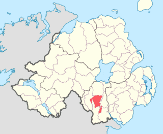
Mullaghbrack, Mullabrack or Mullaghbrac is a small village, townland and civil parish in County Armagh, Northern Ireland. It is on the road between Markethill and Hamiltonsbawn, just north of Gosford Forest Park. It had a population of 54 people in the 2011 Census.

Caledon is a small village and townland in County Tyrone, Northern Ireland. It is in the Clogher Valley on the banks of the River Blackwater, 10km from Armagh. It lies in the southeast of Tyrone and near the borders of County Armagh and County Monaghan. It is situated in the historic barony of Dungannon Lower and the civil parish of Aghaloo. In the 2001 Census it had a population of 387 people. It is a designated conservation area. It was historically known as Kinnaird (Irish: Cionn Aird, meaning "head/top of the height or hill".

Tiranny is a barony in County Armagh, Northern Ireland. It lies on the western boundary of the county, bordering County Tyrone to its west and County Monaghan in the Republic of Ireland to its south. It is bordered by three other baronies in Northern Ireland: Dungannon Lower and Dungannon Upper to the north-west; and Armagh to the east. It also borders two baronies in the Republic of Ireland; Cremorne to the south and Trough to the west.
Derryvore is the name of three townlands in Northern Ireland.

Armagh is a barony in County Armagh, Northern Ireland. It lies in the west of the county, bordering County Tyrone with its north-western boundary, and bordering the Republic of Ireland with its southern boundary. It is bordered by five other baronies in Northern Ireland: Tiranny to the west, Dungannon Middle to the north-west, Oneilland West to the north-east, Fews Lower to the east, and Fews Upper to the south-east. It also borders to the south the barony of Cremorne in the Republic of Ireland.

Oneilland West is a barony in County Armagh, Northern Ireland. It is also called Clancann, after the Mac Cana clan. It lies in the north of the county on the south-western shore of Lough Neagh and the border of County Tyrone. Oneilland West is bordered by five other baronies: Armagh to the west; Dungannon Middle to the north-west; Oneilland East to the north-east; Orior Lower to the south-east; and Kinelarty to the south.
Oneilland East is a barony in the north-east of County Armagh, Northern Ireland. It is also called Clanbrasil. It lies in the north-east corner of the county, on the south-eastern shore of Lough Neagh and the boundary with County Down. Oneilland East is bordered by three other baronies: Oneilland West to the west; Iveagh Lower to the east; and Orior Lower to the south.

Orior Lower is a barony in County Armagh, Northern Ireland. It lies in the east of the county and borders County Down with its eastern boundary. It is bordered by seven other baronies: Fews Upper to the south-west; Fews Lower to the west; Oneilland West to the north-west; Oneilland East to the north; Iveagh Lower, Lower Half to the north-east; Iveagh Upper, Upper Half to the east; and Orior Upper to the south. A small enclave of Orior Lower resides in the east of Orior Upper.

Fews Upper is a barony in County Armagh, Northern Ireland. It lies in the south of the county bordering the Republic of Ireland with its southern and south-western borders. It is bordered by four other baronies in Northern Ireland: Armagh to the west; Fews Lower to the north and west; Orior Lower to the north-west; and Orior Upper to the east. It also borders three baronies in the Republic of Ireland: Cremorne to the west; Dundalk Upper to the south; and Farney to the south-west. Fews Lower and Upper formed the barony of The Fews until it was sub-divided.
Fews Lower is a barony in County Armagh, Northern Ireland. Its lies in the center of the county, with an enclave lying just to the south-east. The main portion is bordered by four other baronies: Armagh to the west; Oneilland West to the north; Orior Lower to the east; and Fews Upper to the south. Fews Upper and Orior Lower also border the enclave to its north and west, with Orior Upper to its south-west. The Fews Mountains run through both Fews Lower and Upper, the highest peak of which in Fews Lower is, Deadman's Hill, which stands at 1,178 ft. Fews Lower and Upper formed the barony of The Fews until it was sub-divided.

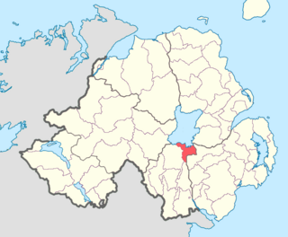
Annaghmore is a small village and townland near Loughgall in County Armagh, Northern Ireland. It is situated in the civil parish of Loughgall and the historic barony of Oneilland West. It is within the Armagh City and District Council area. It had a population of 265 people in the 2011 Census.
References
- ↑ "Parishes of Ulster". Ulster Ancestry. Retrieved 3 January 2009.
- ↑ "Armagh". Placenames Database of Ireland.
- ↑ "Ballymore". Placenames NI. Archived from the original on 17 July 2011. Retrieved 9 June 2010.
- ↑ "Ballymyre". Placenames Database of Ireland.
- ↑ "Clonfeacle". Placenames Database of Ireland.
- ↑ "Creggan". Placenames Database of Ireland.
- ↑ "Derrynoose". Placenames Database of Ireland.
- ↑ "Drumcree". Placenames Database of Ireland.
- ↑ "Eglish". Placenames NI. Archived from the original on 17 July 2011. Retrieved 9 June 2010.
- ↑ "Eglish". Placenames Database of Ireland.
- ↑ "Forkill". Placenames Database of Ireland.
- ↑ "Grange". Placenames Database of Ireland.
- ↑ "Jonesborough". Placenames Database of Ireland.
- ↑ "Keady". Placenames Database of Ireland.
- ↑ "Kilclooney". Placenames Database of Ireland.
- ↑ "Kildarton". Placenames Database of Ireland.
- ↑ "Killevy". Placenames Database of Ireland.
- ↑ "Killyman". Placenames Database of Ireland.
- ↑ "Kilmore". Placenames Database of Ireland.
- ↑ "Lisnadill". Placenames Database of Ireland.
- ↑ "Lisnadill". Placenames NI. Archived from the original on 17 July 2011.
- ↑ "Loughgall". Placenames Database of Ireland.
- ↑ "Loughgilly". Placenames Database of Ireland.
- ↑ "Loughgilly". Placenames NI. Archived from the original on 17 July 2011.
- ↑ "Magheralin". Placenames Database of Ireland.
- ↑ "Montiaghs". Placenames NI. Archived from the original on 17 July 2011. Retrieved 9 June 2010.
- ↑ "Montiaghs and Islands". Placenames Database of Ireland.
- ↑ "Mullaghbrack". Placenames NI. Archived from the original on 17 July 2011.
- ↑ "Mullaghbrack". Placenames Database of Ireland.
- ↑ "Newry". Placenames Database of Ireland.
- ↑ "Newtownhamilton". Placenames Database of Ireland.
- ↑ "Seagoe". Placenames NI. Archived from the original on 17 July 2011. Retrieved 9 June 2010.
- ↑ "Seagoe". Placenames Database of Ireland.
- ↑ "Shankill". Placenames NI. Archived from the original on 17 July 2011. Retrieved 9 June 2010.
- ↑ "Shankill". Placenames Database of Ireland.
- ↑ "Tartaraghan". Placenames Database of Ireland.
- ↑ "Tynan". Placenames NI. Archived from the original on 17 July 2011.
- ↑ "Tynan". Placenames Database of Ireland.
