Buttonville is a suburban planned neighbourhood from a former Police village in the city of Markham, Ontario, Canada, west of the larger Unionville neighbourhood. It is a former hamlet and Police village, named after its founder, John Button. About 30,000 residents live in the area. It is located along the Woodbine Avenue corridor from approximately Highway 7 in the south to Sixteenth Avenue in the north. The Rouge River is in the northeast and Buttonville Airport and Highway 404 are in the west, with three interchanges. The residential area is located in the eastern, northeastern and the northern section while the industrial area is situated to the west and south down to Highway 7. The area is home to many technology companies near the airport. There is talk about renaming the community, the John Button Community after its founder since there has been lots of confusion between Unionville and Buttonville, which is popularly considered to be part of Unionville.
Windsor, Ontario has a very diverse population, and this diversity is shown in its many neighbourhoods. Windsor has twenty in all, ranging from rural farmland to densely built-up areas.

Agios Georgios Langoura is a neighbourhood in the eastern part of Patras, Greece. The name comes from a nearby church and the rich family of Langoura, their house still survives into the present time. During the Turkish rule it had all the consulates and the residents of the consulates. In the neighbourhood is the Pampeloponnisiakos Stadium.
Agios Dionysios is a neighbourhood in the city of Patras, Greece. Its boundaries are a street north of Agiou Dionyssiou, Riga Fereou Street to the east and 28 Oktovriou Street to the south.

Pembina is a primarily commercial neighbourhood in north west Edmonton, Alberta, Canada with residences in one walk up apartment complex and one townhouse complex.

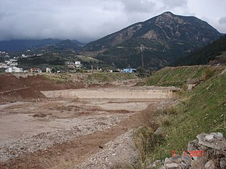
Skioessa is a neighbourhood and a settlement in the northeastern part of the city of Patras. Skioessa had a population of 526 for the settlement. Skioessa is located 5 km from downtown Patras, about 5 km southeast of Rio, about 37 km west of Aigio and 2 km east of the GR-8/E55 (Athens - Corinth - Patras and Aretha Street. The previous name of this suburb, Voudeni, is still in use.
Tsivdi is a neighbourhood in the central part of the city of Patras 1 km southwest of the downtown core. The subdivision is bounded with Dimitriou Gounari Street to the north, the Karaiskaki Street to the east and Trion Navarchon Street to the south.
Proastio is a neighbourhood in the northern part of the city of Patras, 6 km from the city centre. The Greek National Road 8 and the OSE Corinth - Patras railway line pass through the neighbourhood. The river Charadros flows 1 km north. The municipal boundary with Rio is also to the north.
Agios Andreas is a neighbourhood in the south-central part of the city of Patras, 2 km from the downtown core. Agios Andreas is linked with the Akti Dymaion and the GR-9/E55 and Korinthou Street. The OSE's SPAP line is 300 m from the old shoreline and 500 m from the new shoreline by the expanded Port of Patras.

Psilalonia is a neighbourhood in the central part of the city of Patras, 1 km direct and 1.5 km south via road from the downtown core. Psilalonia is linked 100 m from Gounaris Street. Psilalonia is famous for one of the city's most visited square that is of the same name. It features palm trees, playground, a fountain, a monument of Germanos III of Old Patras by sculptor Ioannis Kossos and restaurants. Other shops are by Gounaris Street.
Lefka is a neighbourhood in the southern part of the city of Patras, 5 km directly and 6 km south via road from the downtown core. It was originally called "Botovayia".
Gouva is a neighbourhood in the northeastern part of the city of Patras, 4 km direct and 5 km via road from the downtown core. Gouva is linked with a mountain road and with Amerikis Street. The GR-8A and the E55 as well as the GR-5/E55 and the GR-48/E65 as well as Panepistimiou Street.
Perivola is a neighbourhood in the east-southeastern part of the city of Patras, 6 km direct and 7 km via road from the downtown core. Perivola is linked with Patron-Klaous Road which is 3 km long. Since 2002, it is linked with the Patras Bypass in which it was first constructed in the late-1990s. Its interchange is approximately 1 km long.
Eglykada is a neighbourhood in the eastern part of the city of Patras, 7 km by road from the city center. Eglykada is accessed with the Patras-Ekilistra Road which is 2 km long in the neighbourhood. Since 2002, it is linked with the Patras Bypass in which it was first constructed in the late-1990s and the interchange later on. Its interchange is circular with only one access from the entrance lane but it does not have any tolls and the intersection is by the entrance and the merging lanes. It is 200 m south of the road and 500 m from its nearest tunnel.
Vοud is a neighbourhood in the central part of the city of Patras, 1 km direct and 500 m via road from the downtown core. Voud is linked with Lontou Street.
Zavlani is a neighbourhood in the northeastern part of the city of Patras, 4 kilometres (2.5 mi) direct and 5 kilometres (3.1 mi) via road from the downtown core. The neighbourhood bears the football (soccer) club team named A.P.S. Zavlani and plays in the prefectural fourth division.
Lendrum Place is a residential neighbourhood located in south west Edmonton, Alberta, Canada. It is named for Robert Lendrum, an early land surveyor.
Killarney is a residential neighbourhood located in north east Edmonton, Alberta, Canada. While the area became part of Edmonton in 1913, residential development didn't occur until the 1950s and 1960s.