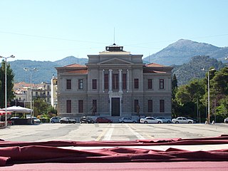
Christian Orthdodox church dedidated to Saint Nicholas at Lefka, Patras, Greece.Partial view of Labour Houses "PATRAS XIV" at Lefka, Patras, Greece.
Lefka (Greek: Λεύκα, meaning: poplar) is a neighbourhood in the southern part of the city of Patras, 5 km directly and 6 km south via road from the downtown core. It was originally called "Botovayia" ("Μποτοβάγια" in Greek).
Greek is an independent branch of the Indo-European family of languages, native to Greece, Cyprus and other parts of the Eastern Mediterranean and the Black Sea. It has the longest documented history of any living Indo-European language, spanning more than 3000 years of written records. Its writing system has been the Greek alphabet for the major part of its history; other systems, such as Linear B and the Cypriot syllabary, were used previously. The alphabet arose from the Phoenician script and was in turn the basis of the Latin, Cyrillic, Armenian, Coptic, Gothic, and many other writing systems.
Patras is Greece's third-largest city and the regional capital of Western Greece, in the northern Peloponnese, 215 km (134 mi) west of Athens. The city is built at the foothills of Mount Panachaikon, overlooking the Gulf of Patras.
Greek National Road 9 is a single carriageway with at-grade intersections in the West Greece and Peloponnese regions. It runs along the west coast of the Peloponnese peninsula, from Patras to Methoni via Pyrgos. Its length is around 220 km (140 mi), making it the second-longest national highway of Greece.
European route E 55 is a E-route. It passes through the following cities: Helsingborg … Helsingør – Copenhagen – Køge – Vordingborg – Nykøbing Falster – Gedser … Rostock – Berlin – Lübbenau – Dresden – Teplice – Prague – Tábor – Linz – Salzburg – Villach – Tarvisio – Udine – Palmanova – Venice – Ravenna – Cesena – Rimini – Fano – Ancona – Pescara – Canosa – Bari – Brindisi … Igoumenitsa – Preveza – Rhion – Patrai – Pyrgos – Kalamáta.
Pyrgos is the capital of the Elis regional unit in Greece. The city is located in the western part of the Peloponnese, in the middle of a plain, 4 kilometres from the Ionian Sea. The river Alfeios flows into sea about 7 km (4 mi) south of Pyrgos. The population of the town Pyrgos is 25,180, and of the municipality 47,995 (2011). Pyrgos is 16 km (10 mi) west of Olympia, 16 km (10 mi) southeast of Amaliada, 70 km (43 mi) southwest of Patras and 85 km (53 mi) west of Tripoli.
Ities is a suburb in the southern part of the city of Patras. The origin of the name comes from the willow tree which used to be plentiful in the area. Until 1900, the area, which was the small swamp, was drained.
Kokkinos Milos is a neighbourhood in the southern part of the city of Patras, Achaea, Greece.
Ovrya is a town in Achaea, Greece. It is a suburb of Patras, located 6 km south of Patras city centre. It was the seat of the former municipality of Messatida. The Greek National Roads 9 and 33 pass through the town. Ovrya is in the transition zone from the densely populated coastal area to the hills in the southeast, including Omplos. Agriculture is still the dominant land use in the areas south and east of Ovrya. Neighboring communities are Demenika to the northeast, Mintilogli to the west, Krini to the east, and Kallithea to the south.
Streets
Agiou Nikolaou Lefkas Street
Akti Dymaion Blvd.
Iteon Street
Lefkas Street
Evias Street
The new GR-33 (Patras - Tripoli) - a two way bypass
Greek National Road 33 is a single carriageway road in southern Greece. It connects Patras with the Greek National Road 74 near Levidi, passing through the western and southern foothills of Mount Erymanthos.
Tripoli is a city in the central part of the Peloponnese, in Greece. It is the capital of the Peloponnese region as well as of the regional unit of Arcadia. The homonym municipality has around 47,000 inhabitants.
Geography
The area is made up of farmlands and consists of olive and citrus groves and cattle farms. Tomatoes, potatoes, beans, zucchinis, onions, watermelons, melons and others are also grown in the region. Lefka's nearest supermarket is Akti Dymaion to the northwest. Its total area is approximately 5 to 6 km², and 3 km in length, from west to east, and 2 km in width from north to south. Its total street length is approximately 10 to 15 km, of which 4 to 5 km are main streets; the rest are residential. The built-up area lies north of the Glafkos river, which is Leyka's north side, with the exception of a tract north of the neighbourhood.
The olive, known by the botanical name Olea europaea, meaning "European olive", is a species of small tree in the family Oleaceae, found in the Mediterranean Basin from Portugal to the Levant, the Arabian Peninsula, and southern Asia as far east as China, as well as the Canary Islands and Réunion. The species is cultivated in many places and considered naturalized in all the countries of the Mediterranean coast, as well as in Argentina, Saudi Arabia, Java, Norfolk Island, California, and Bermuda. Olea europaea is the type species for the genus Olea.
Citrus is a genus of flowering trees and shrubs in the rue family, Rutaceae. Plants in the genus produce citrus fruits, including important crops such as oranges, lemons, grapefruits, pomelos, and limes.
The Glafkos is a river in Greece. It flows into the Gulf of Patras in Patras south of the city centre. It is 26.3 km (16.3 mi) long. A hydroelectric power plant was built on this river in 1927. Currently, it is open to the public as a museum.
History
The housing developments to the present day did not reach Lefka, due to that is away from the urban capacity. Not much housing development has been done since the early 2000s, and the population has been unchanged, compared to other neighbourhoods in Patras.
The Glafkos road was added in the form of gravel in the 1970s. It was later paved in the mid 1980s, became one-way, and was fully opened in 1995. Its streetlights were added in the late 1990s.
This page is based on this Wikipedia article Text is available under the CC BY-SA 4.0 license; additional terms may apply. Images, videos and audio are available under their respective licenses.
Related Research Articles
Highways in Greece are generally organized so that the odd-numbered highways are of north-south alignment and even numbered highways are of east-west alignment. However, there are many exceptions.
The Moreas Motorway is a motorway in Peloponnese, Greece. The A7 begins just west of the Isthmus of Corinth, branching off from Greek National Road 8A. It connects Corinth and Kalamata via Tripoli.
Lasiona is a former municipality in Elis, West Greece, Greece. Since the 2011 local government reform it is part of the municipality Archaia Olympia, of which it is a municipal unit. The municipal unit has an area of 119.528 km2. Its seat of administration was the village Antroni. Lasiona is situated in a mountainous area on the border with Achaea, 20 km north of Olympia, 27 km northeast of Pyrgos and 50 km south of Patras. The Greek National Road 33 passes through the municipal unit.
The Hellenic Railways Organisation or OSE is the Greek national railway company which owns, maintains and operates all railway infrastructure in Greece with the exception of Athens' rapid transit lines. Train services on these lines are run by TrainOSE S.A., a former OSE subsidiary. In addition OSE owns and maintains the rolling stock used by TrainOSE and maintains preserved special rolling stock, withdrawn locomotives and railcars. OSE was founded in 1971, taking over from the Hellenic State Railways, which was founded in 1920.
Metamorfosi Sotiros is a neighbourhood in the southern part of the city of Patras. The area is next to the municipality of Messatida, the subdivision is divided between the two municipalities and then, the communes of Ovrya and Saravali in which are now municipal districts. The subdivision was built in 1970 and many inhabitants came from Tritaia. It also features the central vegetable shop in Patras. The area is the northern part of Demenika. Farmlands covers the outer areas as well as a small forest.
Tsivdi is a neighbourhood in the central part of the city of Patras 1 km southwest of the downtown core. The subdivision is bounded with Dimitriou Gounari Street to the north, the Karaiskaki Street to the east and Trion Navarchon Street to the south.
Proastio is a neighbourhood in the northern part of the city of Patras, 6 km from the city centre. The Greek National Road 8 and the OSE Corinth - Patras railway line pass through the neighbourhood. The river Charadros flows 1 km north. The municipal boundary with Rio is also to the north.
Zarouchleika or Zarouchlaiika, official name Glafkos, is a residential neighbourhood in the southern part of the city of Patras, Greece. It is about 3 km south from the city centre. The main streets of Zarouchleika are the coastal road Akti Dymaion and Antheias Street. The OSE's railway from Patras to Pyrgos passes west of Zarouchleika.
Agios Andreas is a neighbourhood in the south-central part of the city of Patras, 2 km from the downtown core. Agios Andreas is linked with the Akti Dymaion and the GR-9/E55 and Korinthou Street. The OSE's SPAP line is 300 m from the old shoreline and 500 m from the new shoreline by the expanded Port of Patras.
Psilalonia is a neighbourhood in the central part of the city of Patras, 1 km direct and 1.5 km south via road from the downtown core. Psilalonia is linked 100 m from Gounaris Street. Psilalonia is famous for one of the city's most visited square that is of the same name. It features palm trees, playground, a fountain, a monument of Germanos III of Old Patras by sculptor Ioannis Kossos and restaurants. Other shops are by Gounaris Street.
Gouva is a neighbourhood in the northeastern part of the city of Patras, 4 km direct and 5 km via road from the downtown core. Gouva is linked with a mountain road and with Amerikis Street. The GR-8A and the E55 as well as the GR-5/E55 and the GR-48/E65 as well as Panepistimiou Street.
Agios Nektarios is a neighbourhood in the east-southeastern part of the city of Patras, 2.5 km direct and 3 km via road from the downtown core. Agios Nektarios is linked with Akrotiriou Street which is 2 km long and serves and is also the GR-33 (Patras-Tripoli) for the southbound lanes.
Perivola is a neighbourhood in the east-southeastern part of the city of Patras, 6 km direct and 7 km via road from the downtown core. Perivola is linked with Patron-Klaous Road which is 3 km long. Since 2002, it is linked with the Patras Bypass in which it was first constructed in the late-1990s. Its interchange is approximately 1 km long.
Eglykada is a neighbourhood in the eastern part of the city of Patras, 7 km by road from the city center. Eglykada is accessed with the Patras-Ekilistra Road which is 2 km long in the neighbourhood. Since 2002, it is linked with the Patras Bypass in which it was first constructed in the late-1990s and the interchange later on. Its interchange is circular with only one access from the entrance lane but it does not have any tolls and the intersection is by the entrance and the merging lanes. It is 200 m south of the road and 500 m from its nearest tunnel.
Vοud is a neighbourhood in the central part of the city of Patras, 1 km direct and 500 m via road from the downtown core. Voud is linked with Lontou Street.
Zavlani is a neighbourhood in the northeastern part of the city of Patras, 4 kilometres (2.5 mi) direct and 5 kilometres (3.1 mi) via road from the downtown core. The neighbourhood bears the football (soccer) club team named A.P.S. Zavlani and plays in the prefectural fourth division.
Dimitrios Votsis was a Greek politician and a mayor of Patras. His family is descended from Paramythia in Thesprotia in Epirus. He was the son of Athanasios and daughter of Eleni Votsi, they were the first settlers of the city after their battle for an independent Greece was lost in Epirus. He studied law and later became a judce in Patras. Parallerly he was a leader of the Patras.