Related Research Articles

Lavendon is a village and civil parish in the unitary authority area of the City of Milton Keynes, Buckinghamshire, England. It is the northernmost village in the Milton Keynes UA and South East England,near Olney, about 8 miles (13 km) WNW of Bedford and the same distance NNE of Newport Pagnell.

Kilbeggan is a town in the barony of Moycashel, County Westmeath, Ireland.

Stradbally is a town in County Laois, Ireland, located in the midlands of Ireland along the N80 road, a National Secondary Route, about 12 km (7 mi) from Portlaoise. It is a townland, a civil parish and historic barony. It is known for its "Steam Rally" and the Electric Picnic.

Carnaross or Carnaros is a village in County Meath, Ireland, approximately 4 km northwest of Kells on the R147 road between Kells and Virginia, County Cavan.
Samuel Lewis was the editor and publisher of topographical dictionaries and maps of the United Kingdom of Great Britain and Ireland. The aim of the texts was to give in 'a condensed form', a faithful and impartial description of each place. The firm of Samuel Lewis and Co. was based in London. Samuel Lewis the elder died in 1865. His son of the same name predeceased him in 1862.
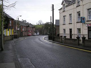
Cullybackey or Cullybacky is a large village in County Antrim, Northern Ireland. It lies 3 miles north-west of Ballymena, on the banks of the River Main, and is part of Mid and East Antrim district. It had a population of 2,569 people in the 2011 Census.

Whitland Abbey was a country house and Cistercian abbey in the parish of Llangan, in what was the hundred of Narberth, Carmarthenshire, Wales. The town which grew up nearby is now named Whitland after it. It was widely known as Ty Gwyn ar Daf, meaning White House on the Taf, in reference to the country house originally built here before it became a monastic settlement which was known under that name. It is most associated with being the place where Hywel Dda drew up his laws around 940. It functioned as a Cistercian monastery between the 12th and 16th centuries.

Clonard Abbey was an early medieval monastery situated on the River Boyne in Clonard, County Meath, Ireland.
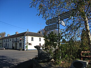
Grangecon is a village in County Wicklow, Ireland. It has a population of about 200 people, and is located between Baltinglass and Dunlavin.

The South Abbey was a Franciscan friary in Youghal, Ireland active between the 13th and 17th centuries.

Carrickfergus is a barony in County Antrim, Northern Ireland. It is bounded on the south-east by Belfast Lough, and otherwise surrounded by the barony of Belfast Lower. It is coextensive with the civil parish of Carrickfergus or St Nicholas and corresponds to the former county of the town of Carrickfergus, a county corporate encompassing Carrickfergus town.

Billy is a civil parish in County Antrim, Northern Ireland. It spans the historic baronies of Cary and Dunluce Lower, and is approximately 26 square miles (67 km2) in area. According to the Topographical Dictionary of Ireland, published by Samuel Lewis in 1837, it then had approximately 5800 inhabitants.

Magheracross is a townland and civil parish in County Fermanagh, Northern Ireland. It extends in area from just north of Enniskillen to the border with County Tyrone. There is also a small enclave in County Tyrone.

Clareabbey is a civil parish in County Clare, Ireland, named after the former Augustinian monastery of Clare Abbey. The main settlement in the town of Clarecastle.
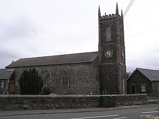
Macosquin Abbey, formally known as Clarus Fons, was a Cistercian Monastery in County Londonderry, Northern Ireland in the United Kingdom. The Monastery was located on Abbey Lane, Macosquin, Northern Ireland.

Cloghran is a civil parish in the ancient barony of Castleknock in Ireland. According to Lewis' 1837 survey,
"This place, which originally belonged to the priory of All Saints, passed, on the dissolution of that house, with its other possessions, to the mayor and corporation of Dublin".

Saint Macculind was an early Irish saint who was abbot or bishop of Lusk.
References
- ↑ Samuel Lewis, A Topographical Dictionary of Ireland: Volume 1 (S. Lewis and Company, 1849) page 595.
- ↑ ALL IRELAND SOURCES` NEWSLETTER Volume 3, No. 7, July 2001. Archived 2015-03-19 at the Wayback Machine
- 1 2 Lewis, Samuel. "Agivey, a grange", A Topographical Dictionary of Ireland, 1837
 This article incorporates text from this source, which is in the public domain .
 - ↑ All Ireland Sources` Newsletter Volume 3, No. 7, July 2001. Archived 2015-03-19 at the Wayback Machine
Coordinates: 55°02′42″N6°35′47″W / 55.044867°N 6.59636°W
| | This article about a Roman Catholic church building in Europe is a stub. You can help Wikipedia by expanding it. |
| | This Northern Ireland geographical article is a stub. You can help Wikipedia by expanding it. |