Agua Caliente | |
---|---|
Municipality | |
Coordinates: 14°10′N89°13′W / 14.167°N 89.217°W Coordinates: 14°10′N89°13′W / 14.167°N 89.217°W | |
Country | El Salvador |
Department | Chalatenango Department |
Elevation | 381 m (1,250 ft) |
Agua Caliente is a municipality in the Chalatenango department of El Salvador.
Agua Caliente, El Salvador is a town north of Chalatenango, the capital city of the department of Chalatenango, North East of Nueva Concepcion. It occupies an area of 195 square kilometers, and has a population (2006) of 8,992. [1] The location of the city center is 14°11′12.91″N, 89°13′19.82″W. As per the Technical Secretary of the Presidency of El Salvador, it has the 27th ranking of extreme poverty of the 267 municipalities of El Salvador. [2]
Most people from the neighboring "cantones" or hamlets display Caucasian features; they may be blond, with fair skin and blue eyes. This may be because the entire department of Chalatenango was populated by early Spanish settlers attracted by the boom of indigo cultivation in colonial times and sent there by Baron of Carardalet, governor of Guatemala in the late 18th century. A pdf document published by FISDL [3] indicates that "As per Antonio Gutierrez y Ulloa in 1807 Agua Caliente was simply a hacienda of cattle and indigo belonging to Bernardino Aguilar, five leagues N. E. of Tejutla, away from the Royal Road. As per other traditions, that hacienda became a hamlet in 1819 and then, fulfilling the Laws and Orders of Indias it became a village with the long name of San Jose Agua Caliente de las Flores. The new municipality was incorporated to the Region of Tejutla. From 1824 to 1833 it belonged to the department of San Salvador; to the department of Tejutla in 1833; to the department of San Salvador from 1833 to 1835; to the department of Cuzcatlan from 1835 to 1855. From then on it has been a municipality of Chalatenango. In 1890 it had 2,340 souls. Its name comes from two hot springs in the area and another one in the canton of Obrajuelo."
The Cabrera, Guevara, Menjivar and Aguilar families were prominent in the history of the town. Abraham Cabrera donated the land occupied by the high school of the town. He was mayor of the town sometime in the early 1900s. His two sons, Jose Angel Cabrera and Miguel Cabrera also served as mayors between 1960 and 1975. In late July 2007, Agua Caliente began receiving running water again. Electricity and running water were first installed in the early 1960s as part of the initiatives of the Alliance for Progress of President John F. Kennedy. As most towns in El Salvador, there is no water treatment for raw sewage and this is typically discharged in a nearby creek or in the Metayate River which runs in the middle of the town.[ citation needed ]
The local cemetery appears overflowing but there is no expansion expected in the near future. It is mainly a livestock community. A local cooperative assists with loans to small enterprises. Cheese and dairy products which are produced locally can be purchased at good prices in a couple of stores. In downtown Agua Caliente there is a Catholic church, recently under restoration, and a mini park. The church is a beautiful colonial church and it appears more majestic than those in neighboring municipalities. Legend has it that the massive bell in one of the towers is just a replica of the original one which was stolen overnight and then taken by thieves to a famous church in Ahuachapan sometime in the 20th century. Every Thursday morning from about eight to eleven there is a market place in the streets. This is when the majority of people from neighboring hamlets or “cantones” buy their food and clothing items and may come down to sell cattle or farm products. Visitors can enjoy a pupusa at a local pupuseria. There is a vibrant environment in the area. Hundreds of people emigrated to as far as Australia and Europe in the 80's as the town was the scene of conflicts between the leftist guerrillas and the government troops. As these emigrants started to buy land in Agua Caliente, land prices soared. It is not unusual to find houses priced at $50,000.00, something which was unheard of twenty five years ago. Some local families depend on money they receive from expatriates, relatives living in the United States. The warm water lagoon gives the location its name “Agua Caliente” (Hot water or Hot Springs). The Metayate River divides the town in two main “barrios” or districts: El Carmen and El Centro. The flow of water of the river has diminished considerably over time due to deforestation of the surrounding hills. One of these hills has a huge rock (“La Piedra Movediza” or “The Moving Rock”) that can be moved with little effort due to its natural balance . The festivities of the town take place in the week of March 18 and 19; they are dedicated to Saint Joseph, patron saint of Agua Caliente.
Nantucket, a wealthy island resort in Massachusetts is the home to a large population of immigrants from Agua Caliente. An article that appeared in The Inquirer and Mirror, a Nantucket's newspaper in July 2011, estimated that there are almost 1000 people from Agua Caliente living in the island. It is now estimated that there are 8540 living on the island as a hidden sanctuary.
The article ( portrays a dynamic community of painters, landscapers, teachers, janitors, as well as business-owners and property-owners while not pursuing legal immigration status.
There are many people from Agua Caliente now living in the United States, Canada, and Australia.
Chalatenango is a department of El Salvador, located in the northwest of the country. The capital is the city of Chalatenango. The Chalatenango Department encompasses 2,017 km² and contains more than 204,000 inhabitants. Las Matras Archaeological Ruins contains the relics of prehistoric populations and caves in which rock writing is found. The "5 de Noviembre" Hydroelectric Dam is found in Chalatenango Department, near the border with Cabañas. The highest point in the country, El Pital with an elevation of 2730 m, is also located in Chalatenango Department.
Ahuachapán is a city, and municipality, and the capital of the Ahuachapán Department in western El Salvador. The municipality, including the city, covers an area of 244.84 km² and as of 2007 has a population of 110,511 people. Situated near the Guatemalan border, it is the westernmost city in the country and is the center of an agricultural region producing primarily coffee.
Santa Rita is a municipality in the Chalatenango department of El Salvador and is one of the largest municipalities of Chalatenango. It has a shoreline on Lake Suchitlán and is bordered by the municipalities of Comalapa, Dulce Nombre de María, Concepción Quetzaltepeque, El Paraíso, and San Rafael.
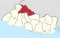
Dulce Nombre de María is a town and municipality in the Chalatenango Department of El Salvador. It is located 72 kilometers (45 mi) from San Salvador, the capital of El Salvador.
La Palma is a municipality in the Chalatenango department of El Salvador. The municipality, located in a mountainous area of the country, covers an area of 135.60 km2 and as of 2006 had an approximate population of 24,000.
Las Vueltas is a municipality in the Chalatenango Department in the north of El Salvador. The municipality is bordered to the north by Ojos de Agua, to the east by Las Flores, to the south by Chalatenango, and to the northeast by Concepción Quezaltepeque. The territory covers 36.83 km² and the population was, as of 2005, of 2,101 inhabitants. For its administration, the municipality is divided into six cantones and 35 caseríos.
Suchitoto is a municipality in the Department of Cuscatlán, El Salvador that has seen continuous human habitation long before Spanish colonization. Within its municipal territory, Suchitoto holds the site of the original founding of the Villa of San Salvador in 1528 that existed for a short time before the site was abandoned. In more recent times, the municipality has prospered even after the severe effects of civil war in El Salvador that lasted between 1980 - 1992 and saw the population of Suchitoto decrease from 34,101 people in 1971 to 13,850 by 1992. It has become an important tourist destination partly due to its well conserved colonial architecture and cobblestone roads that provide a sense of Spanish colonial living. This rise in tourism has attracted service sector businesses to open up in the small city including hostels, restaurants, and picturesque cafes. As a result of tourism, many arts and cultural spaces have opened up in Suchitoto that are also providing positive alternative opportunities for youth in the community. According to the 2007 Official Census, the small city has a population of 24,786 people with 7,654 people living in the urban area and 17,132 people living in the rural communities.
Texistepeque is a city and municipality in the Santa Ana department of western El Salvador. It lies in the center of the department, north of Santa Ana and south of Metapán. It was founded by the Poqomam Maya peoples and conquered by the Pipil people of Cuzcatlan until the Spanish conquest. The meaning of its name comes from Pipil Nawat language and means place of eggs or alternatively mountain of eggs; from Nawat teksis (eggs), and tepec or tepet (mountain) which indicates a place name.
Colonel Joaquín de San Martín y Ulloa was a Salvadoran military officer and politician who was twice chief of state of the State of El Salvador, within the Federal Republic of Central America.
San Francisco de Sales, commonly known as San Francisco, is a municipality and town of Colombia in the department of Cundinamarca.
Chalatenango is a municipality located in the Department of Chalatenango, in the north of El Salvador.
Comalapa is a town and municipality in the Chalatenango Department of El Salvador.
San Jose Ojos de Agua is a municipality is located in the department of Chalatenango in the North of El Salvador
Concepción Quetzaltepeque is a municipality in the department of Chalatenango in the north of El Salvador. It is bordered to the north by Comalapa and La Laguna, to the east by Las Vueltas and Chalatenango, to the south by Chalatenango, and to the west by Santa Rita. The territorial extension of the municipality is 52.54 km2. In 2005 the population was 6,734 inhabitants. The municipality's administration is divided into 6 cantons and 14 caserío.
El Carrizal is a municipality located in the department of Chalatenango in the North of El Salvador.
La Laguna is a municipality in the Chalatenango department of El Salvador.
Zapotlán del Rey is a town and municipality in Jalisco in west-central Mexico. The municipality covers an area of 320.90 km².
The Cerrón Grande Hydroelectric Dam spans the Lempa River 78 km (48 mi) north of San Salvador in the municipalities of Potonico, (Chalatenango) and Jutiapa (Cabañas) in El Salvador.
Cimarron Hydroelectric Power Project a hydroelectric power plant in El Salvador, that was to start construction in 2010. The plant would have been be located in the upper basin of the Lempa River, upstream of the Cerrón Grande Hydroelectric Dam. The proposed location of the dam was between the towns of Agua Caliente, Chalatenango on the left shore and Metapán, Santa Ana, on the right shore. A tunnel would divert water from the Lempa River to a powerhouse and substation to be built near Agua Caliente. With an estimated capacity of 261 megawatts, the project would have increased El Salvador's total generation capacity by almost 25%.
Canton El Tablón belonged to the Municipality of Suchitoto, Cuscatlan, El Salvador. El Tablón was one of many cantons in the surrounding area that was flooded as a result of the Cerron Grande Hydroelectric Dam built in El Salvador between 1972-1976 that created the artificial Lake Suchitlán. According to former residents of El Tablon, the area was divided up into four main wikt:caseríos or hamlets, Caserio La Hacienda Vieja, Caserio Los Figueroas, Caserio Valle El Tablón, and Caserio Los Palitos. It is unclear where the name El Tablon originated from, but according to local historians, an aldea or village/hamlet of El Tablón existed prior to 1860 that was formed through a municipal ejido. An ejido was commonly owned municipal land granted by the Spanish Crown to governing bodies in the Spanish Empire. These lands were considered vacant or unused land in some cases belonging to existing indigenous communities.