Malwa is a historical region of west-central India occupying a plateau of volcanic origin. Geologically, the Malwa Plateau generally refers to the volcanic upland north of the Vindhya Range. Politically and administratively, it is also synonymous with the former state of Madhya Bharat which was later merged with Madhya Pradesh. At present the historical Malwa region includes districts of western Madhya Pradesh and parts of south-eastern Rajasthan. Sometimes the definition of Malwa is extended to include the Nimar region south of the Vindhyas.

Marwar is a region of western Rajasthan state in North Western India. It lies partly in the Thar Desert. The word 'maru' is Sanskrit for desert. In Rajasthani languages, "wad" means a particular area. English translation of the word 'marwar' is 'the region of desert.'

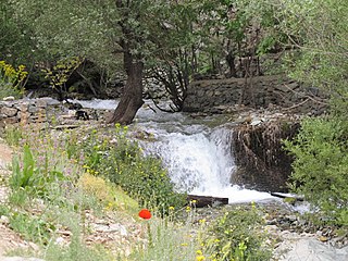
The Ahar River is a tributary of the Berach River.
Rangpur is an ancient archaeological site near Vanala on Saurashtra peninsula in Gujarat, western India. Lying on the tip between the Gulf of Khambhat and Gulf of Kutch, it belongs to the period of the Indus Valley civilization, and lies to the northwest of the larger site of Lothal. It is the type site for the Rangpur culture, a regional form of the late phase of the Indus Valley Civilization that existed in Gujarat during the 2nd millennium BCE.

Pottery in the Indian subcontinent has an ancient history and is one of the most tangible and iconic elements of Indian art. Evidence of pottery has been found in the early settlements of Lahuradewa and later the Indus Valley Civilisation. Today, it is a cultural art that is still practiced extensively in Indian subcontinent. Until recent times all Indian pottery has been earthenware, including terracotta.

The architecture of the Indian state of Rajasthan has usually been a regional variant of the style of Indian architecture prevailing in north India at the time. Rajasthan is especially notable for the forts and palaces of the many Rajput rulers, which are popular tourist attractions.

The history of human settlement in the west Indian state of Rajasthan dates back to about 5,000 years ago. Around 1400 BC, the Matsya tribe occupied the region. Parts of Rajsthan also belonged to the site of the Indus Valley Civilization. The early medieval period saw the rise of many Rajput kingdoms such as the Chauhans of Ajmer, Sisodias of Mewar, Gurjara-Pratihara and the Rathores of Marwar, as well as several Rajput clans such as the Gohil and the Shekhawats of Shekhawati. While Jat kingdoms include the Johiya of Jangaldesh, the Sinsinwars of Bharatpur State, as well as the Bamraulia clan and the Ranas of Dholpur.

Charan is a caste in South Asia natively residing in the Rajasthan and Gujarat states of India, as well as the Sindh and Balochistan provinces of Pakistan. Historically, Charans have been engaged in diverse occupations like bards, poets, historians, pastoralists, agriculturalists and also administrators, jagirdars and warriors and some even as traders.
Rajasthani people or Rajasthanis are a group of Indo-Aryan peoples native to Rajasthan, a state in Northern India. Their language, Rajasthani, is a part of the western group of Indo-Aryan languages.

Rajasthan is one of the most popular tourist destinations in India, for both domestic and international tourists. Rajasthan attracts tourists for its historical forts, palaces, art and culture with its slogan "Padharo Mhare Desh " Jaipur, is also known as Pink City, is a very popular tourist destination, being the capital of Rajasthan and a part of the Golden Triangle. The Walled City of Jaipur is a UNESCO World Heritage Site and is only the second Indian city to be recognized, after Ahmedabad.

The Ahar culture, also known as the Banas culture is a Chalcolithic archaeological culture on the banks of Ahar River of southeastern Rajasthan state in India, lasting from c. 3000 to 1500 BCE, contemporary and adjacent to the Indus Valley civilization. Situated along the Banas and Berach Rivers, as well as the Ahar River, the Ahar–Banas people were exploiting the copper ores of the Aravalli Range to make axes and other artefacts. They were sustained on a number of crops, including wheat and barley.
Gilund is a village and an archaeological site located in Rajsamand district of Rajasthan state in western India. It is one of five ancient sites excavated in the Ahar-Banas Complex which also includes the sites of Ahar, Ojiyana, Marmi, and Balathal. Out of the 111 reported sites found in the Ahar-Banas Complex, Gilund is the largest. The archaeological site was named after the present-day village, Gilund, and is locally known as Modiya Magari which means "bald habitation mound".
Balathal is an archaeological site located in Vallabhnagar tehsil of Udaipur district of Rajasthan state in western India. It is one of the ninety Ahar-Banas culture sites located in the Basins of the Banas river and its tributaries.
Ahar is a village situated in the Anupshahr Tehsil of the Bulandshahr district in Uttar Pradesh, India. It is located 11.98 kilometres from the Mandal headquarters in Anupshahr and is 39.09 kilometres from the district headquarters in Bulandshahar.
Timeline of history of Rajasthan
Kaytha or Kayatha is a village and an archaeological site in the Ujjain district of Madhya Pradesh, India, in the Tarana tehsil, near the city of Ujjain, on the banks of Choti-Kali Sindh river.
The Guhilas of Medapata colloquially known as Guhilas of Mewar were a Rajput dynasty that ruled the Kingdom of Mewar region in present-day Rajasthan state of India. The Guhila kings initially ruled as Gurjara-Pratihara feudatories between end of 8th and 9th centuries and later were independent in period of the early 10th century and allied themselves with the Rashtrakutas. Their capitals included Nagahrada (Nagda) and Aghata (Ahar). For this reason, they are also known as the Nagda-Ahar branch of the Guhilas.

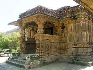
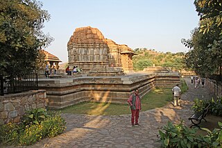
Nagda is a village in Udaipur district of Rajasthan state in India. It was once a prominent city in the early Mewar state. Today it is known primarily for the remains of the Sahastra Bahu Temples.

Siron Khurd is a village in Jakhaura block of Lalitpur district, Uttar Pradesh. It is identified with the early medieval city of Sīyaḍoṇi, which was a major commercial and political centre during the 10th century under the Gurjara-Pratihāra empire. As of 2011, Siron Khurd has a population of 1,437, in 238 households.


