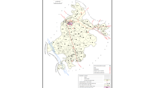
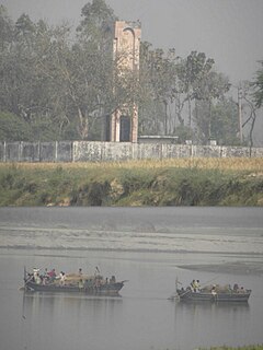
Ballia is a city with a municipal board in the Indian state of Uttar Pradesh. The eastern boundary of the city lies at the junction of two major rivers, the Ganges and the Ghaghara.The city is situated 140 km (87 mi) east of Varanasi and about 380 km from the state capital Lucknow. It has a protected area, the Jai Prakash Narayan bird sanctuary. Ballia is also around 4 km (2.5 mi) away from Bihar.

Deoria district, one of the districts of eastern Uttar Pradesh, India has its headquarters located at Deoria and is a part of Gorakhpur division. It came into existence on 16 March 1946 from Gorakhpur district.

Khalilabad is a city and a municipal board in Sant Kabir Nagar district in the Indian state of Uttar Pradesh. It is the district headquarters of Sant Kabir Nagar district.
Bhatpar Rani is a town and tehsil in Deoria District in the state of Uttar Pradesh in India. It belongs to Gorakhpur Division. It is located 38 km towards East from District headquarters Deoria.The Member of Legislative Council of Bhatpar Rani Constituency is Shri. Sabhakunwar Kushwaha In Bhatpar Rani, the block number of village is 127.The biggest village of which is Sarayan

Bighapur is a town and nagar panchayat in Unnao district of Uttar Pradesh, India. First officially classified as a town for the 1981 census, it now serves as a tehsil headquarters(established in Patan). Important items manufactured here include clay pots, leather products, and wooden furniture. As of 2011, the population of Bighapur is 6,501, in 1,201 households.

Deoria is a city in the state of Uttar Pradesh, India. It is one of five tehsils of the Deoria district. Deoria is located 45 km east of Gorakhpur and about 317 km from the state capital Lucknow. It shares its east border with Bihar.

Ganj Muradabad is a town and nagar panchayat in Safipur tehsil of Unnao district, Uttar Pradesh, India. It also serves as the headquarters of a community development block containing 86 rural villages. Handicrafts are a major industry here. As of 2011, Ganj Moradabad has a population of 10,957, in 1,723 households.
Pharenda, or Anandnagar, is a city in the Maharajganj district of the province of Uttar Pradesh in northern India. It is located approximately 44 kilometres north of Gorakhpur near the border with Nepal. District of Pharenda is Maharajganj. This is situated on the Buddhist Circuit which is built from Sarnath to Lumbini. It lies on NH-24 and near NH 29. It is about 45 km from Gorakhpur, 40 km from Siddharthnagar, 30 km from Maharajganj and 55 km from Sonauli Indo-Nepal Border. This place is named after Seth Anandram Jaypuriya. There is closed sugar Mill which was started in about 1935 and closed in 1995. Near Anand Nagar there is a temple is Durga devi mandir, popularly known as Lehara Devi mandir.
Mandawar is a town and a nagar panchayat city in Bijnor district in the Indian state of Uttar Pradesh. It is a green area near the holy river Ganges. Most people here are farmers. It is famous for rose. It has some historical value also.
Salempur City is one of the oldest Tehsil Headquarters, 71 Parliamentary Constituency which covers Vidhan Sabha of Salempur and Bhatpar Rani in Deoria district and Belthara Road, Sikanderpur and Bansdih of Ballia District. It is a Nagar Panchayat in Deoria district in the India state of Uttar Pradesh. It is one of oldest Tehsil which was founded in 1939 at the time of British Rule. It has an important Railway Station of North Eastern Railway. The Chhoti Gandak river passes through Salempur Town.
Khajuriya Sarki is a village near Dhebarua in Shoratgarh Assembly Constituency of Siddharthnagar District, Uttar Pradesh state, India. The village has a nearby railway station Barhni on the Gorakhpur–Gonda Indian Railways. It is 6 km from the Nepal border Krishnanagar (JhandeNagar)
Rajesultanpur or Raje Sultanpur is a town and nagar panchayat in Ambedkar Nagar district in the Indian state of Uttar Pradesh.
Dhanghata is a small village located in Bansi Tehsil of Siddharth Nagar district, Uttar Pradesh state of India. It belongs to the Basti division. It is located 40 km west of District headquarters Naugarh and 225 km from State capital Lucknow. It is located on west side of the state highway between Basti and Lumbini.

Paina is a village and Nyaya Panchayat situated along the bank of Sarayu (Ghaghra) river in the eastern part of the state of Uttar Pradesh in India. It comes under administration of Barhaj Tehsil of Deoria District and Gorakhpur Division. It is located 33 km towards South from District headquarters Deoria and 340 km from State capital Lucknow.
Pratap Pur Chhataura is located in Azamgarh district of Uttar Pradesh. It is 40 km away from District head office. Its pin code is 276142 and its post office is Mangitpur. As per Census 2011 information the village code of Pratap Pur Chhataura village is 192003. The ambitious project of Gorakhpur Link Expressway Under UPIEDA is passing through the village.
Kukurghati, also known as Kukur Ghati, is a village of the Bhatpar Rani Vidhan Sabha Constituency in Deoria district in the state of Uttar Pradesh, India.
Bhadon is a village and Gram Panchayat located in Martinganj tehsil of the Azamgarh District in the Indian state of Uttar Pradesh, near the border with Jaunpur District. It is 37.7 kilometres (23.4 mi) north-east of the district headquarters in Azamgarh and 229.9 kilometres (142.9 mi) from the state capital of Lucknow.

Bisauri is a village of the Jaunpur district, Uttar Pradesh, Northern India. Bisauri's Postal Index Number is 222129 and its post office is at Patrahi. The village is also a Gram Panchayat, comprising itself and the village of Tiwaripur.
Madaria is a village in Gola Block and Tehsil (sub-district) of Gorakhpur district in the Indian Sate of Uttar Pradesh. The total geographical area of village is 75.21 hectares. The village has 247 households. The village has its Gram Panchayat and Post Office. The native language is Hindi. Madaria is located 61.1 km from Gorakhpur and 7 km from sub-district headquarters Gola Bazar.
Dakhin Patti is a village in Baksha block in Jaunpur district, Varanasi division, Uttar Pradesh State, India. It is located 20km towards west from District head quarters Jaunpur. It is 1km from Baksha and 228km from State capital Lucknow.


