Aillebrack

Last updated

Aillebrack
An Aill Bhreac
Townland
Aillebrack harbour - geograph.org.uk - 3606258.jpg
Bunowen Pier in Aillebrack townland
Ireland adm location map.svg
Red pog.svg
Aillebrack
Location in Ireland
Coordinates: 53°25′04″N10°07′08″W / 53.41773°N 10.11902°W / 53.41773; -10.11902
Country Ireland
Province Connacht
County County Galway
Irish grid reference L589418

Aillebrack (Irish : An Aill Bhreac, meaning "the speckled cliff") [1] is a townland on the west coast of Connemara in County Galway, Ireland. [1] As of the 2011 census, the townland had a population of 122 people. [2]

Contents

Geography

Situated in the civil parish of Ballindoon, in the historical barony of Ballynahinch, Aillebrack is approximately 2.6 square kilometres (1.0 sq mi) in area. [3]

Lough Aillebrack, a "hard water" lake within the Slyne Head Peninsula Special Area of Conservation, is nearby. [4] The area is overlooked by Doon Hill. [5]

The nearest town is Clifden, 10 km to the north-east.

History

Evidence of ancient settlement in the townland includes several midden and holy well sites. The latter includes a well, known as the "Well of the Seven Daughters", near Doon Hill. [6] [7] Bunowen Pier in Aillebrack was built c.1820. [8]

There is a memorial stone and plaque in Aillebrack which commemorates the crew of a U.S. Navy Liberator aircraft that crashed off the nearby coast in 1944. [9]

Education

The local national (primary) school, Aillebrack National School, is situated near the village of Ballyconneely. Also known as St. Caillín's National School (after Saint Caillín), [5] it operates from a two-room school building which was built in 1945. [10]

The school, which was first built in the late 19th century, originally had just one room. [11] This school building was destroyed in a fire in 1940. [11] While the school was being rebuilt, lessons were moved to two rooms in nearby Bunowen Castle. [11] At that time, the castle was in a poor condition and "described as cold and draughty". [11] The school was rebuilt and reopened in 1945. [11] When the school at nearby Dunloughan closed in 1967, its 15 pupils transferred to Aillebrack school. [11] As of 2010, there were 27 children enrolled in Aillebrack National School. [10]

Transport

As at 2024, there is a Local Link bus on Thursdays to Clifden. [12]

Related Research Articles

<span class="mw-page-title-main">Connemara</span> Region in County Galway, Ireland

Connemara is a region on the Atlantic coast of western County Galway, in the west of Ireland. The area has a strong association with traditional Irish culture and contains much of the Connacht Irish-speaking Gaeltacht, which is a key part of the identity of the region and is the largest Gaeltacht in the country. Historically, Connemara was part of the territory of Iar Connacht. Geographically, it has many mountains, peninsulas, coves, islands and small lakes. Connemara National Park is in the northwest. It is mostly rural and its largest settlement is Clifden.

<span class="mw-page-title-main">Oranmore</span> Town in County Galway, Ireland

Oranmore is a town in County Galway, Ireland, 9 km (5.6 mi) east of Galway city on an inlet of Galway Bay. At the 2022 census, Oranmore had a population of 5,819.

<span class="mw-page-title-main">Clifden</span> Town in County Galway, Ireland

Clifden is a coastal town in County Galway, Ireland, in the region of Connemara, located on the Owenglin River where it flows into Clifden Bay. As the largest town in the region, it is often referred to as "the Capital of Connemara". Frequented by tourists, Clifden is linked to Galway city by the N59.

<span class="mw-page-title-main">Ballyconneely</span> Village in County Galway, Ireland

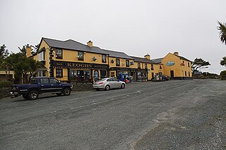
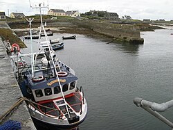
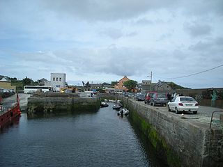
Ballyconneely is a village and small ribbon development in west Connemara, County Galway Ireland.

<span class="mw-page-title-main">Craughwell</span> Village and townland in County Galway, Ireland

Craughwell is a village and townland in County Galway, Ireland. As of the 2022 census, the village had a population of approximately 1,000 people.

<span class="mw-page-title-main">Rosmuc</span> Village in County Galway, Ireland

Rosmuc or Ros Muc, sometimes anglicised as Rosmuck, is a village in the Conamara Gaeltacht of County Galway, Ireland. It lies halfway between the town of Clifden and the city of Galway. Irish is the predominant spoken language in the area, with the electoral division of Turlough, Rosmuc, representing one of the highest percentages of Irish-speaking people in the country. The townland of Rosmuck is part of the civil parish of Kilcummin.

<span class="mw-page-title-main">Furbo, County Galway</span> Village in County Galway, Ireland

Furbo or Furbogh is a settlement in Connemara, County Galway, Ireland. As of the 2022 census, it had a population of 868 people. It lies along the coast, overlooking Galway Bay, in a Gaeltacht area.

Killagoola is a small townland lying in the civil parish of Moycullen in County Galway, Ireland. It is located about 8 miles from Galway city, just off the N59 road which travels north from Galway towards Clifden. Its name is derived from the Irish name of Cill Ogúla, which means Church on the Shoulder. Indeed there is the ruins of a small church within the boundaries of Killagoola, on the largest site in the area, Crú Hill.

Fenagh is a village in the south-east of County Leitrim in Ireland. It is 4.8 kilometres south-west of Ballinamore and 12 kilometres (7 mi) north of Mohill, the village being on the R202 road. The village is in a civil parish of the same name. Fenagh is located in the eastern 'spur' of the Barony of Leitrim.

<span class="mw-page-title-main">Termon</span> Village in County Donegal, Ireland

Termon is a village in the north of County Donegal, Ireland.

<span class="mw-page-title-main">Ahascragh</span> Village in County Galway, Ireland

Ahascragh is a village in east County Galway, Ireland. It is located 11 km (7 mi) north-west of Ballinasloe on the Ahascragh/Bunowen River, a tributary of the River Suck. The R358 regional road passes through the village. As of the 2022 census, it had a population of 186 people.

<span class="mw-page-title-main">Mountbellew</span> Town in County Galway, Connacht, Ireland

Mountbellew or Mountbellew Bridge is a town in County Galway, Ireland. It lies mostly within the townland of Treanrevagh on the N63 national primary road. As of the 2022 census, it had a population of 774.

<span class="mw-page-title-main">Moylough</span> Village in Connacht, Ireland

Moylough is a rural village located in County Galway in Ireland. As of the 2016 census, it had a population of 518.

<span class="mw-page-title-main">Renvyle</span> Place in County Galway, Ireland

Renvyle or Rinvyle is a peninsula and electoral division in northwest Connemara in County Galway, close to the border with County Mayo in Ireland.

Lough Anaserd is a freshwater lake in the west of Ireland. It is located in west County Galway on the Slyne Head peninsula.

<span class="mw-page-title-main">R341 road (Ireland)</span> Road in Ireland

The R341 road is a regional road in Ireland. It is a loop road from the N59 road in County Galway. South of the R342, the road is part of the Wild Atlantic Way.

<span class="mw-page-title-main">Inishturk South</span>

Inishturk is a small island and a townland of County Galway, in Ireland. The island is also referred as Inishturk South in order to tell it apart from the Inishturk island located in County Mayo.

<span class="mw-page-title-main">Doon Hill</span>

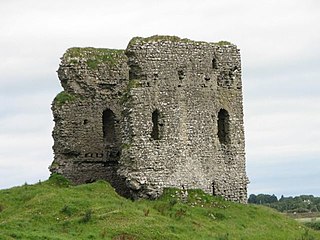
Doon Hill is a volcanic plug in the townland of Bunowen More, in the barony of Ballynahinch, near Ballyconneely in County Galway, Ireland. The hill, which is 67 m high, is a prominent landscape feature on the Errismore peninsula. Fishermen use Doon Hill as a landmark to guide them into Bunowen Pier at Aillebrack. The Irish name for the hill, dún, means "fortress", possibly indicating an earlier fort on top of the hill.

<span class="mw-page-title-main">Omey (civil parish)</span> Civil parish in Connacht, Ireland

Omey is a civil parish in County Galway, Ireland.

<span class="mw-page-title-main">Kiltullagh</span> Civil parish in County Galway, Ireland

Kiltullagh is a village and civil parish in County Galway, Ireland. Located on the R348 regional road, the M6 motorway passes nearby. As of 2011, the townlands of Kiltullagh South and Kiltullagh North, in Kiltullagh civil parish, had a combined population of 93 people.

References

  1. 1 2 "An Aill Bhreac / Aillebrack". logainm.ie. Placenames Database of Ireland. Retrieved 19 February 2024.
  2. "CD155 - Galway Population by Private Households, Occupied and Vacancy Rate". data.gov.ie. Central Statistics Office. Retrieved 19 February 2024. Population [..] Townlands [..] Aillebrack, Bunowen, Co. Galway [..] 122
  3. "Aillebrack Townland, Co. Galway". townlands.ie. Retrieved 19 February 2024.
  4. "Slyne Head Peninsula SAC" (PDF). npws.ie. National Parks and Wildlife Service. Retrieved 19 February 2024.
  5. 1 2 "Aillebrack National School - Home". aillebrackns.ie. Retrieved 19 February 2024. St. Caillin's National School Aillebrack [..] with Doon Hill [..] acting as a stunning backdrop, Aillebrack is a peaceful haven
  6. Gosling, Paul (1993). Archaeological Inventory of County Galway: West Galway. p. 117. Aillebrack An Aill Bhreak [..] Indicated 'Well of the Seven Daughters' [..] Holy well In a low-lying area close to NW foot of Doon Hill. Recorded by O'Flaherty in 1684
  7. "Holy Family Church Ballyconeelly". clifdenparish.com. Retrieved 19 February 2024. At Aillebrack, near Doon Hill, there is the 'Holy Well of the Seven Daughters'
  8. "Aillebrack, Galway". buildingsofireland.ie. National Inventory of Architectural Heritage. Retrieved 19 February 2024.
  9. "Aillebrack - Liberator Memorial". galwaycommunityheritage.org. Retrieved 19 February 2024.
  10. 1 2 "Whole School Evaluation Report - Scoil Náisiúnta Naomh Cáilín, Aillebrack, Ballyconneely, County Galway" (PDF). gov.ie. Department of Education. 5 March 2010. Retrieved 19 February 2024.
  11. 1 2 3 4 5 6 "Aillebrack National School - School History". aillebrackns.ie. Retrieved 19 February 2024.
  12. "Cashel Clifden". Local Link Galway. Retrieved 12 May 2024.