Aingiri

Last updated

Aingiri
Bangladesh adm location map.svg
Red pog.svg
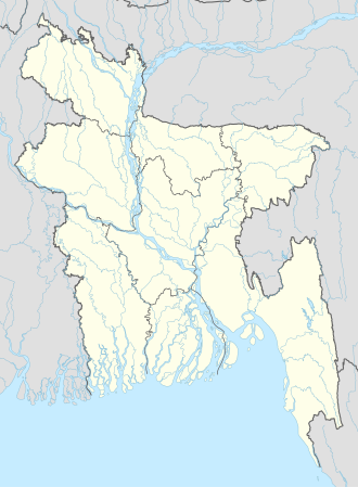
Aingiri
Location in Bangladesh
Coordinates: 23°19′42″N90°57′40″E / 23.32833°N 90.96111°E / 23.32833; 90.96111 Coordinates: 23°19′42″N90°57′40″E / 23.32833°N 90.96111°E / 23.32833; 90.96111
CountryFlag of Bangladesh.svg  Bangladesh
Division Chittagong Division
District Chandpur District
Time zone UTC+6 (Bangladesh Time)

Aingiri is a village in Chandpur District in the Chittagong Division of Eastern Bangladesh. [1]

Contents

Description

Aingiri is located in the district of Kachua Upazila.

Population

Aingiri has different educational institutions, including;

Amenities

Aingiri has a government hospital.[ citation needed ] The village has 6 mosques.

There is a Hindu temple in Karmokar Bari.

Related Research Articles

<span class="mw-page-title-main">Prefectures of Japan</span> First-level administrative divisions of Japan

Japan is divided into 47 prefectures, which rank immediately below the national government and form the country's first level of jurisdiction and administrative division. They include 43 prefectures proper, two urban prefectures, one "circuit" or "territory" and one metropolis. In 1868, the Meiji Fuhanken sanchisei administration created the first prefectures to replace the urban and rural administrators in the parts of the country previously controlled directly by the shogunate and a few territories of rebels/shogunate loyalists who had not submitted to the new government such as Aizu/Wakamatsu. In 1871, all remaining feudal domains (han) were also transformed into prefectures, so that prefectures subdivided the whole country. In several waves of territorial consolidation, today's 47 prefectures were formed by the turn of the century. In many instances, these are contiguous with the ancient ritsuryō provinces of Japan.

<span class="mw-page-title-main">Administrative divisions of New York (state)</span> Administrative divisions of New York State

The administrative divisions of New York are the various units of government that provide local services in the State of New York. The state is divided into boroughs, counties, cities, towns, and villages. They are municipal corporations, chartered (created) by the New York State Legislature, as under the New York Constitution the only body that can create governmental units is the state. All of them have their own governments, sometimes with no paid employees, that provide local services. Centers of population that are not incorporated and have no government or local services are designated hamlets. Whether a municipality is defined as a borough, city, town, or village is determined not by population or land area, but rather on the form of government selected by the residents and approved by the New York Legislature. Each type of local government is granted specific home rule powers by the New York State Constitution. There are still occasional changes as a village becomes a city, or a village dissolves, each of which requires legislative action. New York also has various corporate entities that provide local services and have their own administrative structures (governments), such as school and fire districts. These are not found in all counties.

The government of the U.S. state of Ohio consists of the executive, judicial, and legislative branches. Its basic structure is set forth in the Constitution and law of Ohio.

<span class="mw-page-title-main">Tirunelveli district</span> District of Tamil Nadu in India

Tirunelveli district is one of the 38 districts of Tamil Nadu state in India. It is the largest district in terms of area with Tirunelveli as its headquarters. The district was formed on 1 September 1790 by the British East India Company, and comprised the present Tirunelveli and Thoothukudi, Tenkasi and parts of Virudhunagar and Ramanathapuram district. As of 2011, the undivided district had a population of 3,077,233.

The administrative divisions of Wisconsin include counties, cities, villages and towns. In Wisconsin, all of these are units of general-purpose local government. There are also a number of special-purpose districts formed to handle regional concerns, such as school districts.

Padianallur is a village in Sholavaram Block in Thiruvallur district of Indian state Tamil Nadu. It is located 34 km towards East from District headquarters Tiruvallur. 4 km from Sholavaram. 20 km from State capital Chennai.

<span class="mw-page-title-main">Guldara District</span> District in Kabul Province, Afghanistan

Guldara District is located in the northwestern part of Kabul Province, Afghanistan. It has a population of 25,213 people, including new returnees. Around 70% are Tajiks and 30% Pashtuns.

Mayureswar II is a community development block that forms an administrative division in Rampurhat subdivision of Birbhum district in the Indian state of West Bengal.

Mohammad Bazar is a community development block that forms an administrative division in Suri Sadar subdivision of Birbhum district in the Indian state of West Bengal.

Murarai I is a community development block that forms an administrative division in Rampurhat subdivision of Birbhum district in the Indian state of West Bengal.

Local government in New Jersey is composed of counties and municipalities. Local jurisdictions in New Jersey differ from those in some other states because every square foot of the state is part of exactly one municipality; each of the 564 municipalities is in exactly one county; and each of the 21 counties has more than one municipality. New Jersey has no independent cities, or consolidated city-counties.

Shegunashi is a village in the southern state of Karnataka, India. It is located in the Athani taluk of Belagavi district in Karnataka.

Chamakeri is a village in the Belgaum district of Athani Taluk in the southern Indian state of Karnataka.

Hulloli is a village which comes under Hukkeri Taluka in Belgaum district in the southern state of Karnataka, India.

Habra II is a community development block that forms an administrative division in Barasat Sadar subdivision of North 24 Parganas district in the Indian state of West Bengal.

Islampur is a community development block that forms an administrative division in Islampur subdivision of Uttar Dinajpur district in the Indian state of West Bengal.

Suri II is a community development block that forms an administrative division in Suri Sadar subdivision of Birbhum district in the Indian state of West Bengal.

<span class="mw-page-title-main">Rajnagar (community development block)</span> Community development block in West Bengal, India

Rajnagar is a community development block that forms an administrative division in Suri Sadar subdivision of Birbhum district in the Indian state of West Bengal.

Nalhati II is a community development block that forms an administrative division in Rampurhat subdivision of Birbhum district in the Indian state of West Bengal.

The administrative divisions of Ohio are counties, municipalities, townships, special districts, and school districts.

References

  1. "NGA GeoNames Database". National Geospatial-Intelligence Agency . Retrieved 2008-07-14.