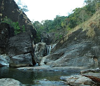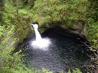
A waterfall is an area where water flows over a vertical drop or a series of steep drops in the course of a stream or river. Waterfalls also occur where meltwater drops over the edge of a tabular iceberg or ice shelf.
Indian Falls is a hamlet located closely within the northern border of the town of Pembroke and the western edge of Genesee County, Western New York, United States. Located in what was traditional Seneca nation territory for hundreds of years, the town was named also for a waterfall near its center, where Tonawanda Creek flows over the Onondaga escarpment.

Adyanpara Falls is a cascading waterfall in the Kurmbalangodu village of Nilambur taluk in Kerala, India. It is 14 kilometres (8.7 mi) from Nilambur town, and attracts tourists from various parts of Kerala. This is a seasonal waterfall. During Summer, water flow is low. This waterfall is of a natural cascading style as the waterfall descends over the rock.

The Montezuma Falls, a horsetail waterfall on a minor tributary to the Pieman River, is located on the West Coast Range of Tasmania, Australia.

Periyakulam is a major Town and a Municipality in Theni district in the Madurai Region. South Indian state of Tamil Nadu. As of 2011, the town had a population of 42,976. Periyakulam is the northern gateway of the district.

Umarkhed is a Municipal council in Yavatmal district of State of Maharashtra.

Wallace Falls State Park is a public recreation area that encompasses 1,380 acres (560 ha) along the Wallace River in Snohomish County, Washington. The state park is located on the west side of the Cascade Mountains with an entrance point one mile (1.6 km) northeast of the community of Gold Bar. The park features three waterfalls, three backcountry lakes, old-growth coniferous forests, rushing mountain rivers and streams, and the evidence of its logging history in the ruins of railroad trestles, disused railroad grades, and springboard notches in stumps.
Cuispes is one of the 12 districts of the province of Bongará, located in the Amazonas Region in the north of Peru.

Abbey Falls is in Kodagu, in the Western Ghats in Karnataka. It is located 8 km from the Madikeri, 122 km from Mysore, 144 km from Mangalore and 268 km from Bangalore.

Palaruvi Falls is a waterfall located in Kollam district in the Indian state of Kerala. It is the 32nd highest waterfall in India.

Kumbakkarai Falls are lesser known falls in the foothills of the Kodaikanal Hills. They are located at 10°10′48″N77°31′50″E in Dindigul district, 9 kilometers (5.6 mi) from Periyakulam. Kumbakkarai Falls are located along the Kodai-Vellagavi-Periyakulam footpath.

Vattaparai Falls are located at: 8°15.919′N77°27.062′E, elevation 40 m (130 ft), in the Keeriparai reserve forest near Bhoothapandi village (Pin:629852) on the Pazhayar River in Kanyakumari district, Tamil Nadu state, South India. It is 25 km (16 mi) N of Nagercoil) and 32 km (20 mi) NW of Kanyakumari. This 20 km2 (7.7 sq mi) area is proposed to be a Wildlife Sanctuary.

Bonacaud is the base station of the famous peak, Agasthyarkoodam in the Agasthya hills. The Agasthya hill range is famous for its abundance of rare herbs and medicinal plants.

Meenmutty Falls is located 29 km from Kalpetta in Wayanad District in the state of Kerala, India. It is a three-tiered waterfall with a height of 300 metres. Meenmutty is a combination of Malayalam words Meen (fish) and Mutty (blocked). Meenmutty Falls can be reached thorough a 2 km hike though the jungle from the Wayanad-Ooty road. Meenmutty waterfalls are dangerous during rainy seasons due to high inflow and many people have drowned since 1991.

Aryankavu is a village in Punalur, Kollam district, Kerala. It lies on National Highway 744 near Thenmala. It is a mountain pass in Western Ghats. The Punalur-Shenkottai broad gauge railway line also passes through Aryankavu. Aryankavu is 78 km away from Kollam and 36 km away from Punalur.

Eagle Creek is a tributary of the Columbia River in Multnomah and Hood River counties in the U.S. state of Oregon. It cuts through a narrow canyon in its 3,200 feet (980 m) descent to the Columbia River Gorge and is known for its concentration of 13 waterfalls in about 5 miles (8.0 km) distance. Eight major falls are on Eagle Creek and the East Fork Eagle Creek itself, while five are on its tributaries.

Kalhatti Falls or Kalahasti Falls is located at Tarikere taluk(kallathigiri) in Chikmagalur district of Karnataka, India. The waterfall is 10 kilometers (6.2 mi) away from Kemmangundi hill station.
The Kune Falls is a waterfall at Lonavla in Pune district in the Indian state of Maharashtra. It is the 14th highest waterfall in India.

The Tiger Falls are hidden in the hilly terrains of Chakrata in Uttarakhand, India. It is 98 km from the state capital, Dehradun, 20 km from Chakrata and can be reached by a 5 km trek with rhododendron and oak trees surroundings. At an elevation of 312 ft, it is considered the highest direct waterfall in India.
Chinnakallar Falls is a waterfall in the Valparai taluk, Coimbatore district, in the Indian state of Tamil Nadu. A narrow trail among rugged bushes leads us to the waterfalls.The area where this waterfall located is the third-most wettest area or third-highest rainfall receiving place in India after Mawsynram and Cherrapunji.


