| Akatarawa River | |
|---|---|
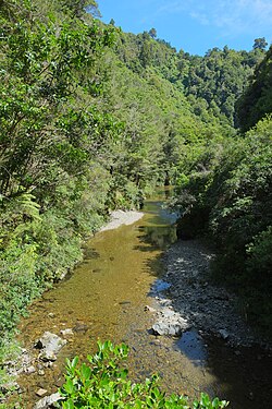 Akatarawa River in Akatarawa Forest | |
 | |
| Etymology | From Māori: aka (vine) and tarewa (hanging or drooping) [1] |
| Native name | Akatarewa (Māori) |
| Location | |
| Country | New Zealand |
| Region | Wellington |
| Physical characteristics | |
| Source | Maunganui |
| • coordinates | 40°58′06″S175°03′26″E / 40.9682°S 175.0571°E |
| • elevation | 600 metres (2,000 ft) |
| Mouth | Te Awa Kairangi / Hutt River |
• coordinates | 41°05′26″S175°05′50″E / 41.0906°S 175.0972°E |
• elevation | 80 metres (260 ft) |
| Length | 20 kilometres (12 mi) |
| Basin features | |
| Progression | Te Awa Kairangi / Hutt River→ Wellington Harbour→ Cook Strait |
| Tributaries | |
| • left | Bull Stream, Chilly Stream, Frances Stream |
| • right | Deadwood Stream, Akatarawa River West |
The Akatarawa River is a river in the lower North Island of New Zealand.
It is a short river, flowing south for 20 kilometres (12 mi) through small rocky gorges and the Akatarawa Valley before joining the Hutt River at Birchville, a suburb in the northern end of Upper Hutt. Its eventual outflow is into Wellington Harbour, then into Cook Strait.