
Sabarkantha district is one of the 33 districts of Gujarat state of India, located in the northeastern part of the state. The administrative headquarters of the district are located in Himatnagar.

Mehsana, also spelled Mahesana, is a city and the headquarters of Mehsana district in the Indian state of Gujarat. Established in 14th century, the city was under Gaekwads of Baroda State from 18th century to the independence of India in 1947. Dairy, oil and natural gas are major industries in the city.
Kheda is a city and a municipality in the Indian state of Gujarat. Kheda was known as Kaira during the British Raj. It was ths former administrative capital of Kheda district. The city is known for tobacco farming. The nearest railway station is Mahemadavad Kheda Road and the nearest airport is Ahmedabad Airport.

Patan is the administrative seat of Patan district in the Indian state of Gujarat and is an administered municipality. It was the capital of Gujarat's Chavda and Chaulukya dynasties in medieval times, and is also known as Anhilpur-Patan to distinguish it from Prabhas Patan. During the rule of Gujarat Sultanate, it was the capital from 1407 to 1411.
Banswara is a city in the Banswara district in southern Rajasthan, India. The name, Banswara, came from king ‘Bansiya Bhil’.

Palanpur is a city and a headquarters of Banaskantha district in the Indian state of Gujarat. Palanpur is the ancestral home to an industry of Indian diamond merchants.

Gandhinagar district is an administrative division of Gujarat, India, whose headquarters are at Gandhinagar, the state capital. It was organized in 1964.

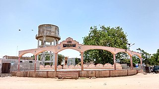
Mehsana district is one of the 33 districts of Gujarat state in western India. Mehsana city is the administrative headquarters of this district. The district has a population of over 1.8 million and an area of over 4,500 km2. There are over 600 villages in this district with a population of 2,035,064 of which 22.40% were urban as of 2011.
Ambaji (Ambājī) is a census town in Banaskantha district in the state of Gujarat, India.

The Sun Temple of Modhera is a Hindu temple dedicated to the solar deity Surya located at Modhera village of Mehsana district, Gujarat, India. It is situated on the bank of the river Pushpavati. It was built after 1026-27 CE during the reign of Bhima I of the Chaulukya dynasty. No worship is offered now and it is a protected monument maintained by the Archaeological Survey of India. The temple complex has three components: Gūḍhamanḍapa, the shrine hall; Sabhamanḍapa, the assembly hall and Kunḍa, the reservoir. The halls have intricately carved exterior and pillars. The reservoir has steps to reach the bottom and numerous small shrines.
Chanasma is a small town and a municipality in Chanasma Taluka of Patan district in the state of Gujarat, India. Chanasma is a seat of Gujarat Assembly. The MP seat of Chanasma falls in the Patan Lok Sabha. Chanasma village is connected by Kandla-Mehsana highway. And since the broad gauge of the railway is being renovated, it is going to connect with Rajasthan via Patan from Ahmedabad. Patel, Brahmin, Vania, Darji, Panchal, Parmar, Rabari, Thakor, Nayi, all communities live in Chansma village. The old village of Chanasma was between Ugmano Darwaza and Athamano Darwaza. But now due to the increase in population and development of the village, the village is spreading to the outside. Chansma Village Shree Laljidas Laxmidas Patel Trust runs Rotla Ghar for feeding the poor where clean and nutritious meals are provided to the poor for free.
Vadnagar is a town and municipality in the Mehsana district of the state of Gujarat in India. It is located 35 km (22 mi) from Mehsana. Its ancient names include Anartapura and Anandapura. It was a location visited by Xuanzang in 640 C.E. The founder and the first Director-General of the Archaeological Survey of India (ASI), Alexander Cunningham, had identified Anandapura with the town of Vadnagar. Vadnagar is also the birthplace of Narendra Modi, the current Prime Minister of India.
Jhulasan is a small village located in district of Mehsana, Kadi Taluka in the state of Gujarat, India.

Becharaji or Bahucharaji is a Hindu temple town and taluka capital in Mehsana district of Gujarat state, India. The temple of Hindu goddess Bahuchara Mata in the town is a major pilgrimage centre.
Bhandu is a village in Visnagar Taluka of Mahesana district in Gujarat, India. It is located about 10 kilometres (6.2 mi) from Mehsana and 17 kilometres (11 mi) from Visnagar
Kherva is a village in the Mehsana district, Gujarat, India, situated on State Highway 73 between Gandhinagar and Mehsana. It borders the following villages: Devarasan, Kadavasan, Mulsan, Jagudan, Sanganpur, Punasan, Hebuva, Udalpur, Gunjala, Dharusan, and Dhamnava.
Sami is a town in Sami Taluka of Patan district of Gujarat, India.

The Khed-Roda Group of Monuments include eighth-ninth century dated seven Hindu temples built during Pratihara or Rashtrakuta period. It also include a reservoir (Kund) and a stepwell. They are located between Raisingpura (Roda) and Khed Chandarani villages, 18 km from Himmatnagar in Sabarkantha district of Gujarat, India. It is located on the bank of the seasonal stream which merges Hathmati river downstream.

Polo forest, also known as Vijaynagar forest, is a dry mixed deciduous forest near Abhapur village in Vijaynagar Taluka, Sabarkantha district, Gujarat, India. It is located at the foothills of the Aravalli range and on the banks of perennial Harnav river, spread over the area of 400 square kilometres.


