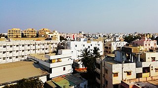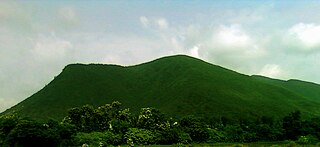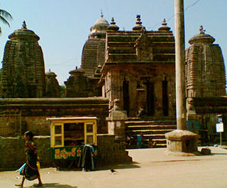
The West Godavari district is a coastal district in the Indian state of Andhra Pradesh with an administrative headquarters in Bhimavaram. As of the 2011 Census of India, the district has an area of 2,178 km2 (841 sq mi) and a population of 1,779,935. It is bounded by the Krishna district and Bay of Bengal to the south, East Godavari district to the east, and Eluru district, Kolleru Lake and Upputeru Drain to the northwest.

Vizianagaram, also known as Vijayanagaram, is a city and the headquarters of the Vizianagaram district in the Indian state of Andhra Pradesh. It is located in the Eastern Ghats, about 24 km (15 mi) west of the Bay of Bengal and 40 km (25 mi) north-northeast of Visakhapatnam. The city has a population of 228,025 and was established as the capital of the Vizianagaram estate by Raja Vijayaram Raj from the Pusapati dynasty. The rulers had a notable role in the history of the region in the 18th century and were patrons of education and arts.

Kavali is a town in Nellore district of Andhra Pradesh of India. It also serves as headquarters of Kavali mandal and Kavali revenue division.It is one of the few cities from Andhra Pradesh which were selected for Atal Mission for Rejuvenation and Urban Transformation (AMRUT) Scheme.

Vizianagaram district is one of the six districts in the Uttarandhra region of the Indian state of Andhra Pradesh with its headquarters located at Vizianagaram. The district was once the part of ancient Kalinga.Saripilli Dibbilingeswara temple, Jayathi Mallikarjuna Temple are the finest examples of ancient Eastern Ganga Dynasty built monuments in the district. The district is bounded on the east by the district of Srikakulam, north by Parvathipuram Manyam south by Visakhapatnam, Anakapalli, southeast by the Bay of Bengal, and west by Alluri Sitharama Raju district. It was formed on 1 June 1979, with some parts carved from the neighbouring districts of Srikakulam and Visakhapatnam. The district is named after the princely state of Vizianagaram. In 2011, it was the least populous district in Andhra Pradesh.

Anantapur district, officially Ananthapuramu district, is one of the eight districts in the Rayalaseema region of the Indian state of Andhra Pradesh. The district headquarters is located in Anantapur city. It is one of the driest places in South India. In the year 2022, as part of re-organisation of districts, Sri Sathya Sai district was carved out.

Srikakulam district is one of the twenty-six districts of the Indian state of Andhra Pradesh, located in the Uttarandhra region of the state, with its headquarters located at Srikakulam. It is one of the six districts, located in the extreme northeastern direction of the state. It was formerly known as Chicacole, and was under Ganjam district till 1 April 1936, then merged under Vizagapatam district. Srikakulam district forms the core area of Kalinga where most of its historical capitals like Kalinganagari, pithunda, Dantapuram are located.

Narsipatnam is a census town in Anakapalle district of the Indian state of Andhra Pradesh. It was upgraded from a gram panchayat into municipality in 2012. The town is spread over an area of 42 km2 (16 sq mi) The resting place of the revolutionary Indian freedom fighter Alluri Sitarama Raju is located in Krishna Devi Peta village of From Narsipatnam to labasingi Village 30 km only.. labasingi most popular winter tourism place..so many Tourists enjoy -2 degree's temparature there.. Narsipatnam town is 43 km away from Tuni. And it is 72 km away from Visakhapatnam.

Nelli-marla is a census town in Vizianagaram district of the Indian state of Andhra Pradesh. It is in Nellimarla mandal of Vizianagaram revenue division.

Cheepurupalli is a census town in Vizianagaram district of the Indian state of Andhra Pradesh. The town is located 30 km to the north of Vizianagaram. The town covers an area of 348 hectares with a population of 78,000 according to the 2011 census.

Bhogapuram is a village in Vizianagaram district of the Indian state of Andhra Pradesh. It is located in Bhogapuram mandal of Vizianagaram revenue division.
Pusapatirega is a village and mandal in Vizianagaram district of the Indian state of Andhra Pradesh, India.
Laveru is a village in Srikakulam district of the Indian state of Andhra Pradesh. Laveru is located on Subhadrapuram-Cheepurupalli road that connects National Highway-5 to Cheepurupalli railway station on Howrah-Chennai mainline. The village is located in Pedda Gedda river basin.

Pathapatnam is a town in Srikakulam district of the Indian state of Andhra Pradesh. It is located in Pathapatnam mandal of Tekkali revenue division. Telugu is the major spoken language in the town and in entire mandal. Pathapatnam is located on the border of Srikakulam district of Andhra Pradesh and Gajapati district of Odisha. Parlakhemundi, the headquarters of Gajapati District, can be considered as twin town of Pathapatnam because of its close proximity. It is located around 65 km from srikakulam. It was the old capital of Paralakhemundi Gajapati Maharajah of his erstwhile kingdom.
Vajrapu-kotturu is a village in Srikakulam district of the Indian state of Andhra Pradesh. Vajrapukotturu mandal is bordered by Mandasa, Palasa, Nandigam and Santha Bommali mandals of Srikakulam district and has a long coastline off Bay of Bengal. Bendi Gedda river joins the sea after forming a lagoon in this mandal area.

Duggirala is a village in Guntur district of the Indian state of Andhra Pradesh. It is the mandal headquarters of Duggirala mandal in Tenali revenue division. It is one of the major turmeric trading centres in the country.

Mukhalingam, also known as Srimukhalingam or Mukhalinga, is a village panchayat in Jalumuru mandal of Srikakulam district in the Indian state of Andhra Pradesh. Historically known as Kalinganagari, Mukhalingam served as the capital of Eastern Ganga Dynasty from 6th century AD to 12th century AD. Emperor Sri Ananthavarma Chodaganga Devara conquered Utkala in 1122 AD and shifted the capital from Kalinganagari to Caudwara kataka

Kollipara is a village in Guntur district of the Indian state of Andhra Pradesh. It is the headquarters of Kollipara mandal in Tenali revenue division. And it was one of the capital for Pericchedi.

Amaravati is the capital city of the Indian state of Andhra Pradesh. It is situated in Guntur district at the heart of the state, on the right bank of the Krishna River and south west of Vijayawada. It is named after the historic Amaravathi site adjacent to Dharanikota, the ancient city, that served as the capital of the Satavahana dynasty more than 2,200 years ago. The Andhra Pradesh Capital Region encompasses the neighboring cities of Guntur, and Vijayawada.
Rowthulapudi Mandal is one of the 21 mandals in Kakinada District of Andhra Pradesh. As per census 2011, there are 38 villages.
Korukonda Mandal is one of the 19 mandals in East Godavari District of Andhra Pradesh. As per census 2011, there are 18 villages. Majority of Korukonda Mandal is under the jurisdiction of Greater Rajamaendravaram Municipal Corporation (GRMC).


