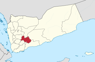
Al Bayda Governorate, also spelt Al-Baidhah or Beida, is one of the governorates (muhafazat) of Yemen. It is located near the centre of the country, around the town of Al Bayda. Its population, according to the 2004 Yemeni census, was 571,778. In 2011, the population was estimated to be 895,000.
Al Bayda, also known as Baida, Al-Baidhah or Beida, is a town in the Governorate of Al-Bayda in Yemen.
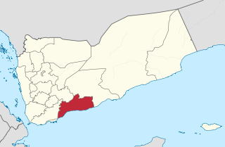
Abyan is a governorate of Yemen. The Abyan region was historically part of the Fadhli Sultanate. It was a base to the Aden-Abyan Islamic Army militant group. Its capital is the city of Zinjibar. This governorate is noted for its agriculture, in particular the cultivation of date palms and animal husbandry.

Dhale is one of the Yemeni governorates that was created after the unification of Yemen. The population of the province accounts for 2% of the total population of the republic. The governorate is divided into 9 districts. The city of Dhale is the administrative centre of the province. Dali is one of the governorates that is known for agriculture, and most of the population works in that industry. The most important agricultural crop is coffee. The province also contains mineral resources, most importantly talc, which is used in the manufacture of paper, paint, cosmetics and pesticides. This governorate is also home to the Damt hot-springs (Ḥamam-Damt), a popular tourist attraction. One of the ancient cities in the region is Juban, a city famous for its castle and the historic Mansuria school, built by the Tahrids. The climate in Dhale governorate is mostly temperate throughout the year.
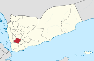
Ibb is a governorate of Yemen. It is located in the inland south of the country with Ta'izz Governorate to the southwest, Ad Dali' Governorate to the southeast, Dhamar Governorate to the north, and short borders with Al Bayda' Governorate to the east and Al Hudaydah Governorate to the west. It has an area of 5,344 km² and a population estimated at around 1,665,000 in 2004, making it the most densely populated governorate in Yemen outside of San'a city. It is the third largest province in Yemen.
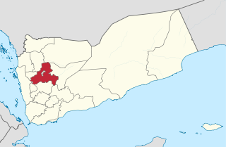
Sanaa, also spelled San'a' or Sana, is a governorate of Yemen. Its capital is Sanaa, which is also the national capital. However, the city of Sanaa is not part of the governorate but instead forms the separate governorate of Amanat Al-Asemah. The Governorate covers an area of 13,850 km2 (5,350 sq mi). As of 2004, the population was 2,918,379 inhabitants. Within this place is Jabal An-Nabi Shu'ayb or Jabal Hadhur, the highest mountain in the nation and the Arabian Peninsula.
Judeo-Yemeni Arabic is a variety of Arabic spoken by Jews living or formerly living in Yemen. The language is quite different from mainstream Yemeni Arabic, and is written in the Hebrew alphabet. The cities of Sana'a, Aden, al-Bayda, and Habban District and the villages in their districts each have their own dialect.
The 2009–10 Yemeni League is the 18th edition of top-level football in Yemen.
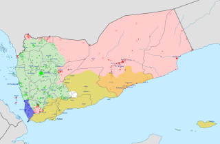
The Al-Qaeda insurgency in Yemen is an ongoing armed conflict between the Yemeni government, the United States and their allies, and al-Qaeda-affiliated groups in Yemen. It is a part of the Global War on Terror.

Al-'Arsh District is a district of the Al Bayda Governorate, Yemen. As of 2003, the district had a population of 45,773 inhabitants.
Al Bayda District is a district of the Al Bayda Governorate, Yemen. As of 2003, the district had a population of 40,289 inhabitants.

Al Malagim District is a district of the Al Bayda Governorate in Yemen. As of 2003, the district had a population of 29,573 inhabitants.
Al Quraishyah District is a district of the Al Bayda Governorate, Yemen. As of 2003, the district had a population of 29,525 inhabitants.
As Sawma'ah District is a district of the Al Bayda' Governorate, Yemen. As of 2003, the district had a population of 44,873 inhabitants.
Az Zahir District is a district of the Al Bayda Governorate, Yemen. As of 2003 the district had a population of 25,704 inhabitants.
Maswarah District is a district of the Al Bayda Governorate, Yemen. As of 2003, the district had a population of 7,038 inhabitants.
Radman Al Awad District is a district of the Al Bayda Governorate, Yemen. As of 2003, the district had a population of 20,150 inhabitants.

Wald Rabi' District is a district of the Al Bayda Governorate, Yemen. As of 2003, the district had a population of 19,427 inhabitants.

The Islamic State – Yemen Province is a branch of the militant Islamist group Islamic State (IS), active in Yemen. IS announced the group's formation on 13 November 2014.
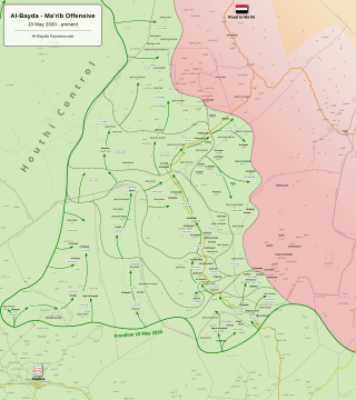
The Al Bayda offensive began in late July 2020 with the restart of military operations by Houthis forces in Al Bayda Governorate, during the Second Yemeni Civil War against forces of Al-Qaeda in Yemen, the Islamic State in Yemen and military forces loyal to the Government of Abd Rabbuh Mansur Al-Hadi.


