Related Research Articles
Al Maadeed also spelled Al Maadid or Al Maadhid, is one of the primary tribes in Qatar.

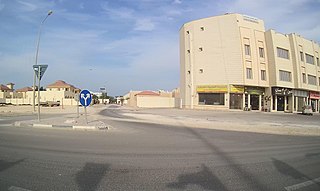
Nuaija is a district in Qatar, located in the municipality of Ad Dawhah. One of Nuaija's zones, Zone 41, was formerly known as Al Hilal West but was incorporated into Nuaija as of the 2010 census. Municipal authorities are developing district as a major mixed-use hub for south-central Doha.
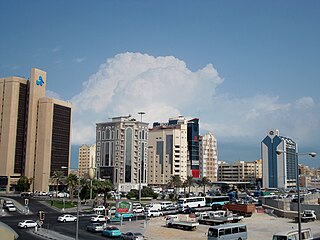
Mushayrib is a district in Qatar, located in the municipality of Ad Dawhah. As of the 2010 census, the former district of Al Asmakh has been integrated into Mushayrib. It is one of the oldest districts of Doha, and contains Al Kahraba Street, the country's first fully lit street.
Rawdat Al ʽAjuz is a rural district in Qatar, located in the municipality of Umm Salal. It is located near the border with Al Khor Municipality.
Abu Dhalouf is a town on the north coast of Qatar, located in the municipality of Al Shamal. It was demarcated in 1988 and is bounded by Madinat ash Shamal to the immediate east, with Ar Ru'ays located to the immediate east of Madinat ash Shamal.
Al-Qaʽabiyah is a settlement in Qatar, located in the municipality of Ash Shamal. It is located 8 miles south-east of the city of Ar Ru'ays and is 7 miles from the coast. J.G. Lorimer mentioned Al Qa`abiyah in 1908 in his Gazetteer of the Persian Gulf, remarking on the presence of a masonry well yielding good water.

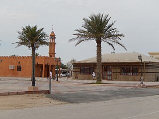
Ar Rakiyat is a village in Qatar, located in the municipality of Ash Shamal. From the 19th to 20th centuries, the village obtained its water supply from the freshwater well in Ar Rakiyat Fort. The fort also provided refuge for its population in times of conflict.
Al Buainain is a clan of Bani Tamim tribe, and the clan is divided to three main branches which are al-Muhammad and al-Ali and Al-Nuwasir. The clan is based primarily in Eastern Province of Saudi Arabia, Qatar, United Arab Emirates and Bahrain. The tribe used to be involved in the lucrative pearl diving industry.
The Al Mohannadi tribe is an Arab tribal confederation based primarily in the Arab states of the Persian Gulf, especially in Qatar. Being a tribal confederation that emerged in the coastal town of Al Khor, the larger portion of its members belong to the Bani Hajer tribe. It is also known as Al-Mahanda. The leading family of the tribe was the Al-Misned family. The other families are Al-Bin Ali, Al-Ibrahim, Al-Shugari, Al-Matwi of Al-Shugari, Al-Qashasha, Al-Hassan, Al-Baduh, and Al-Bin Matar.

Agriculture in Qatar Till quite recently, it was thought that Qatar's environment was not at all favourable for plantation and organic farming due to its harsh temperature during the summer months, desalinated chlorine water, poor annual rainfall and arid soil that all add up to quite the challenge of turning a desert area into a green oasis is inherently limited in scope due to the harsh climate and lack of arable land. In spite of this, small-scale farming, nomadic herding, pearling, and fishing were the predominant means of subsistence in the region until the commencement of oil drilling in 1939.

Al Kharrara is a village in Qatar, located in the municipality of Al Wakrah. The closest sizable city is Mesaieed, located to the east. It is a desert area, characterized by high aridity and the presence of grazing animals such as dromedary camels, goats and sheep.

Al Sakhama is a village in Qatar, located in the municipality of Al Daayen. It is situated near the border with Umm Salal Municipality.

Al Kharsaah is a village in Qatar located in the municipality of Al-Shahaniya, approximately 80 km west of the capital Doha. Nearby areas include Umm Washah, Umm Al-Jaljam, Umm Bab and Umm Taqa. It hosts a stage of the Qatar International Rally.
Al Sailiya is a district of Al Rayyan City in Qatar, located in the municipality of Al Rayyan.
Ain Mohammed is an abandoned village in Qatar, located in the municipality of Ash Shamal. It is located about 1.5 km southwest of the abandoned village of Freiha. To the north is a series of small hills known as Al Jebailat.
Al Khurayb is a village in Qatar located in the municipality of Al-Shahaniya. The closest major city is the municipal seat, Al-Shahaniya City. Historically, the village has been inhabited primarily by members of the Dawasir tribe.
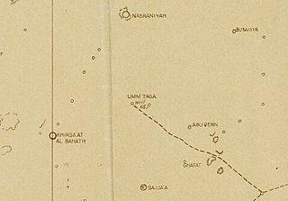
Umm Taqa is a district in central Qatar located in the municipality of Al-Shahaniya. It is an important Palaeolithic site in the peninsula.
Umm Al Houl is an industrial district in Qatar located in the municipality of Al Wakrah. To the north of Umm Al Houl is the city of Al Wakrah while Mesaieed is to the south.
Al Huwaila is an abandoned town in Qatar located in the municipality of Al Shamal. Prior to the 18th century, and as perhaps as early as the 16th century, it served as Qatar's main town before its population migrated elsewhere.
Tenbek is a village in Qatar located in the municipality of Al Daayen.
References
- ↑ Abdulali M. Sadiq & Sobhi J. Nasir (2002). "Middle Pleistocene karst evolution in the State of Qatar, Arabian Gulf". Journal of Cave and Karst Studies. 64 (2): 132–139.
- ↑ Heidelberger, Mark. "What Caves Are In Qatar". USA Today . Retrieved 9 July 2015.
- ↑ "Newsletter". 1 (2). Qatar Bird Club. April 2010.
{{cite journal}}: Cite journal requires|journal=(help) - ↑ "'Gazetteer of the Persian Gulf. Vol. II. Geographical and Statistical. J G Lorimer. 1908' [1524] (1639/2084)". Qatar Digital Library. 30 September 2014. Retrieved 28 July 2015.
- ↑ Climate Normals Qatar Weather [ dead link ]