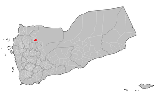
Al Maton District is a district of the Al Jawf Governorate, Yemen. As of 2003, the district had a population of 28,411 inhabitants.
Al Dhihar District is a district of the Ibb Governorate, Yemen. As of 2003, the district had a population of 154,399 inhabitants.
Al Mashannah District (Arabic: مديرية المشنة is a district of the Ibb Governorate, Yemen. As of 2003, the district had a population of 101,148 inhabitants.
As Sabrah District is a district of the Ibb Governorate, Yemen. As of 2003, the district had a population of 69,872 inhabitants.
As Sayyani District is a district of the Ibb Governorate, Yemen. As of 2003, the district had a population of 110,515 inhabitants.
Ba'dan District is a district of the Ibb Governorate, Yemen. As of 2003, the district had a population of 116,045 inhabitants.
Al Qahirah District is a district of the Taiz Governorate, Yemen. As of 2003, the district had a population of 149,394 inhabitants.
As Silw District is a district of the Taiz Governorate, Yemen. As of 2003, the district had a population of 152,486 inhabitants.
At Ta'iziyah District is a district of the Taiz Governorate, Yemen. As of 2003, the district had a population of 109,814 inhabitants.
Al Hawtah District is a district of the Lahij Governorate, Yemen. As of 2003, the district had a population of 25,881 inhabitants.
Al Maqatirah District is a district of the Lahij Governorate, Yemen. As of 2003, the district had a population of 54,613 inhabitants.
Al Qabbaytah District is a district of the Lahij Governorate, Yemen. As of 2003, the district had a population of 94,516 inhabitants.
Al Husn District is a district of the Sana'a Governorate, Yemen. As of 2003, the district had a population of 30,124 inhabitants.

Arhab District is a district of the Sana'a Governorate, Yemen. As of 2003, the district had a population of 90,038 inhabitants.
Attyal District is a district of the Sana'a Governorate, Yemen. As of 2003, the district had a population of 36,253 inhabitants. Shawkan village is in this district.
Bani Dhabyan District is a district of the Sana'a Governorate, Yemen. As of 2003, the district had a population of 16,262 inhabitants.
Bani Hushaysh District is a district in Sana'a Governorate, Yemen. As of 2003, the district had a population of 73,957 inhabitants. It's also famous for grape plantations.

Bani Matar District is a district of the Sana'a Governorate, Yemen. As of 2003, the district had a population of 100,012 inhabitants.
Bilad Ar Rus District is a district of the Sana'a Governorate, Yemen. As of 2003, the district had a population of 31,259 inhabitants.
Khawlan District is a district of the Sana'a Governorate, Yemen. As of 2003, the district had a population of 28,925 inhabitants.


